Weather Blog: Severe storms hit Indiana
- Interactive radar | Latest forecast in weather blog | Closings and Delays | Storm Track 8 weather app |Watches and warnings | Hourly forecast | Wind gusts | Check the Indiana Travel Advisory map
6:02 p.m.
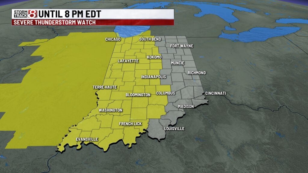
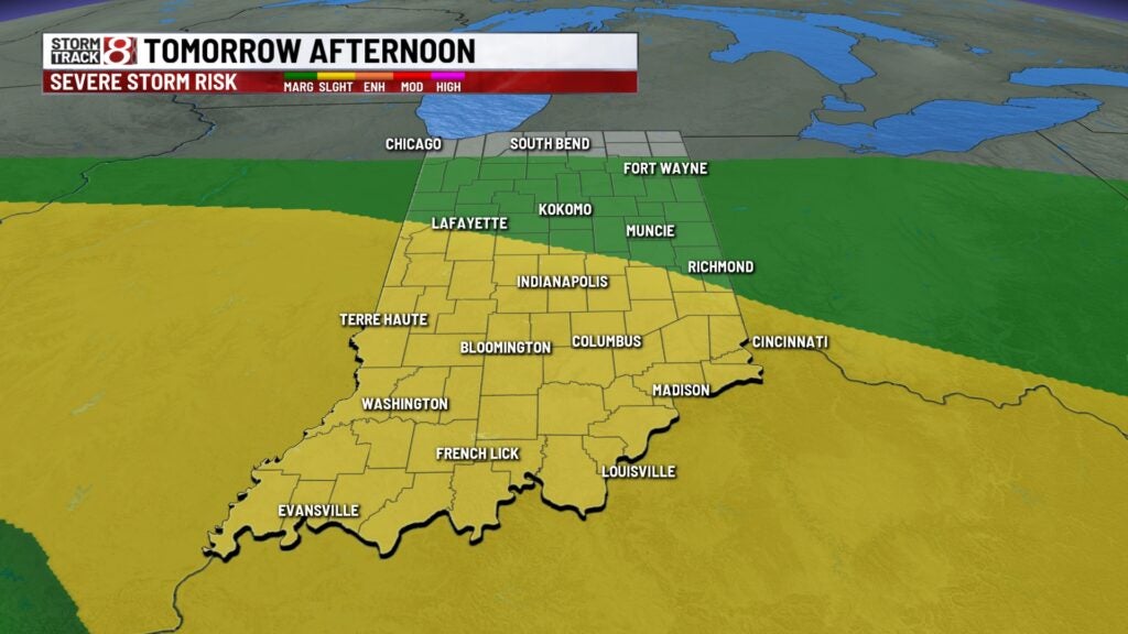
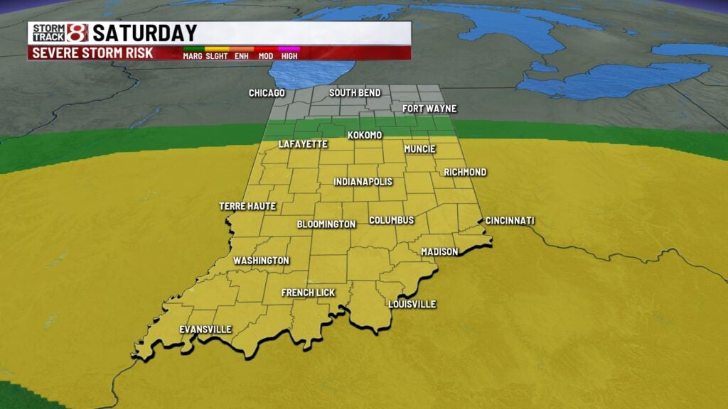
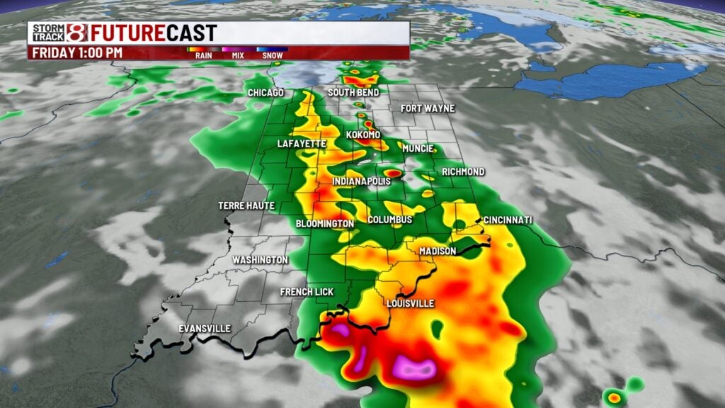
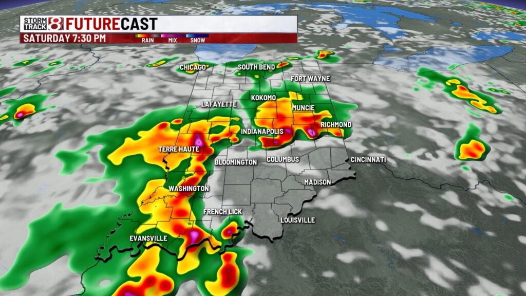
We had a busy Thursday, unfortunately, more stormy weather is ahead with additional severe weather chances. Rain is still needed, but we’ll also have to watch the possibility of flooding through this weekend. FRI & SAT’s severe threats are wind/hail.
5:34 p.m. – Tree down near East 16th Street and North Delaware Street in Indianapolis
5:29 p.m.
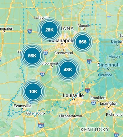
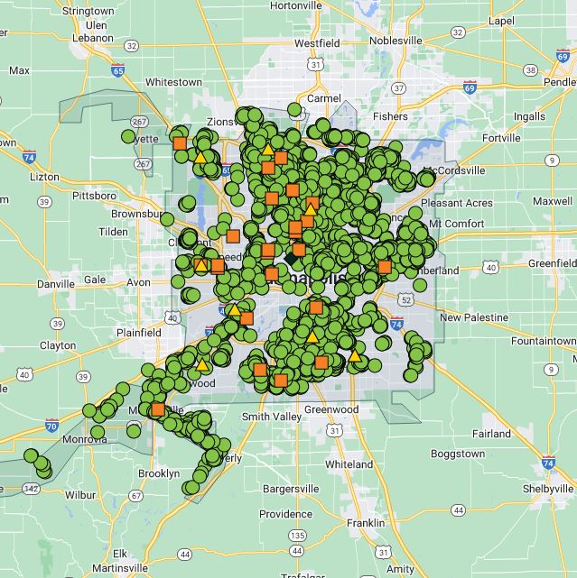
AES Indiana reports 46,342 power outages in Indiana.
5:28 p.m. – Tree branch down in Westfield
5:25 p.m.
Duke energy reports 144,234 people are without power across Indiana.
5:14 p.m.
Indiana Michigan Power reports 438 power outages across Indiana.
5:13 p.m.
Over 178,000 power outages are being reported across the state of Indiana. The majority of those outages are being reported to Duke Energy, with an estimated 142,748 customers without power.
4:48 p.m. – Tree down near MLK Jr. Street and Udell Street on Northwest side of Indianapolis

4:42 p.m.
An estimated 24,828 people are without power across Indiana, according to the AES outage map.
4:28 p.m.
Indiana Michigan Power has reported 9 outages.
4:28 p.m.
AES has reported 19,284 customers without power.
4:25 p.m.
Reports that trees and power poles are down in Saint Paul, the National Weather Service at Indianapolis reports.
4:18 p.m.
Reports of trees down on North Street in Greenfield, the National Weather Service at Indianapolis reports.
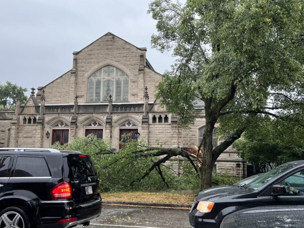
4:18 p.m. – Trees down on Church Street near downtown Indianapolis

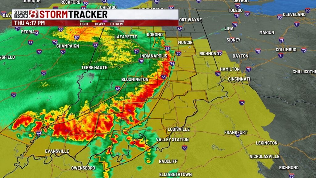
4:17 p.m.
Reports of tree limbs broken and power poles broken in Greenfield, the National Weather Service at Indianapolis reports.
4:17 p.m.
Damaging line of storms continues into eastern and southern Indiana. The part of the line from Shelbyville and points southwest is still producing wind gusts up to 70 MPH.
4:15 p.m.
Reports of a tree down in the right lane of I-65 southbound near IN-58. Reports of semi trucks impacted, the National Weather Service at Indianapolis reports.
4:13 p.m.
A Severe Thunderstorm Warning for Decatur, Hancock, Rush and Shelby County until 5:00pm.
4:10 p.m.
Reports of damage to several buildings in Rockville. Lots of trees down in roads, including 36 and 59, the National Weather Service at Indianapolis reports.
4:10 p.m.
A Severe Thunderstorm Warning for Bartholomew, Jackson, and Jennings County until 5:00pm.
4:06 p.m.
A Severe Thunderstorm Warning for Bartholomew, Decatur, Hancock, Henry, Jennings, Rush and Shelby County until 4:45pm.
4:05 p.m.
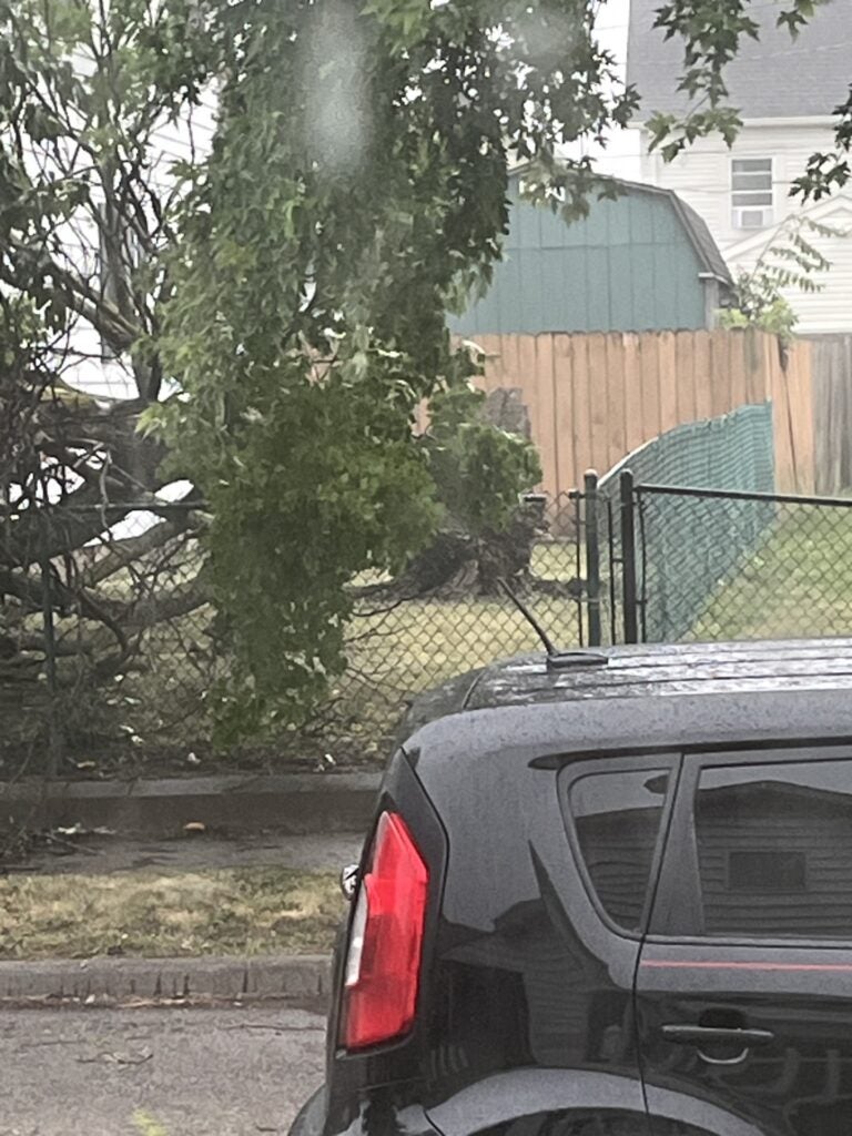
Reports of a fallen tree on a car at D/18th Streets in Bedford, the National Weather Service at Indianapolis reports.
4:02 p.m.
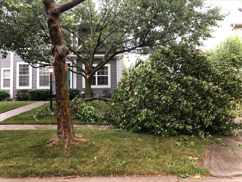
Numerous large branches down across the Bates Hendricks neighborhood near Monument Circle, the National Weather Service at Indianapolis reports.
4:01 p.m.
Duke Energy reports more than 52,855 Indiana customers are without power, with 43,000 of those people in the Terre Haute area.
4:00 p.m.
Reports of a large tree uprooted along Mill Creek Road in Mitchell, the National Weather Service at Indianapolis reports.
4:00 p.m.
Reports of numerous large tree branches down in Greenwood, the National Weather Service at Indianapolis reports.
3:56 p.m.
A Severe Thunderstorm Warning for Delaware, Hamilton, Henry, Howard, Madison and Tipton County until 4:45pm.
3:55 p.m.
Reports of tree limbs broken and power poles broken in Rocky Ripple, the National Weather Service at Indianapolis reports.
3:54 p.m.
Reports that a large tree down in Bargersville. Power lines down with it, the National Weather Service at Indianapolis reports.
3:50 p.m.
Reports of several trees and power lines down across Monroe County. Duke Energy reporting widespread outages in Monroe County from the storms, the National Weather Service at Indianapolis reports.
3:45 p.m.
Reports of large tree branch down in the National Weather Service Indianapolis parking lots, the National Weather Service at Indianapolis reports.
3:43 p.m.
Downtown Indianapolis is without power in some areas.
3:42 p.m.
Reports that a large tree fell on a car in Frankfort. Car was unoccupied. Numerous power lines down across Frankfort.
3:40 p.m.
Reports that trees are down and blocking 86th/1000 North on Marion/Hendricks County Line.
3:40 p.m.
A Severe Thunderstorm Warning for Bartholomew, Brown, Greene, Jackson, Lawrence and Monroe County until 4:30pm.
3:36 P.M.
Reports that multiple trees are down in Lafayette, the National Weather Service at Indianapolis reports.
3:31 p.m.
Duke Energy reports more than 49,500 Indiana customers are without power, with 42,000 of those people in the Terre Haute area.
3:30 p.m.
Reports that power is down for half of Greencastle due to storms. Numerous trees down. Some barns have lost roofs, the National Weather Service at Indianapolis reports.
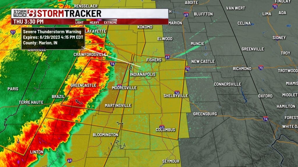
3:30 p.m.
A Severe Thunderstorm Warning in effect for parts of Marion/Bartholomew/Boone/Brown/Hamilton/Hancock/Hendricks/Johnson/Madison/Morgan/Shelby counties until 4:15 PM.
3:28 p.m.
A Severe Thunderstorm Warning for parts of Boone/Carroll/Clinton/Hamilton/Howard/Tippecanoe/Tipton counties until 4:15 PM.
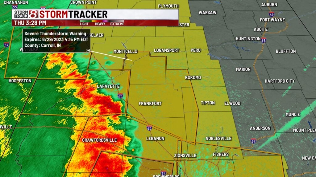
3:25 p.m.
Reports of a snapped power pole and trees down just south of Lagoda, No injuries reports, the National Weather Service at Indianapolis reports.
3:24 p.m.
A Severe Thunderstorm Warning for Boone, Carroll, Clinton, Hamilton, Howard, Tippecanoe and Tipton County until 4:15pm.
3:20 p.m.
Reports of a tree on a dwelling in Heritage Lake in Groveland. No injuries reports, the National Weather Service at Indianapolis reports.
3:20 p.m.
Duke Energy reports more than 42,500 Indiana customers are without power, with 21,000 of those people in the Terre Haute area.
3:20 p.m.
Reports of a porch collapse and tree on house. Trees down in the area, the National Weather Service at Indianapolis reports.
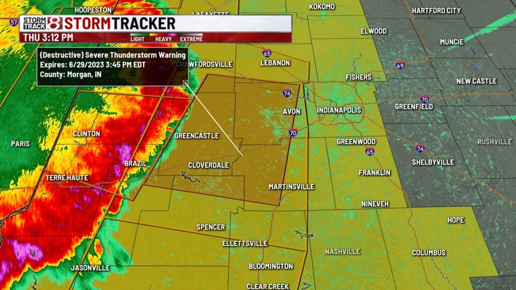
3:12 p.m.
A focused area of a Destructive Severe Thunderstorm Warning in place for parts of Montgomery/Boone/Hendricks/Putnam/Morgan/Owen counties until 3:45 PM EDT.
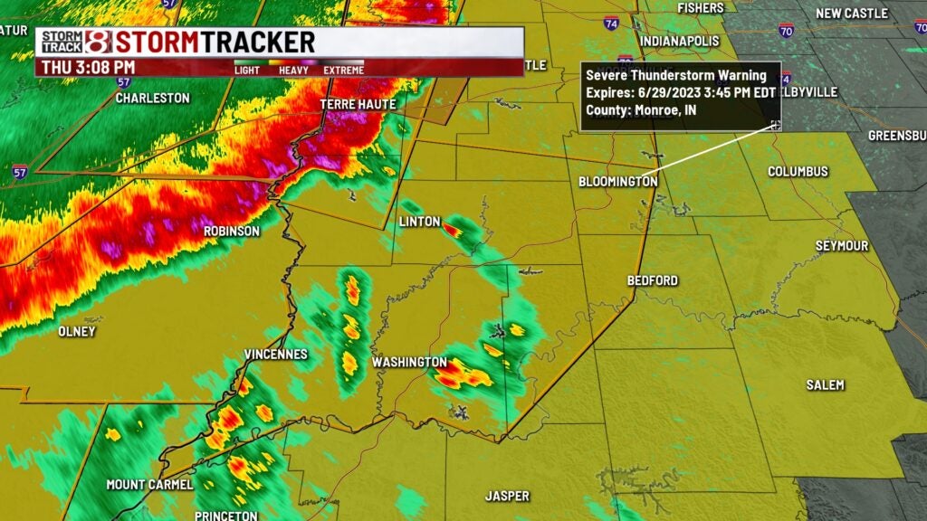
3:08 p.m.
A Severe Thunderstorm Warning for parts of Clay/Daviess/Greene/Knox/Lawrence/Martin/Monroe/Owen/Sullivan counties until 3:45 PM EDT.
3:06 p.m.
Reports of damage to a metal building in Vigo County. Photo from social media shows walls collapsed and roof blown back.
3:05 p.m.
Amateur radio operators report a large tree fell on a house. Powerlines are also down at 8th and Indiana in Terre Haute, the National Weather Service at Indianapolis reports.
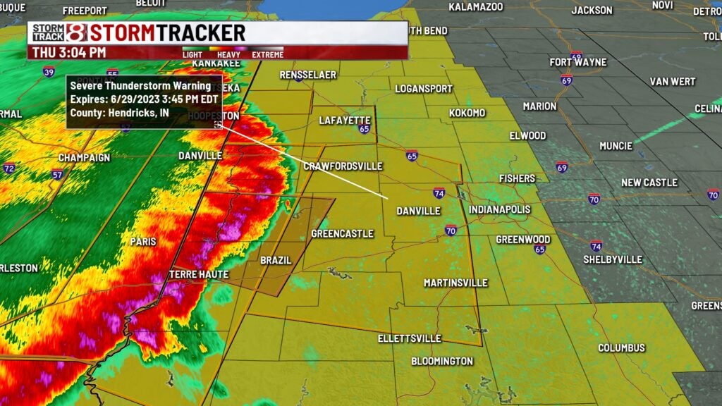
3:04 p.m.
A Severe Thunderstorm Warning for parts of Hendricks/Montgomery/Boone/Clay/Clinton/Monroe/Morgan/Owen/Parke/Putnam counties until 3:45 PM.
3:00 p.m.
Amateur radio operators report widespread damage to trees and powerlines in Terre Haute due to winds estimated at 70-80 mph, the National Weather Service at Indianapolis reports.
2:53 p.m. – Shelf Cloud in Veedersburg, Indiana

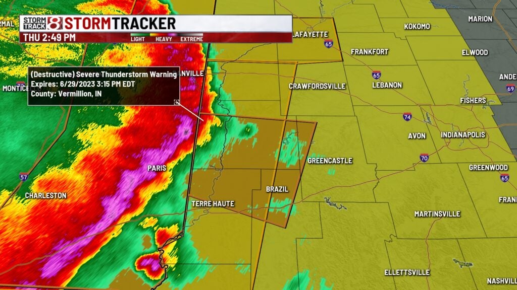
2:49 p.m.
A Severe Thunderstorm Warning for parts of Clay, Parke, Putnam, Vermillion, Vigo counties until 3:15 PM EDT. This is a destructive storm with winds up to 80 MPH wind gusts. Rotation is also being observed.
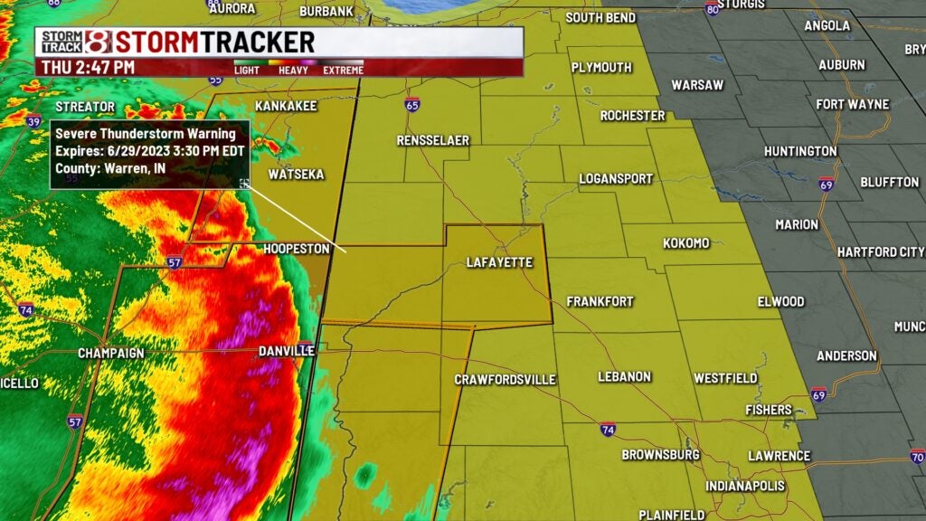
2:47 p.m.
A Severe Thunderstorm Warning now in effect for Fountain, Warren, Montgomery, and Tippecanoe counties until 3:30 PM EDT. Hazards include 60 MPH wind gusts and one inch hail.
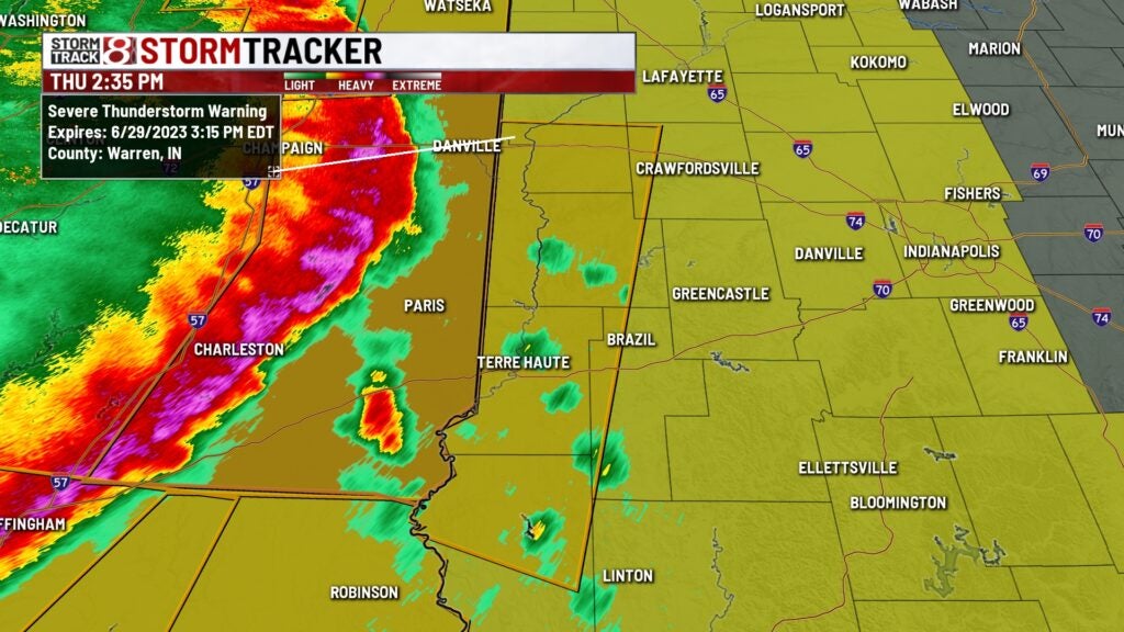
2:36 p.m.
A Severe Thunderstorm Warning for parts of Clay, Fountain, Montgomery, Parke, Sullivan, Vermillion, Vigo, Warren until 3:15 PM. Hazards include 70 mph wind gusts and 1-inch hail.
2:15 p.m.