


Winds near 45 mph with strong storms possible
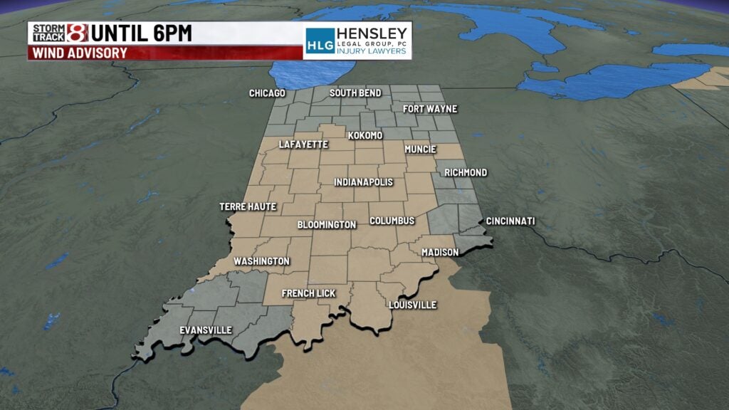
INDIANAPOLIS (WISH) — A wind advisory is in place until 6 p.m. as gusts may reach 45 mph. Strong storms are possible as a cold front swings across the state later this afternoon.
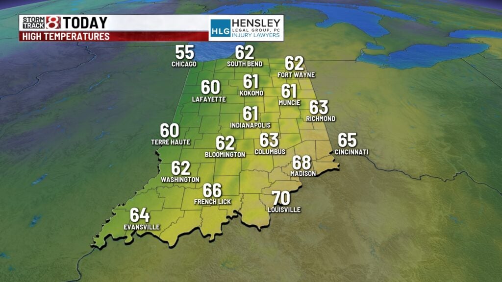
TODAY: A few light spotty showers are possible this morning. Lots of clouds with mild conditions as temperatures start into the 50s. Winds continue to be strong throughout the morning and day. A wind advisory is in effect for much of central and southern Indiana until 6 p.m. Gusts may be close to 45 mph at times today.

STRONG STORMS
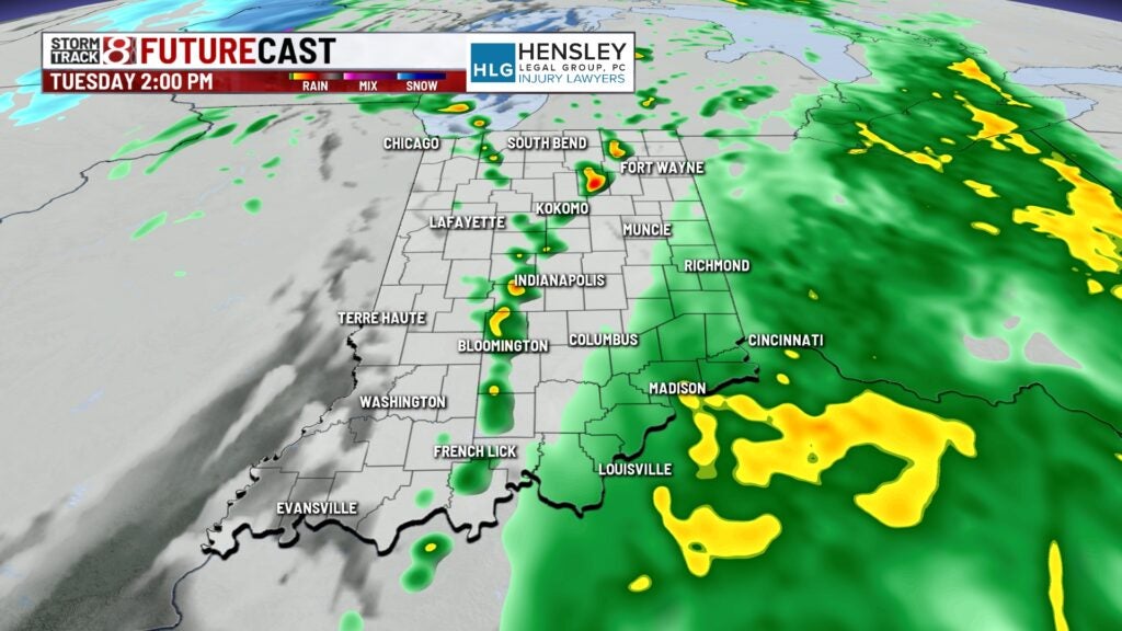
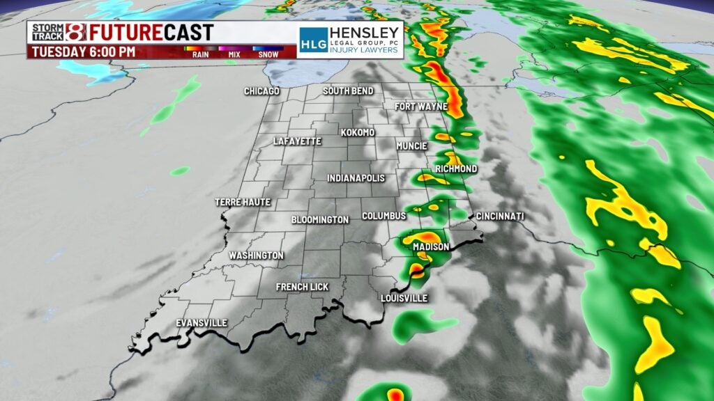
A break in the rainfall for the mid morning and early afternoon before another chance of showers and storms pops up. A cold front moves through Indiana later this afternoon and will be the focal point for a line of showers and thunderstorms to develop. Some strong storms are possible. Much of Indiana is under a marginal risk while the northeastern part of the state is under a slight risk which is a level 2 out of 5. The main threats from these storms is the gusty winds but there is a chance for some rotation and even an isolated tornado.

Highs today climb into the lower 60s.
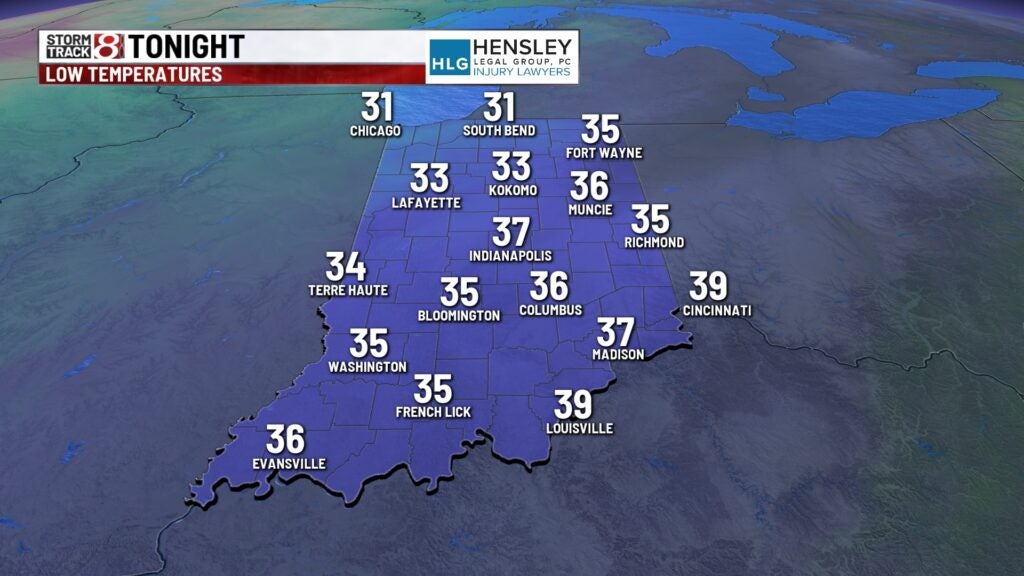
TONIGHT: Rain comes to an end and skies begin to clear. Lows fall into the 30s. Winds begin to ease a bit.
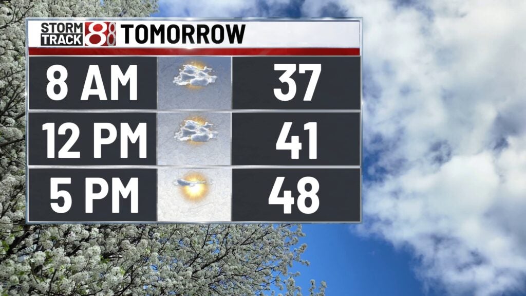
WEDNESDAY: Skies become partly cloudy for the afternoon hours on Wednesday. Temperatures drop a bit below normal with highs in the upper 40s. Temperatures fall into the 30s near freezing Wednesday night and early Thursday morning.
THURSDAY: Look for mostly sunny skies on Thursday with highs climbing back to normal into the middle 50s.
8DAY FORECAST: Good Friday looks dry with temperatures climbing back into the middle 60s. This holiday weekend looks like there will be a chance for showers. While it won’t be a complete wash out there will be rain chances. Temperatures stay into the upper 60s on Saturday and on Sunday highs reach 60. Rain chances continue into early next week.
