Windy Tuesday night with scattered rain and storms
INDIANAPOLIS (WISH) — We are tracking gusty winds, rain, and scattered storms for our Tuesday night with the potential for even stronger storms. Then, a much colder airmass will slide in through midweek.
Wind advisories will be in effect tonight from 7 PM EST Tuesday until 4 AM EST Wednesday.

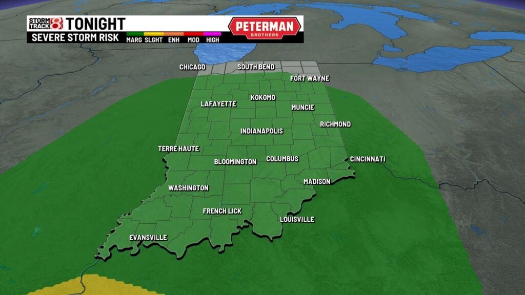
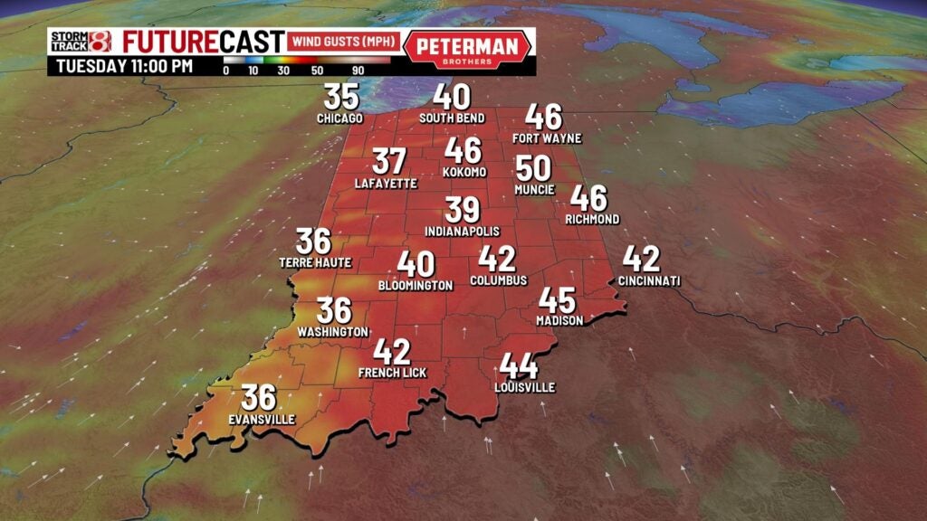
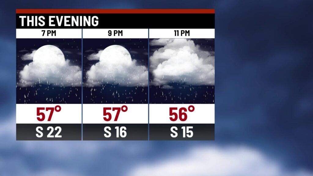
Tuesday night: Scattered showers and storms are expected tonight. There is even the potential for isolated strong to severe storms with damaging winds as the primary threat. However, an isolated tornado threat is also in place.
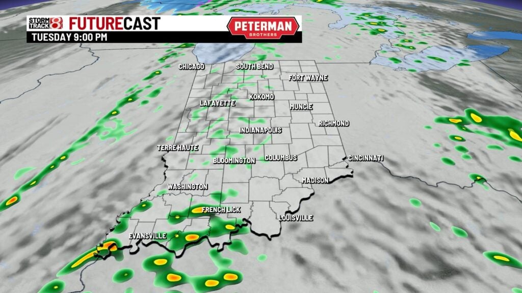

Winds will also continue to pick up as a strong cold front advances closer to our area with gusts up to 40-50 MPH at times after sunset.
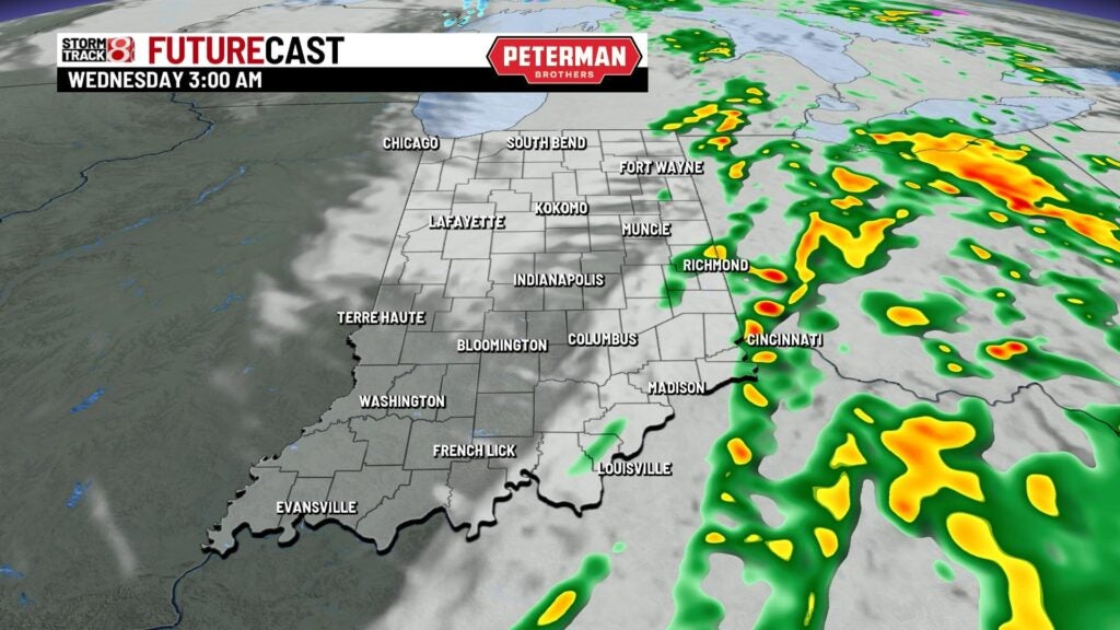
Temperatures will remain mild through midnight, but we will quickly tumble out of the 50s through the overnight hours as the strong cold front rushes through our state.
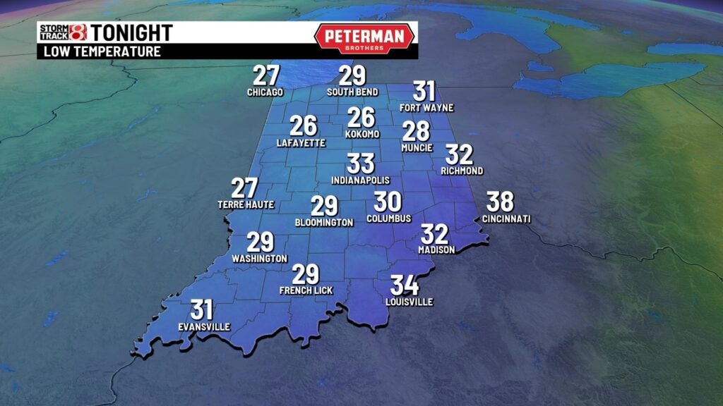
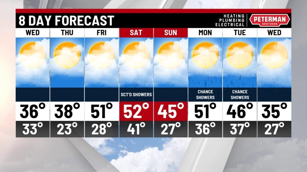
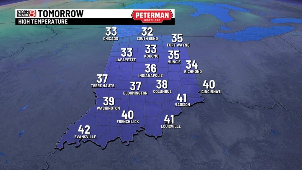
Wednesday: Active weather will be well out of the state by daybreak, but be prepare for a fairly cold Wednesday overall. Morning temperatures are expected to be in the 30s, and we will stay put in that range during the day. Breezy winds with gusts up to 30-35 MPH will lead way to brisk wind chill values in the teens to 20s. Overall, November will end on an uncomfortable cold note.

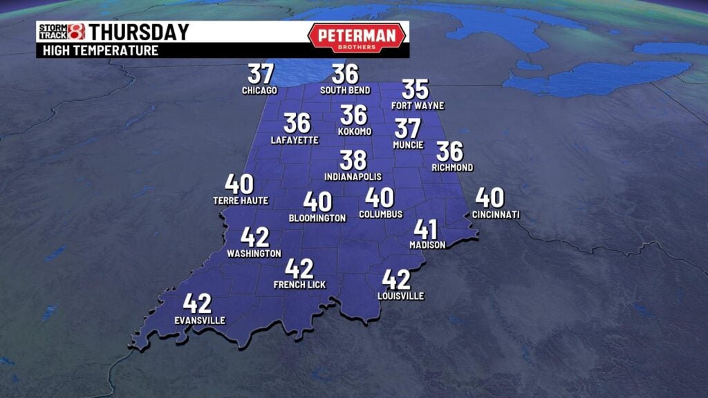
Thursday: Mainly sunny skies are set to return for our Thursday, but it will not keep the cold air away. In fact, highs are only going to make their way into the mid to upper 30s to start our December.
8-Day Forecast: We look to warm-up just in time for the first full weekend of December with highs quickly charging back into the 50s. This fast warmup will open the door for more rain chances this weekend and into the first part of next week.