Windy with rain and storm potential Monday night into Tuesday
INDIANAPOLIS (WISH) — After enjoying a terrific, yet windy, Monday, we’re setting up for a rainy night with strong winds continuing into Tuesday. We’ll also continue to undergo a temperature roller coaster.
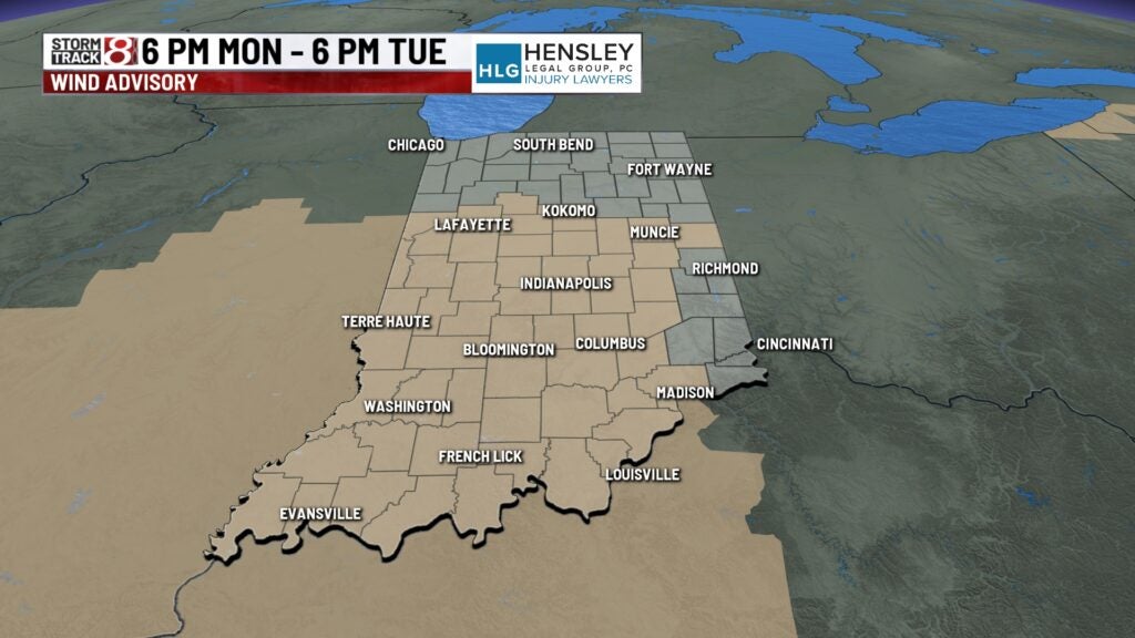
A Wind Advisory will be in effect from 6 PM EDT Monday to 6 PM EDT Tuesday.
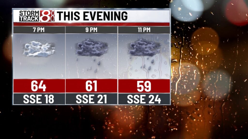
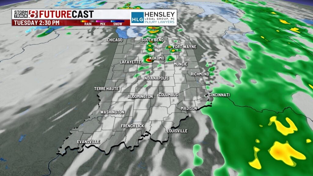
Monday night: Widespread rain will move in tonight with some of it expected to be moderate-heavy at times.
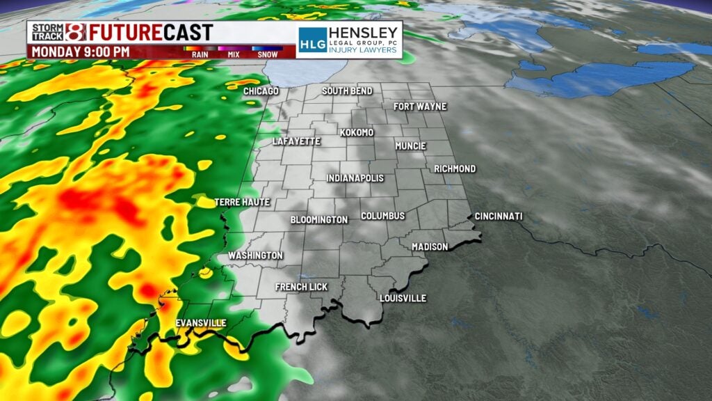
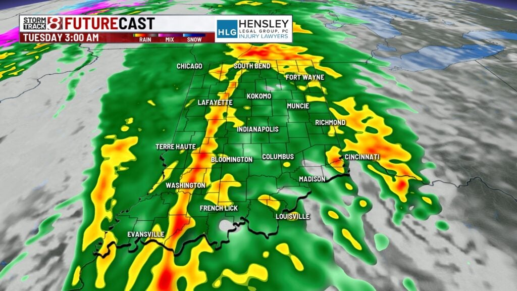
At most, we’re looking at up to 0.5″-0.75″ of rain by Tuesday morning.
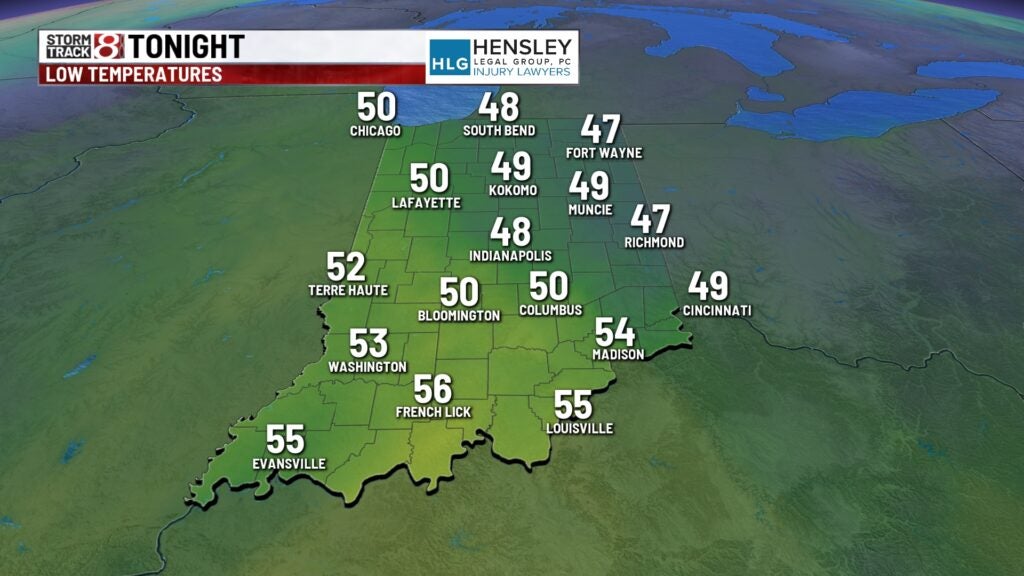
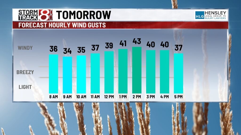
It will be a mild, wet, and windy night with lows only falling into the upper 40s to low-mid 50s. Wind gusts will crank up further towards 40-45 MPH at times.

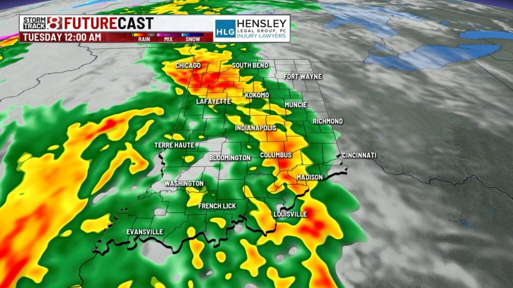
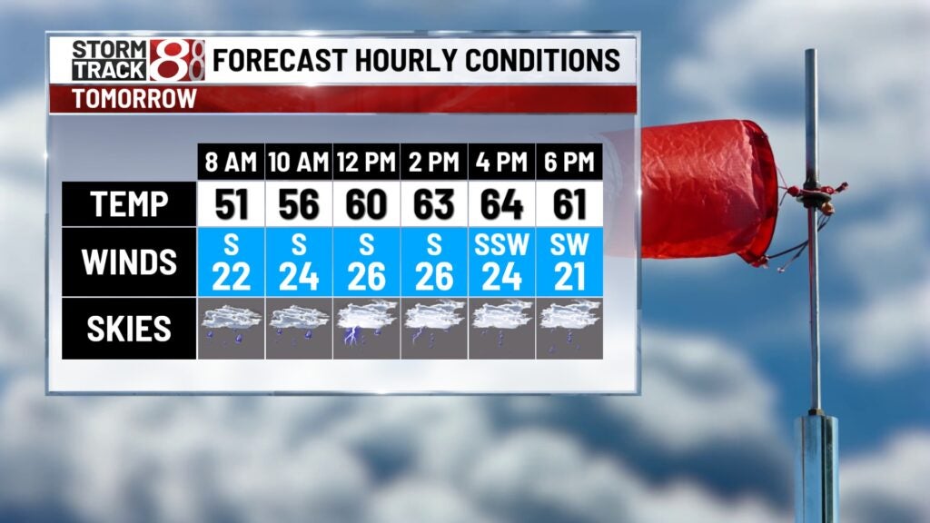
Tuesday: A few showers will be leftover from the overnight rain as we go through daybreak Tuesday. Some sunshine could emerge in spots with a brief dry period of time emerging. Re-development in scattered fashion looks to take place closer to the lunch hour. This will move quickly to the north and east through Tuesday afternoon.
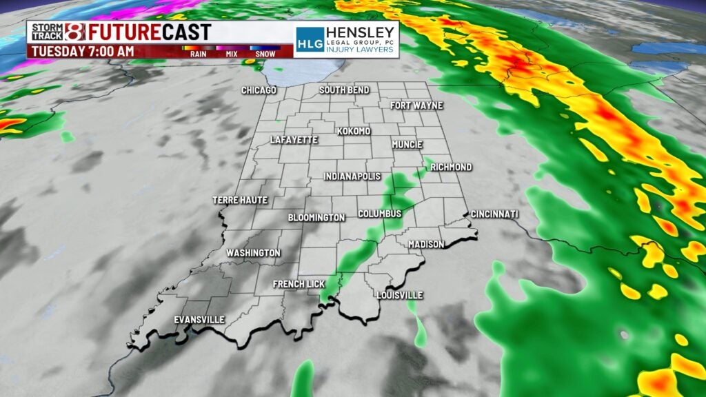


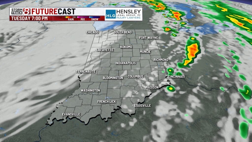
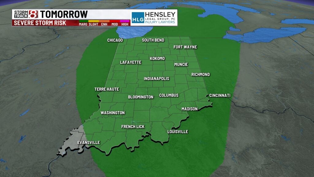
This Tuesday afternoon round of activity could feature isolated instances of strong to severe storms. Damaging winds will be the main threat, but an isolated tornado is not completely out of the question.
Highs will still manage to scoot into the 60s due to a persistent strong southerly breeze. We’ll keep the potential for gusts up to 40-45 MPH until Tuesday evening.

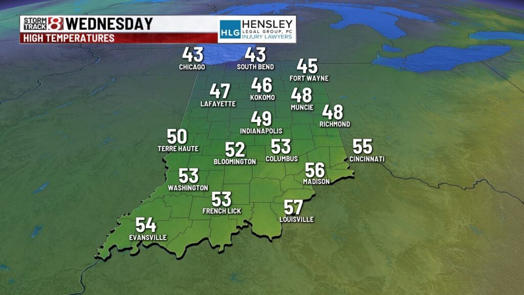
Wednesday: Tuesday’s system will bring about much cooler air to the forecast Wednesday. Skies will turn partly cloudy with high temperatures only rising into the upper 40s.
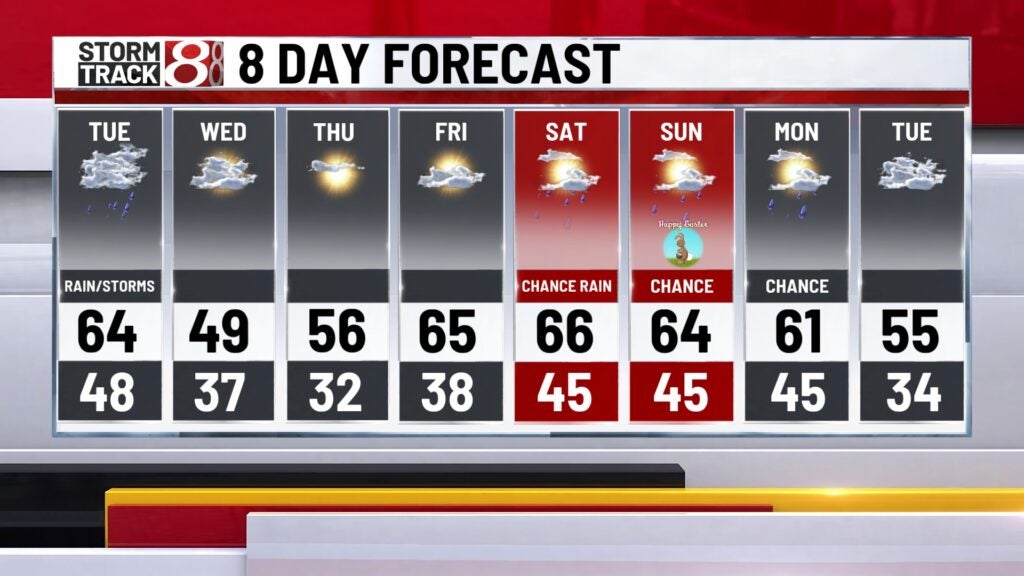
8-Day Forecast: It won’t take long for us to warm back up as we approach the final weekend of March. Highs quickly bounce back into the 60s Friday with additional rain chances in play Friday night and this weekend. Easter Sunday at this current time will feature above normal temperatures with a low chance for rain.