A look back at Wednesday’s winter storm
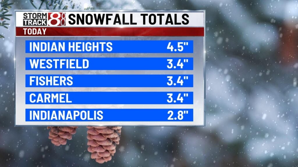
INDIANAPOLIS (WISH) — Wednesday’s winter storm brought a heavy, wet and slushy snow to much of central Indiana. Areas north of Indianapolis picked up more snowfall while some locations didn’t see much at all. Areas around Carmel, Fishers, Westfield, and Indian Heights picked up about 3-4 inches, while Indianapolis measured about 3 inches. Click here for a look at some other snowfall totals from the National Weather Service in Indianapolis.
There were several factors with this complex system that moved through the state. First off there was not enough cold air in the lower levels of the atmosphere. These warmer than forecasted surface temperatures allowed a lot of the snow to melt as it fell. Even though we saw several reports of thundersnow which usually means intense snowfall rates, the melting along with other factors didn’t produce high snowfall amounts.
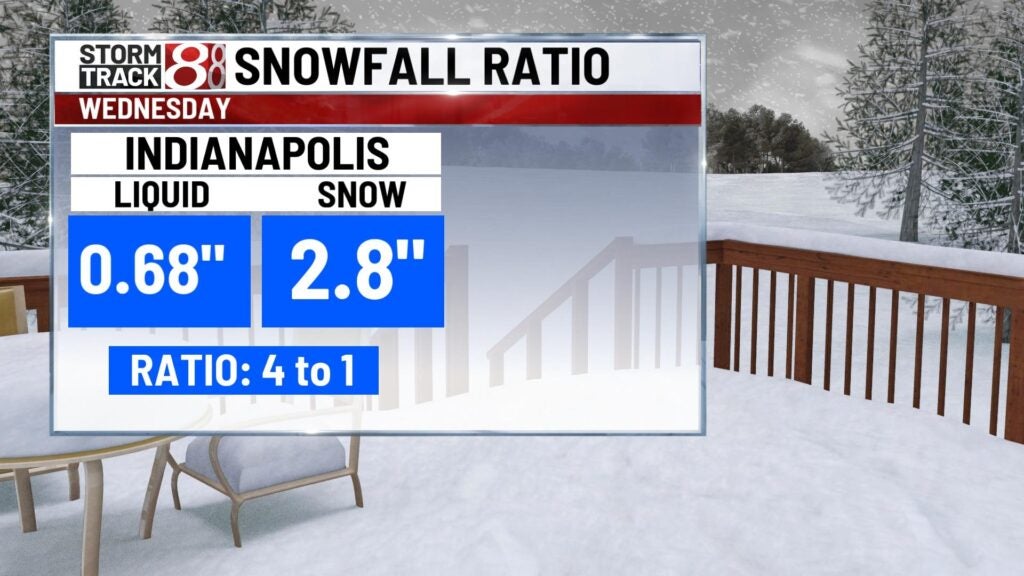
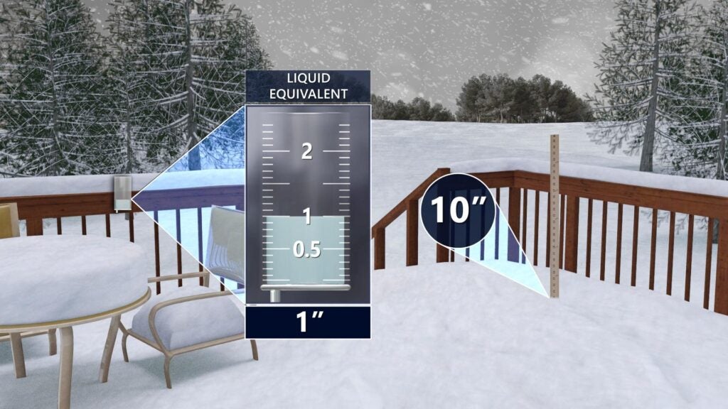
One of the most interesting factors with this storm was the snow to liquid ratio. It was much lower than forecasted. There’s a usual rule of thumb, one inch of liquid equals 10 inches of snowfall. Sometimes snow ratios are around 8:1 or 10:1 if we’re expecting a heavy wet snow. These usually occur when the temperature is close to the freezing mark. If temperatures are colder sometimes higher snowfall rations like 15:1 or 20:1 can occur. This leads to a light and fluffy snow.
This storm had a snowfall ratio of about 4 to 1. A little more than a half inch of liquid produced about 3 inches of snowfall in Indianapolis. This is an incredibly low snowfall ratio that we usually don’t see very often.