


Hurricane Ian intensifying quickly in warm water
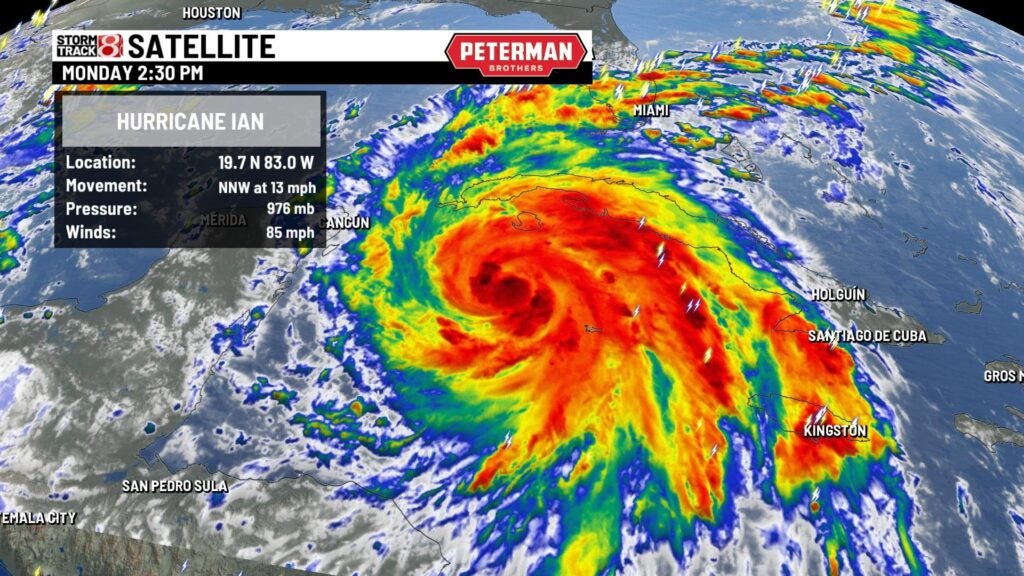
INDIANAPOLIS (WISH) — Hurricane Ian has rapidly intensified within the past 24 hours in the Caribbean.
“Rapid intensification” is defined has a tropical cyclone that increases wind speed by 35 mph in 24 hours or less.
Ian went from a tropical storm with winds of 50 mph at 2 p.m. Sunday to a Category 1 hurricane with maximum winds of 85 mph at 2 p.m. Monday.

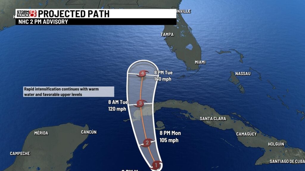
The storm will likely intensify into a major hurricane with warm water and low shear ahead of it before striking Cuba early Tuesday. From there, the environment is still favorable for intensification on Tuesday and early Wednesday in the eastern Gulf of Mexico, where water temperatures are running in the mid 80s.
Ian’s center will possibly parallel the Florida coastline and pass very closely to the Tampa area late Wednesday into Thursday.
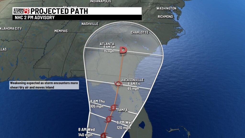
The exact point of landfall remains very tricky. If it does not come on shore close to the Tampa area, it will make landfall further off to the north in Florida. Increasing wind shear and dry air will weaken the system Thursday and Friday.
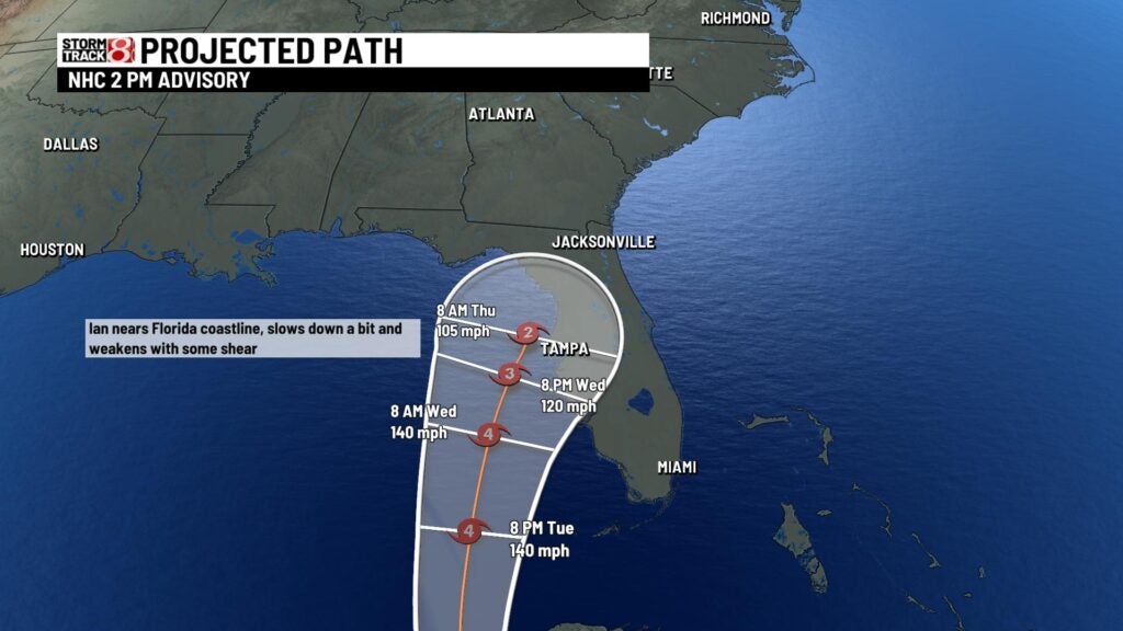
Regardless of the landfall point, the biggest threat with this system will be the storm surge potential. The slower movement will bring flooding rain along with dangerous storm surge. This could pile up water quickly in the Tampa-St. Petersburg area. Hurricane watches were in place Monday for these areas.