Recap of tornadoes on Saturday
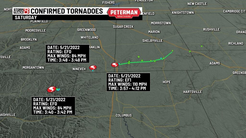
INDIANAPOLIS (WISH) — It was an active weather pattern this past weekend, and a few tornadoes have been confirmed from Saturday’s severe weather. Pictured below is a radar image from Saturday evening showing that squall line passing to the south of Indianapolis. At the time of this loop all over these counties on this graphic were under a severe thunderstorm watch. The first tornado warning was issued at 4:02 PM EDT for Shelby, and Rush county.

This squall line produced 2 brief EF0 tornadoes in Johnson and Brown county, while an EF1 tornado traveled nearly 14 miles in Shelby county. That EF1 tornado produced maximum winds of 110 mph. Both EF0s occurred before the first tornado warning.
When we check out the velocity scan of the one of the weaker EF0 tornadoes in Brown county, you can see the rotation pretty clearly in one quick scan. This tornado went without a warning because of how brief the tornado was on the ground (2 minutes).

Keep this is mind as a good example to always be vigilant when severe weather is expected. Sometimes these tornadoes along a squall line spin up so quickly they go with out warning.
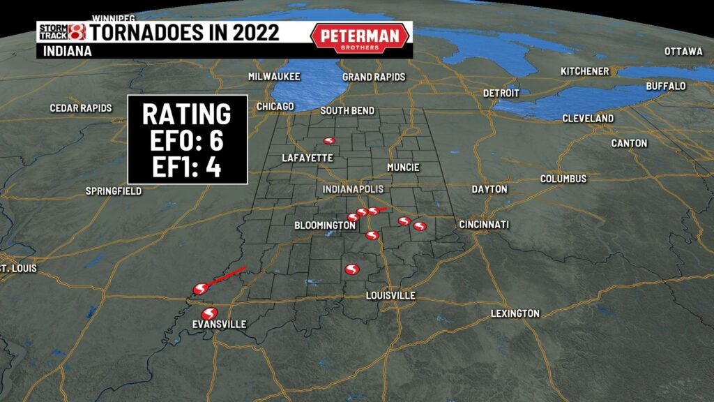
Indiana’s tornado count now stands at 10 for the entire state. In the month of May, 5 tornadoes have been confirmed alone.