Watching for more rain in eastern Kentucky
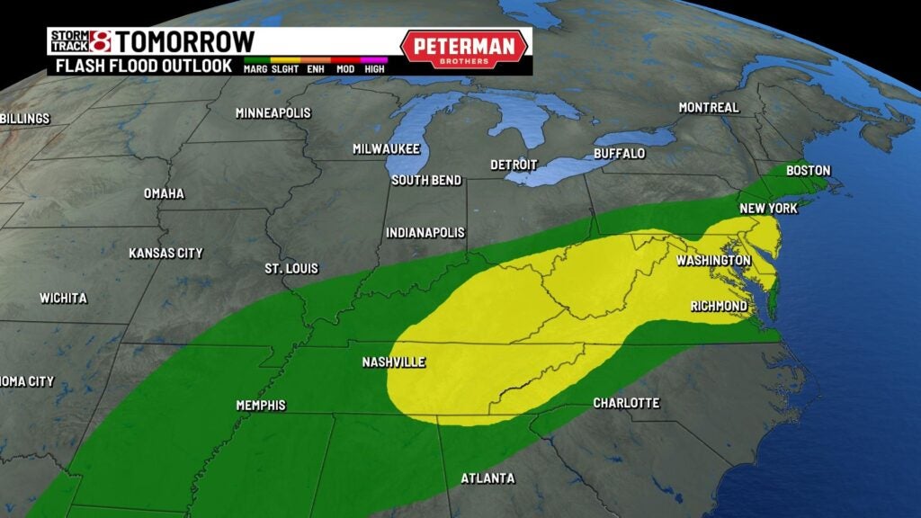
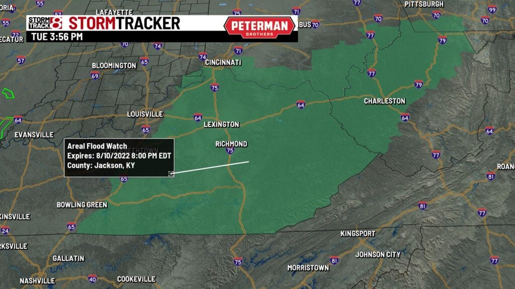
INDIANAPOLIS (WISH) — Areal flood watches are posted until Wednesday evening for eastern Kentucky ahead of another chance of rain along a slow moving cold front. A slight risk of excessive rainfall on Wednesday could slow any recovery efforts from the devastating flooding that took place in July.
Over the last the week of July, a small swath of area recorded 14-16″ of rain according to radar estimates with many more locations getting 6-10″. Rainfall rates in some thunderstorms got to 4″ per hour which lead devastating impacts.
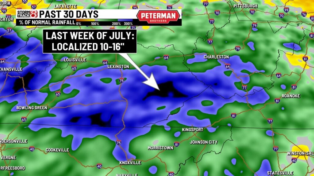
This significant flooding caused river levels to rise to major flood stage and most of these areas are still recovering. In Whitesburg, KY, the North Fork of the Kentucky River got to major flood stage at around 21′ feet before the gauge failed. Compared to normal rainfall amounts over the past 30 days, eastern Kentucky has seen a good chunk of the area up over 300% percent on rainfall.
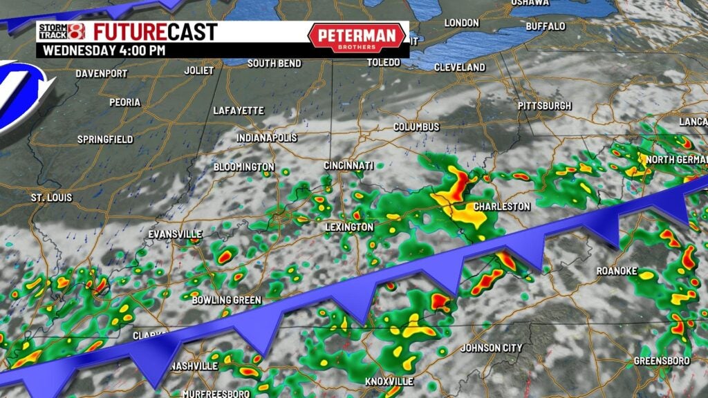
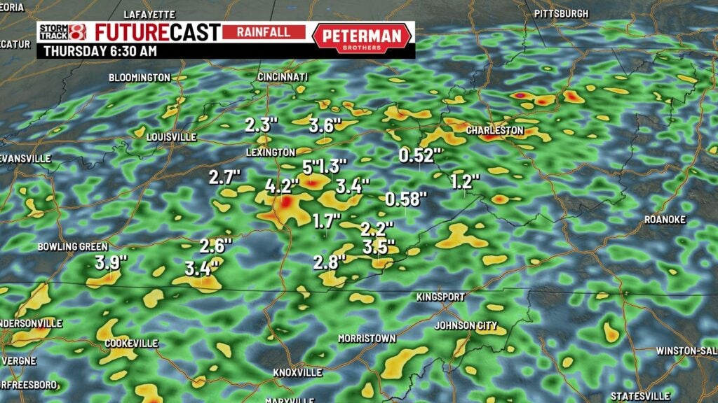
Futurecast shows that spots will have the chance of getting 3″ or more of rain from Tuesday night into early Thursday morning.