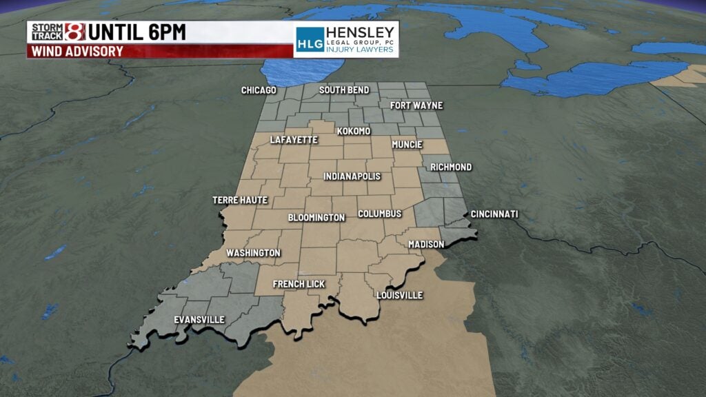
Windy with storm chances later this afternoon
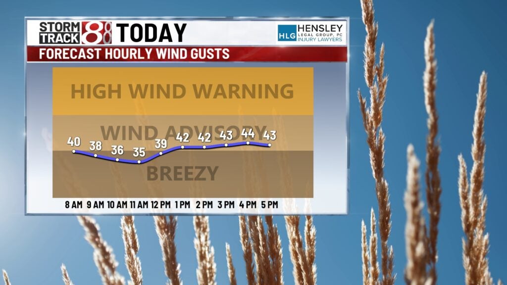
Wind gusts could reach up to 50 mph today
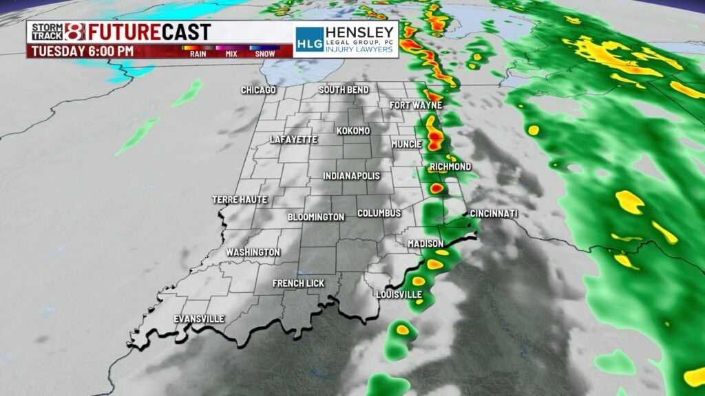
Tuesday:
The wind advisory remains in effect until 6:00 PM Tuesday.
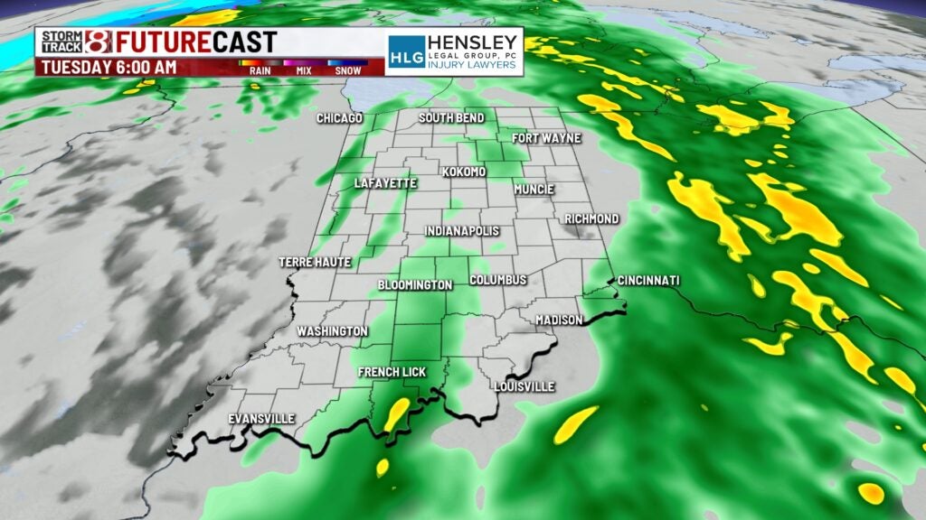
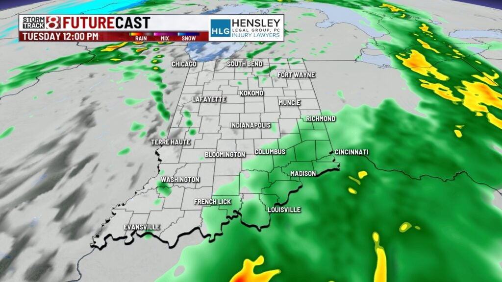
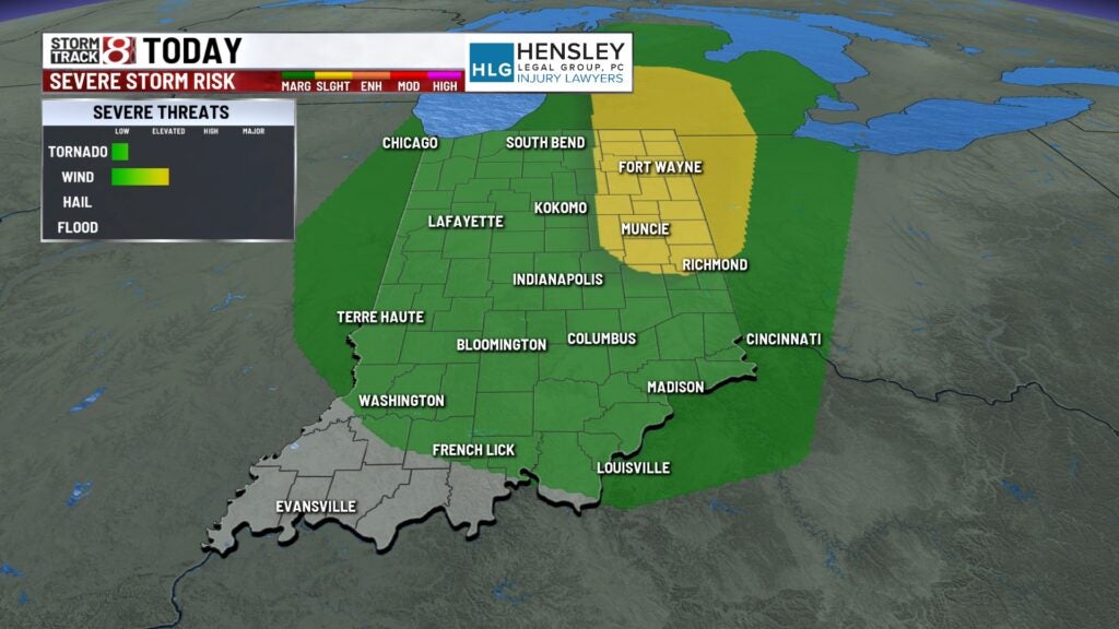
As As a cold front moves through later this afternoon we expect a few isolated showers and thunderstorms to develop. There is enough spin in the atmosphere that there is the possibility of a quick spin-up of a tornado. The higher-end severe threat would likely be a damaging wind threat, especially in northeastern Indiana.
Meanwhile, wind gusts could reach up to 50 mph at times throughout the day.
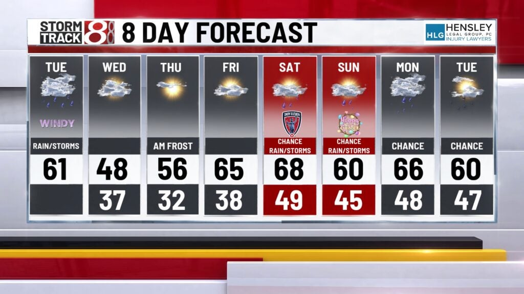
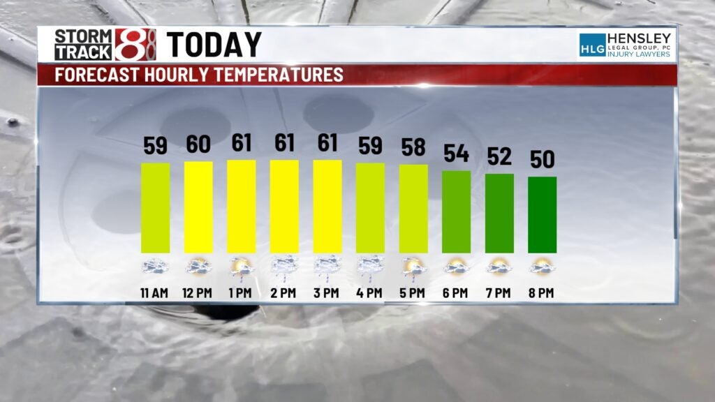
Highs top out in the lower 60s by early afternoon but will quickly fall into the 50s after the cold front passes by later in the day.
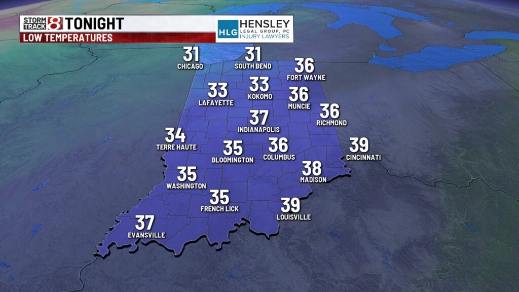
Tuesday night:
Some areas of drizzle are possible later tonight otherwise we’ll quiet things down with lighter winds and colder temperatures. Lows dip down into the mid and upper 30s.
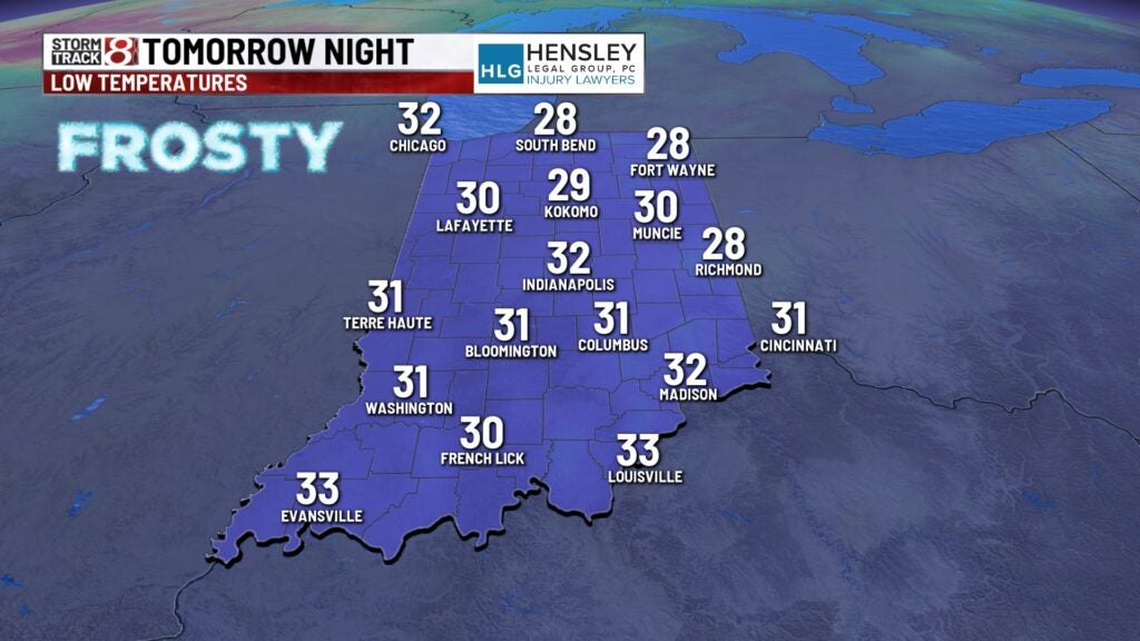
Mid-week:
Wednesday and Thursday look to be dry however we will be much colder. Wednesday’s highs only top out into the mid and upper 40s. We do anticipate widespread frost and possibly freezing temperatures when you wake up Thursday morning.
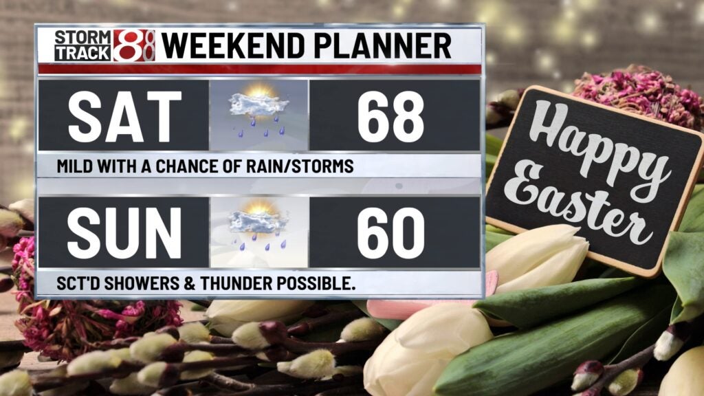
Holiday weekend:
Milder temperatures returned for Good Friday with highs back into the mid-60s across the region. The holiday weekend looks active with a warm front draping itself across much of the Midwest. Expect scattered rain and possibly thunderstorms chances Saturday Sunday and Monday although it does not appear that the days look to be a washout at this time.
8 day forecast:
Temperatures look to remain above average for the extended especially during the holiday weekend.