


Wintry mix with windy conditions Monday
INDIANAPOLIS (WISH) — Ugly start to the week, with chilly rain, mixing with sleet and freezing rain at times. Warmer temperatures return mid week.
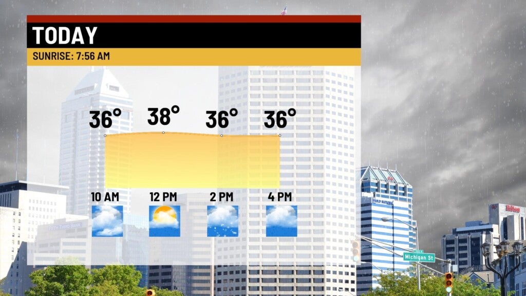
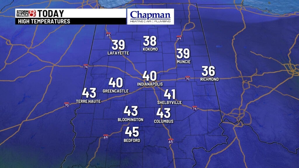
Monday:
A massive system that wreaked havoc out west over the weekend slowly moves into the Midwest, Monday. Expect rain showers to continue through the morning. As temperatures continue to fall, we’ll transition to a mix of rain and sleet, and possibly freezing rain at times. The main focus will be on the northern half of the state, where temperatures will hover or dip just below freezing.
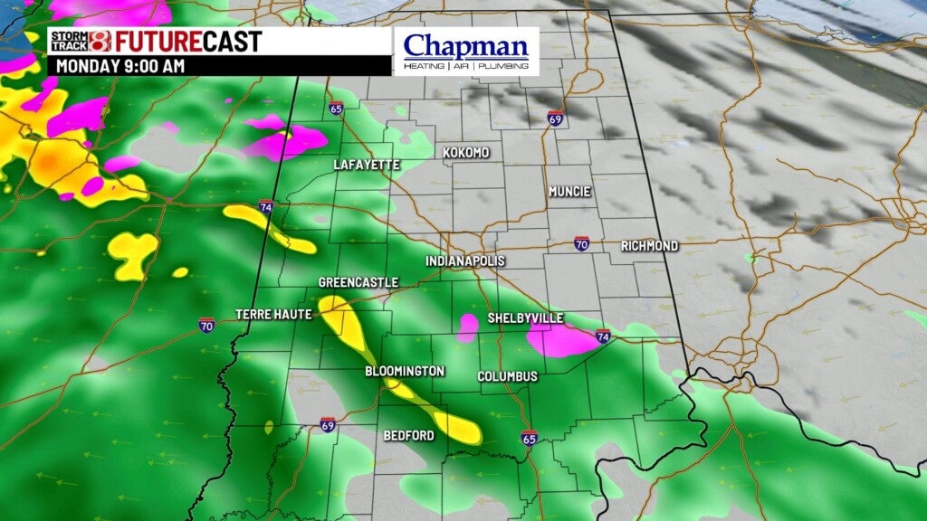
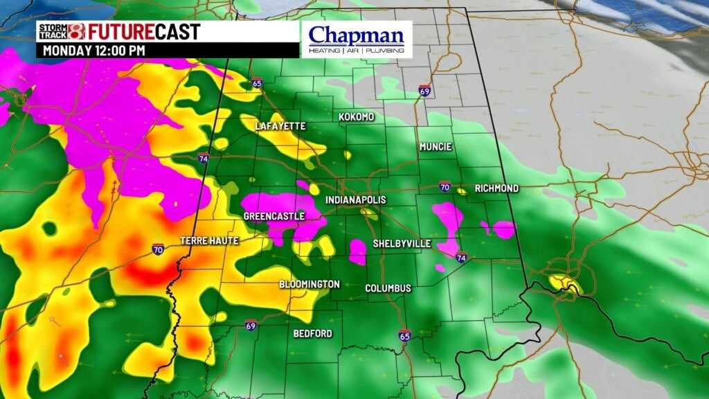
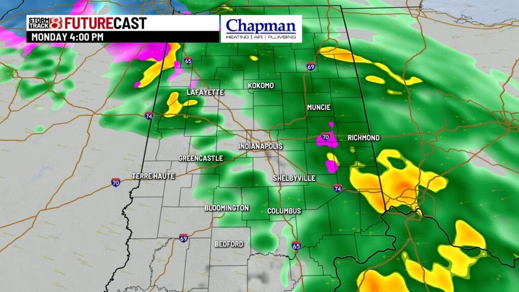
Icing should be limited, due to a warmer ground temperatures. That said, some elevated surfaces could become icy.
Along with the rain, wind gusts will range between 35-40mph for much of the day.
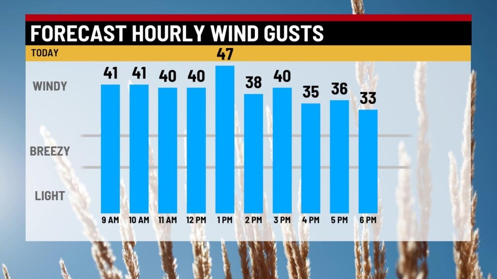
Highs will hover in the mid-30s for much of the day.
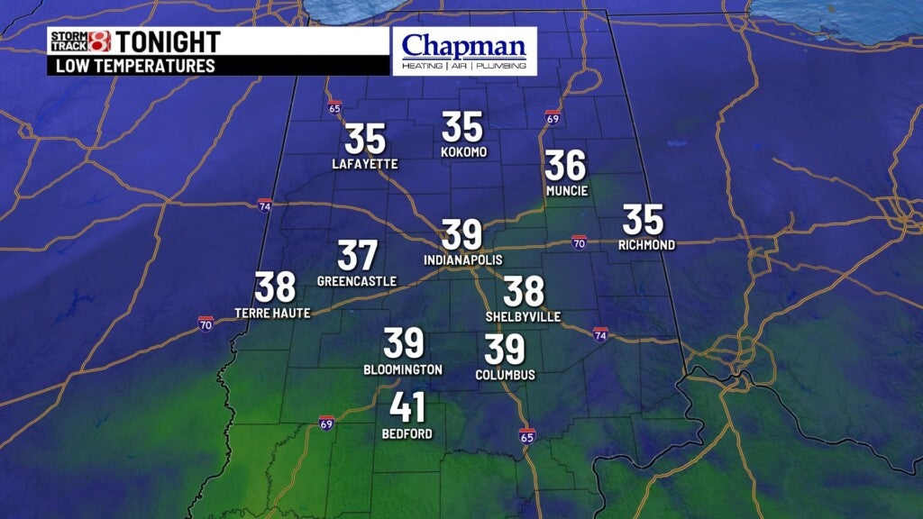
Monday night:
Rain will come to an end by early evening. We’re left with mostly cloudy conditions and warming temperatures overnight, with temperatures hovering in the lower 40s leading into daybreak.
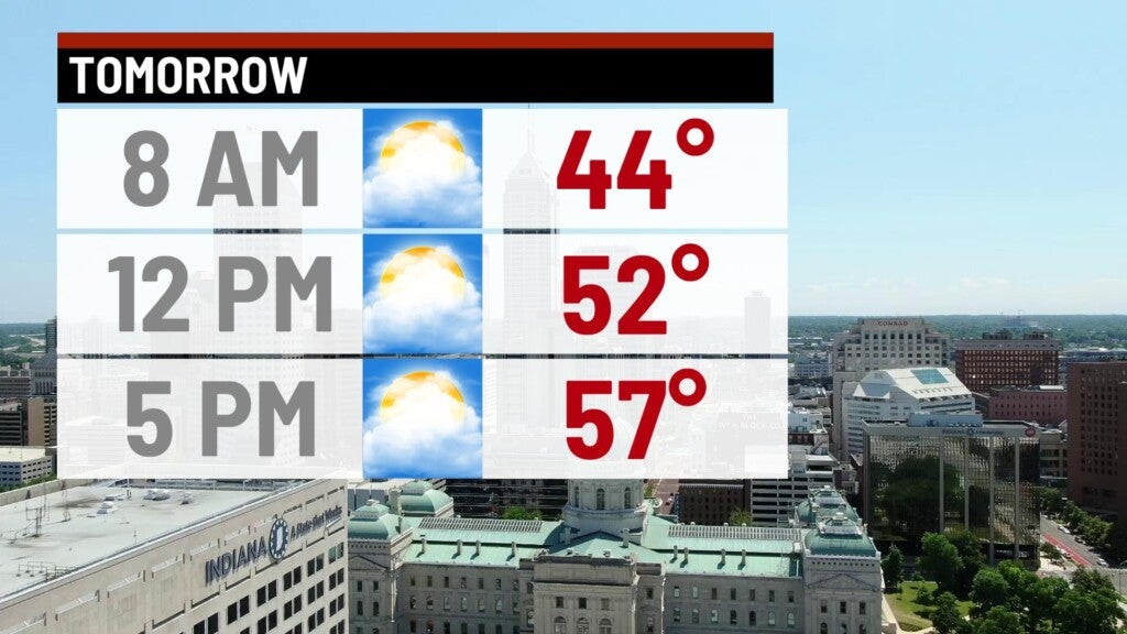
Tuesday:
Much better day on tap, with sunshine returning and back to above average temperatures. Highs top out in the upper 50s.

8 day forecast:
The warmest day of the week is on Wednesday (St. Patrick’s Day luck??), with highs in the mid-60s. Another potent system moves in Thursday, bringing the potential for some thunderstorms and also heavy rain. Quick cool down with highs in the lower 50s by Friday, before we bounce back to the 60s by the end of the weekend.
