


Dry and comfortable weather returns
INDIANAPOLIS (WISH) — After a brief shot of showers overnight, drier and more comfortable air will move into central Indiana for the extended forecast.
Sunday:
A cold front will continue to march across the state this morning. A few early-morning isolated showers will hang around, but should quickly move out by mid morning.
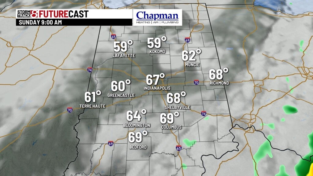
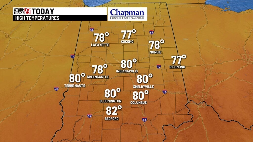
Some areas of fog and low cloud cover will be possible through the mid to late morning hours, but we should see the skies breaking by the afternoon. Highs will top out in the upper 70s and lower 80s

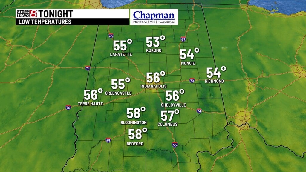
Sunday Night:
Clear, cool and quiet conditions are anticipated for the overnight hours. Lows should fall to the middle 50s across the area.

Monday:
It will be a beautiful start to the work week,with sunshine and pleasant conditions. Highs will finish up in the upper 70s.


8-Day Forecast:
Quiet weather will continue for Tuesday into Wednesday. Tropical Storm Sally will make landfall along the Louisiana coast on Tuesday. Most of the remnants will stay to our south, but some outer bands could reach parts of our area late Wednesday night into Thursday. Unfortunately, with drier air in place over the Midwest, rain chances will be very limited and likely won’t amount to much, in what has been a very dry stretch for central Indiana over the last month.

Temperatures remain near normal for the entire extended, with extremely limited rain chances over the next 8 days.
