
Weather blog: Flooding ahead for central, southern Indiana

- Interactive radar | Latest forecast in weather blog | Closings and Delays | Storm Track 8 weather app |Watches and warnings | Hourly forecast | Wind gusts | Check the Indiana Travel Advisory map
INDIANAPOLIS (WISH) — Storm Track 8 tweeted shortly after 3 p.m. Thursday that a flood watch is in effect from 8 p.m. Thursday-8 a.m. Saturday.
Round 1 of heavier rain will be Thursday night through Friday monring.
Round 2 of heavier rain will be Friday night.
Rain will become more scattered Friday afternoon in between the two main waves.
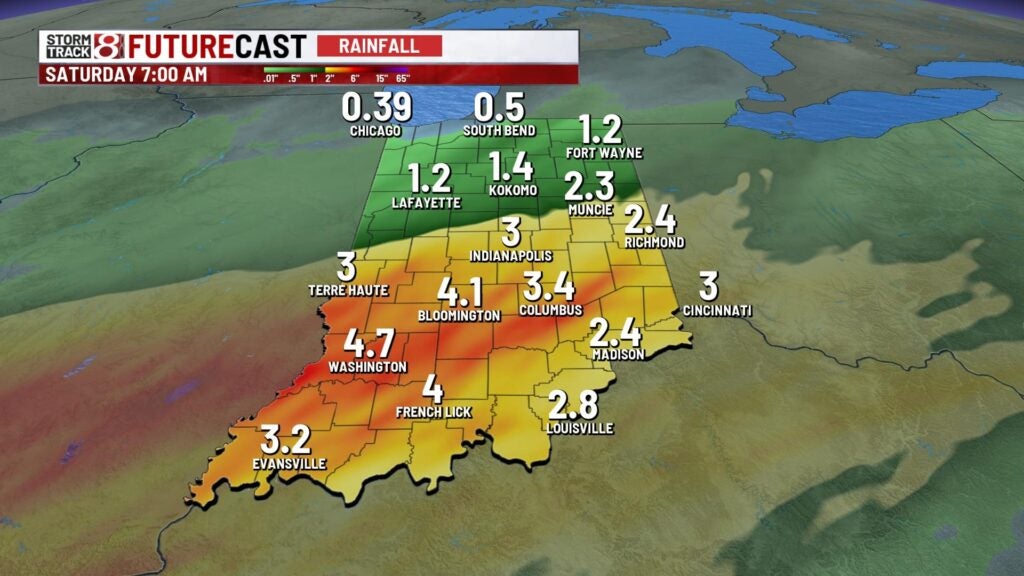
By Saturday morning, a chunk of central and southern Indiana will have received from 2-4 inches of rain, with the highest totals south of Indianapolis.


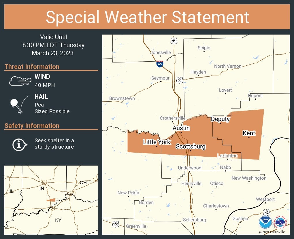
8:05 p.m.
The National Weather Service in Louisville, Kentucky, issued special weather statement for the Indiana communities of Scottsburg, Austin and Little York until 8:30 p.m. Eastern.
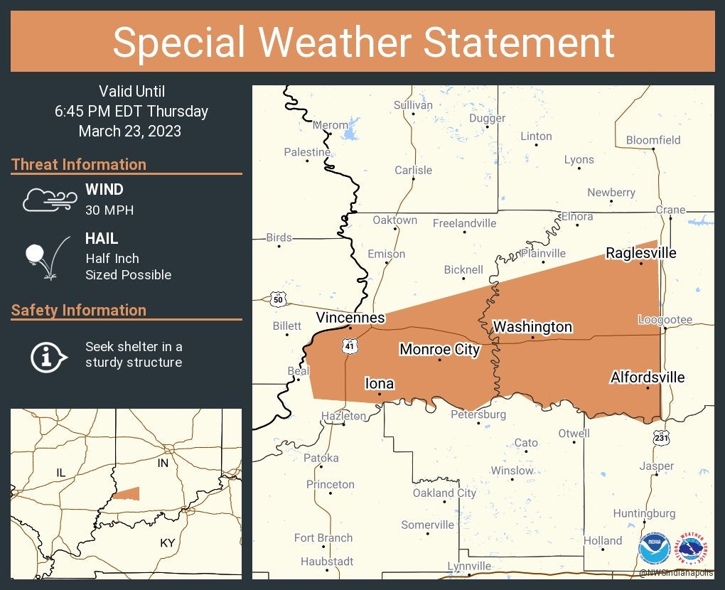
6:20 p.m.
The National Weather Service at Indianapolis issued a special weather statement for Vincennes, Washington and Monroe City until 6:45 p.m.
11:08 a.m.
10:55 a.m.
10:36 a.m.
A severe thunderstorm warning is in effect for central Morgan County and southeastern Putnam County until 11 a.m. Thursday.
At 1031 a.m. a severe thunderstorm was located 10 miles southeast of Greencastle, or 26 miles northwest of Bloomington, moving east at 55 mph.
Threats include quarter size hail. Damage to vehicles is expected.
Locations in the path of this thunderstorm include Monrovia, Brooklyn, Bethany, Centerton, Mooresville, Lake Hart, and Waverly. This includes I-70 between mile markers 43 and 52.