


Soggy and windy Mother’s Day
INDIANAPOLIS (WISH) — Chilly temperatures with on and off showers are expected as we wrap up the weekend.
Sunday:
An area of low pressure will swing through the state Sunday, bringing several rounds of showers to the area. There is a marginal risk for a few severe storms for the late morning – mid afternoon hours, with large hail and damaging winds the primary concern.
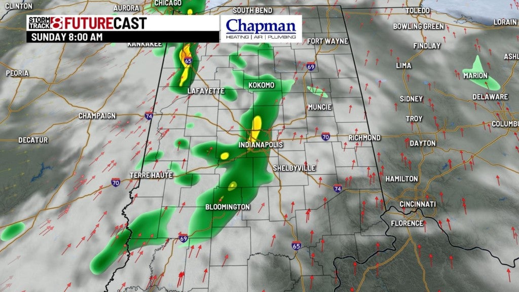


Highs will top out in the upper 50s around lunch time, and slide back to the lower to middle 50s later this afternoon.


In addition to the rain, expect stronger winds, with gusts exceeding 30mph at times through late afternoon.

Sunday Night:
A system will continue to work through the Midwest, so scattered showers will likely be around at least through the early to mid evening hours, before winding down overnight. Gradual clearing and chilly temperatures will take hold, but thanks to a stronger breeze, we should hold off on widespread frost across the area, with the exception of sheltered areas. Lows will dip to the middle 30s.


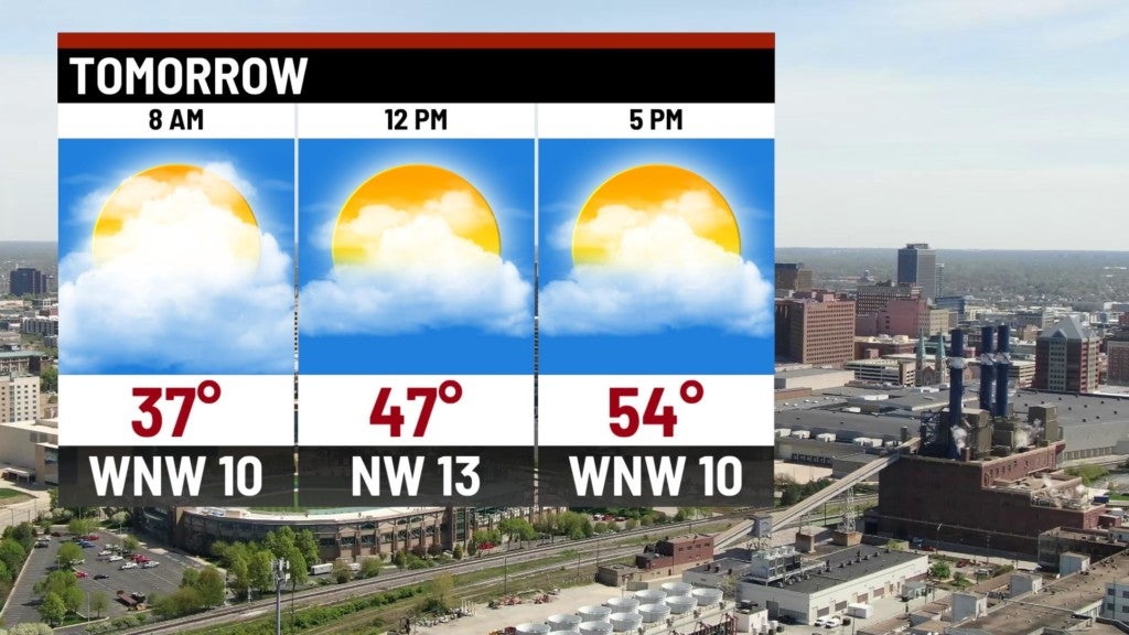
Monday:
Cool temperatures will kick off the work week. Expect sunshine with highs only in the middle 50s.
8-Day Forecast:
We’ll have a couple more cool and quiet days before we finally see a pattern change, and much warmer air will return to central Indiana starting on Thursday. Highs should hit the middle 70s to end the work week, with numbers near 80° to kick off the weekend. With the warmer temperatures comes an active pattern, with daily rain and storm chances from Thursday through Sunday.
