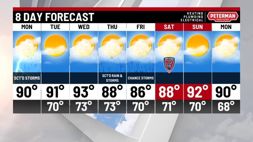
Active start to the week!
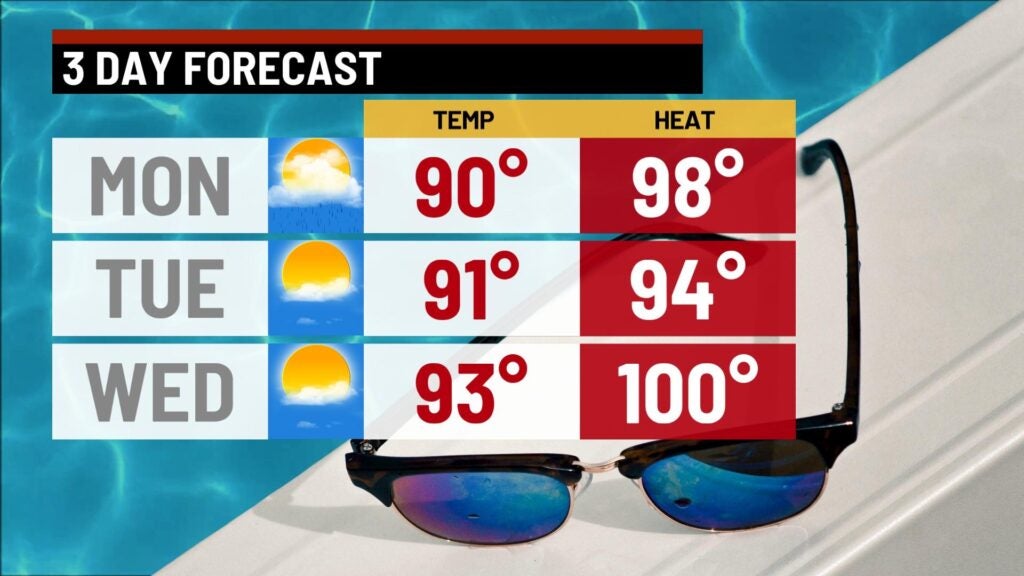
A dry start for most this Monday morning with temperatures in the lower 70s. We have several waves of storms that will pass through. First wave arrives mid morning with a gusty stom possible. An additional line of storms will develop during mid afternoon and could contain a gusty or severe storm with damaging winds as the main threat. There is a slight risk in central parts of the state. Highs today will top in the lower 90s with high humidity. Scattered storm chances will continue through this evening with lows in the lower 70s.


Tuesday will be a toasty one with highs still hot with most spots in the lower 90s with sunshine! Mid 90d return mid week with feel like temperatures in the lower 100s.

Shower and storms return late week. Thursday we factor in a scattered shower or storm into the mix with highs in the upper 80s to near 90°. Rain chances will continue through the end of the week with highs in the mid 80s.
Unsettled weather looks to continue through the weekend with highs remaining fairly toasty! Most spots will remain in the lower 90s through the weekend and early next week.