


Mild and breezy conditions before Friday night showers
TODAY
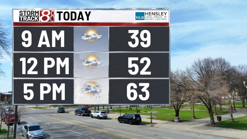
Indy welcomes the first full breaths of spring warmth with the mercury rising to a spring feeling mid-60s. A breezy feel will be present in Indianapolis all day log with clouds gathering strength late. Scattered showers arrive as we approach the twilight hours.
TONIGHT
The symphony of evening may carry a few raindrops, though fleeting and light, as temperatures dip into the more typical 32-degree range. The city’s heartbeat slows under a partly cloudy sky.
TOMORROW
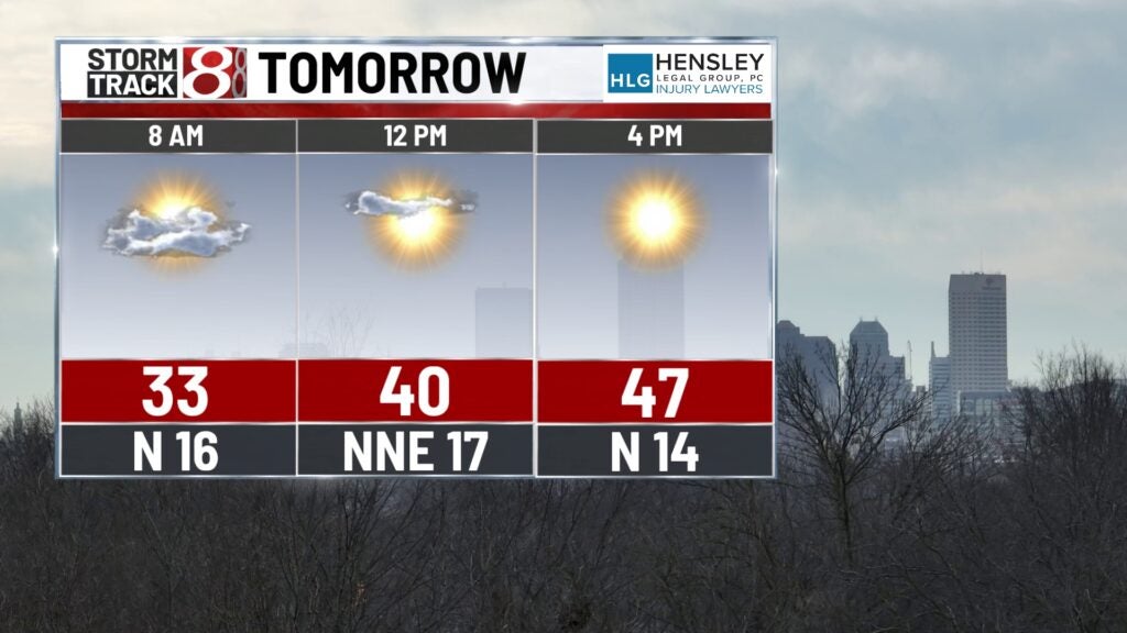
Saturday’s sun will rise to a cooler day, with the thermostat reaching only 50 if not only making it to the upper 40s. This showing a stark contrast to Friday’s warmth. The wind, shifting from the southwest to a brisk northern flow, heralds the cooler air mass moving in.
TOMORROW NIGHT
Under a quilt of scattered clouds, we’ll see a low near 30, feeling the full effect of the northern wind’s chill, a reminder that spring’s warmth is a fickle friend.
SUNDAY
A mixed sky awaits the day, offering sunny spells with temperatures bouncing back to a comfortable early 50s, as the wind settles into a more tranquil rhythm from the south.
SUNDAY NIGHT
The pendulum swings back to a milder night, with lows nestled in the low 40s and the southern breezes sustaining a hint of the day’s warmth.
8 DAY FORECAST
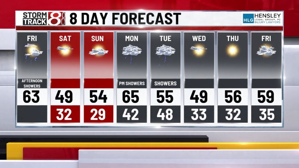
Looking ahead, we ride the carousel of early spring, with temperatures waxing and waning between the teasing warmth of sun-filled days and the nippy embrace of clear, starry nights. The weather narrative holds chapters of crisp mornings and potential rain, but overall, the script seems to be set for a gradual warming trend, hinting that we might just be bidding the last of the cold adieu. Showers look very likely as we move into Monday night. These showers could last till around sundown Tuesday and hold a few thunderstorms within it.