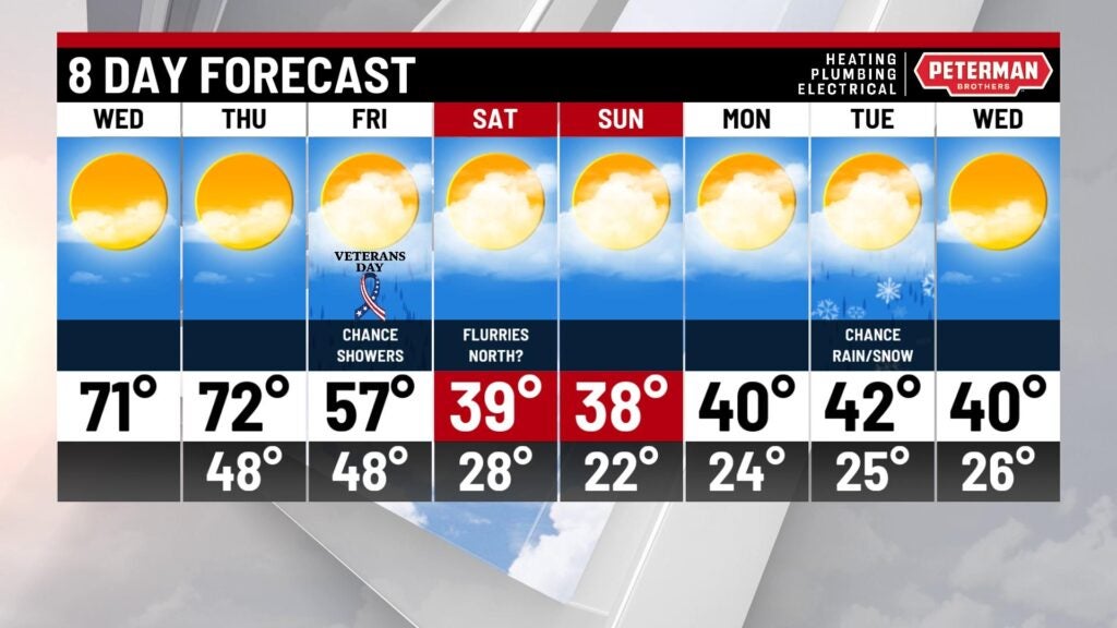
Mild mid week; Big cool down ahead
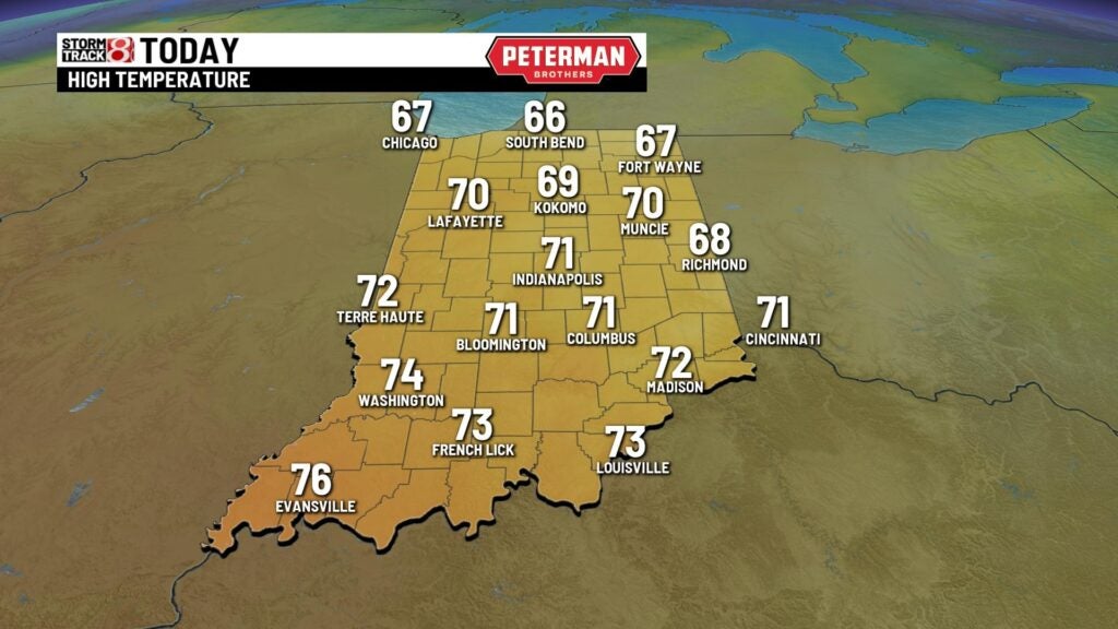
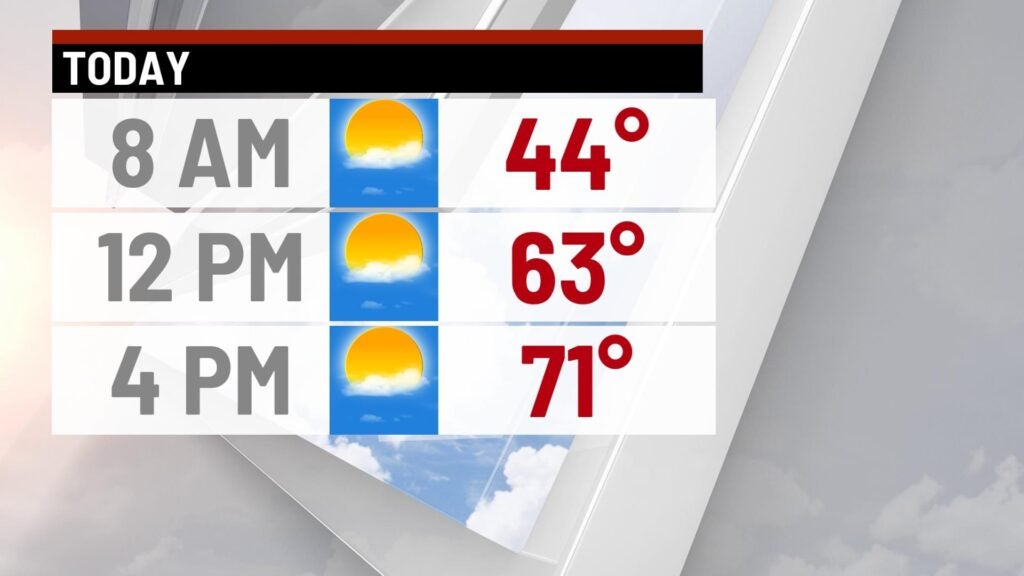
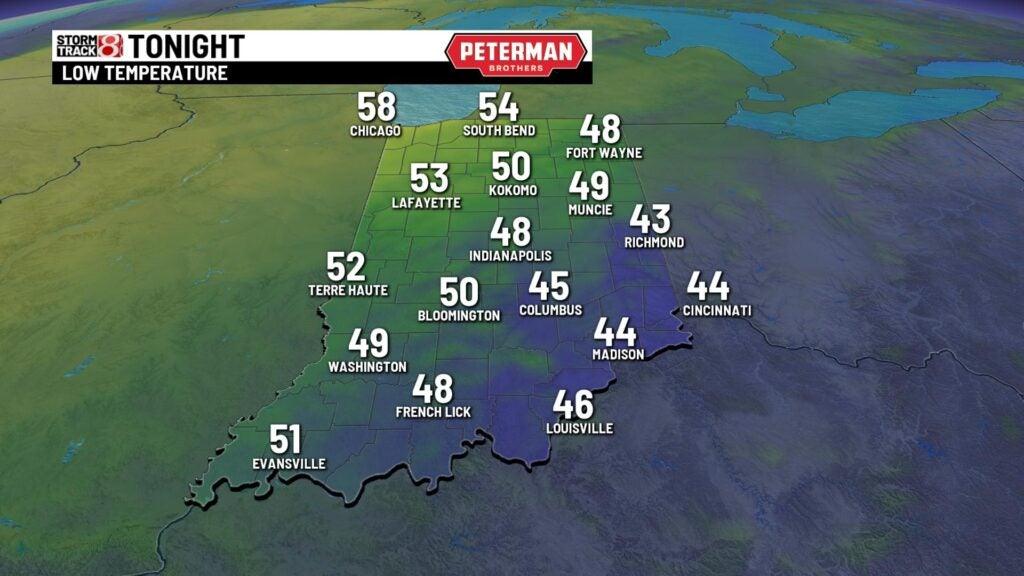
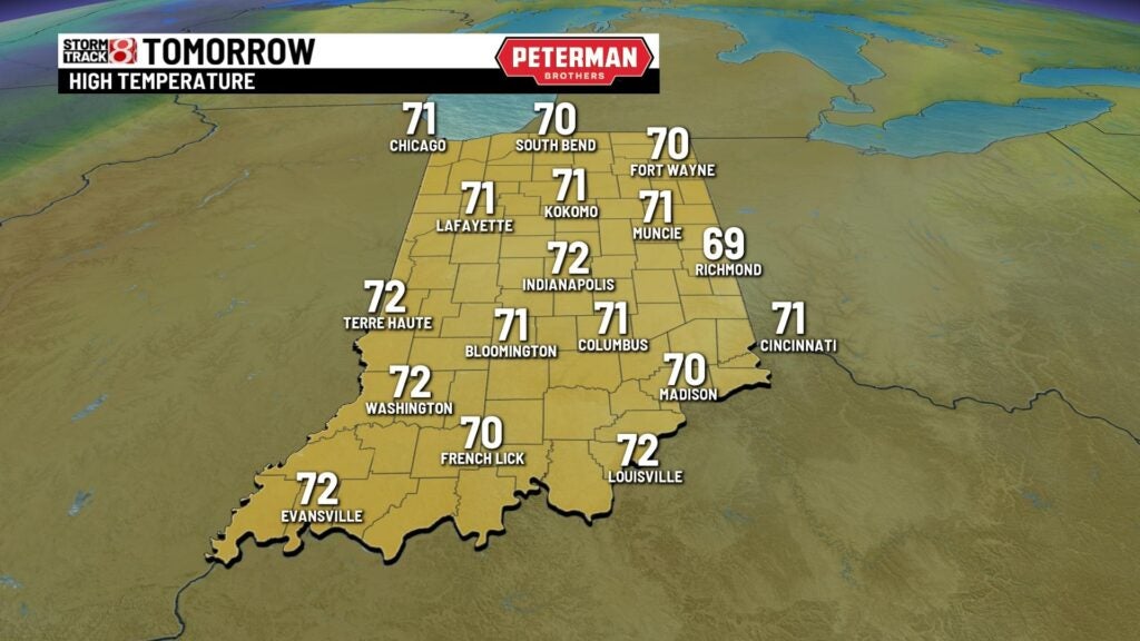
A cool start to the morning with temperatures in the lower 40s with a clear sky. Should be a beautiful day with highs in the lower 70s with mainly sunny skies. Lows tonight will fall to the upper 40s. Should be another beautiful day Thursday with highs in the lower 70s with a slight breeze. This is all out ahead of our next cold front which will shake things up for us temperature wise.
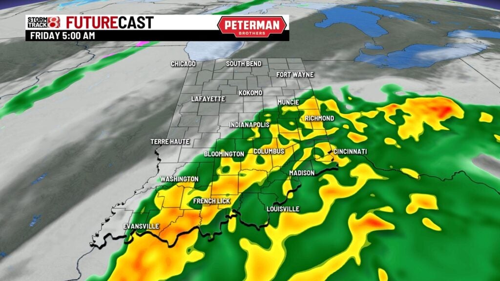
We’re tracking tropical storm Nicole which will make landfall as a cat 1 hurricane or a strong tropical storm along the Atlantic coast of Florida. Some of that moisture could give us a stray shower Friday with most spots staying dry. The cold front will help usher out some of the moisture Friday but will drag in much colder air. Highs thorugh the end of the week with remain mild with highs in the lower 60s.
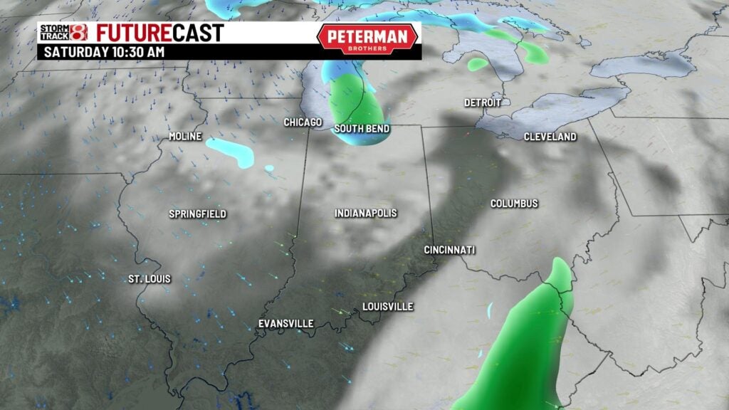
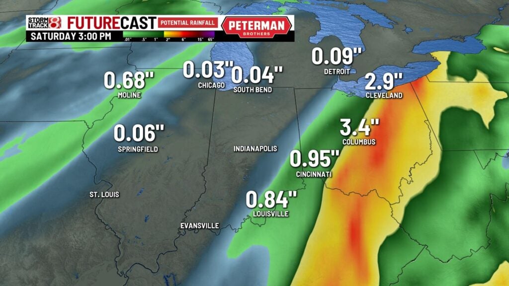
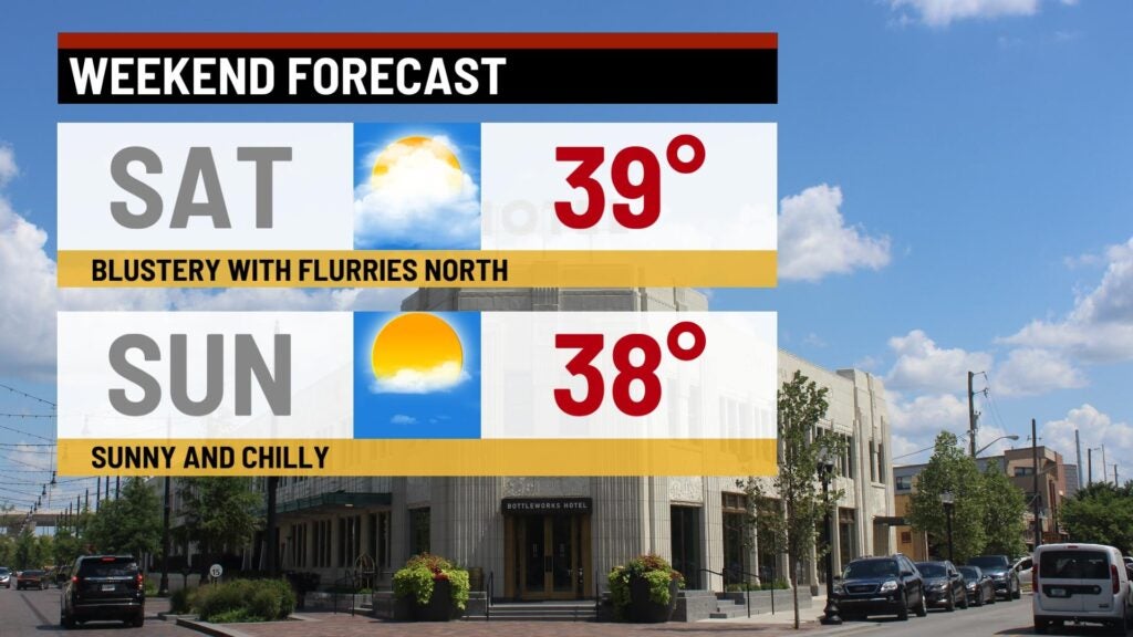
Much colder weekend for us with highs struggling to make it out of the 30s both Saturday and Sunday! There might be a stray snow chance early on well north of the viewing area. Most of the weekend will be bright with plenty of sunshine.
Early next week we’ll have this cooler pattern stick around with a rain/snow chance Tuesday with highs in the lower 40s through mid week.