


Navigating between raindrops next week
TONIGHT
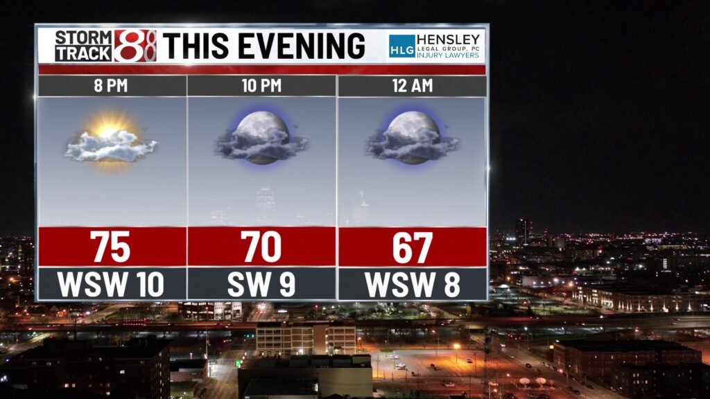
The evening bids farewell under mostly clear skies, as temperatures dip to a comfortable 59°F. Gentle southwest breezes set the stage for a serene night.
TOMORROW
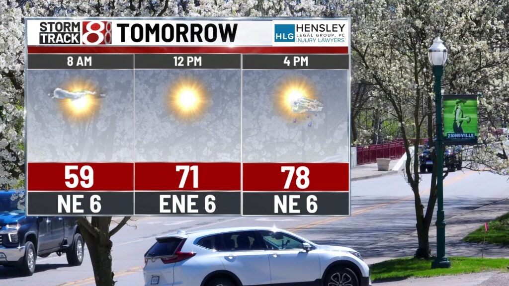
As we tally our deductions, the sun asserts itself with a high of 79°F, promising a bright outlook amidst the tax season hustle. A light northeast wind whispers through at 7 mph, offering a respite from the calculators and forms.
TOMORROW NIGHT
Partly cloudy with a 20% chance of late-night showers, the ledger of the sky balances out to a low of 59°F. Winds from the east-northeast keep the air stirred at a calm 6 to 9 mph.
TUESDAY
Uncertainty creeps into our fiscal day with a slight chance of morning showers, followed by potential afternoon thunderstorms. The financial forecast tops at 76°F, while south-southeast winds 10 to 14 mph, with gusts up to 22 mph, remind us to anchor down those receipts.
TUESDAY NIGHT
Nightfall could bring a 90% chance of thunderstorms, as the atmosphere audits the day. With a low around 63°F and breezy conditions, it’s a night to secure those windows.
WEDNESDAY
Showers likely, mainly after 3 pm, under mostly cloudy skies and a high near 74°F. The air moves briskly from the south at around 26 mph, gusting up to 40 mph, stirring up any unsecured tax documents left astray.
WEDNESDAY NIGHT
Showers continue as we clock out of the midweek, with a 70% chance of precipitation. The atmosphere’s review results in a steady east-northeast wind of 9 to 14 mph, gusting as high as 21 mph.
8 DAY OUTLOOK
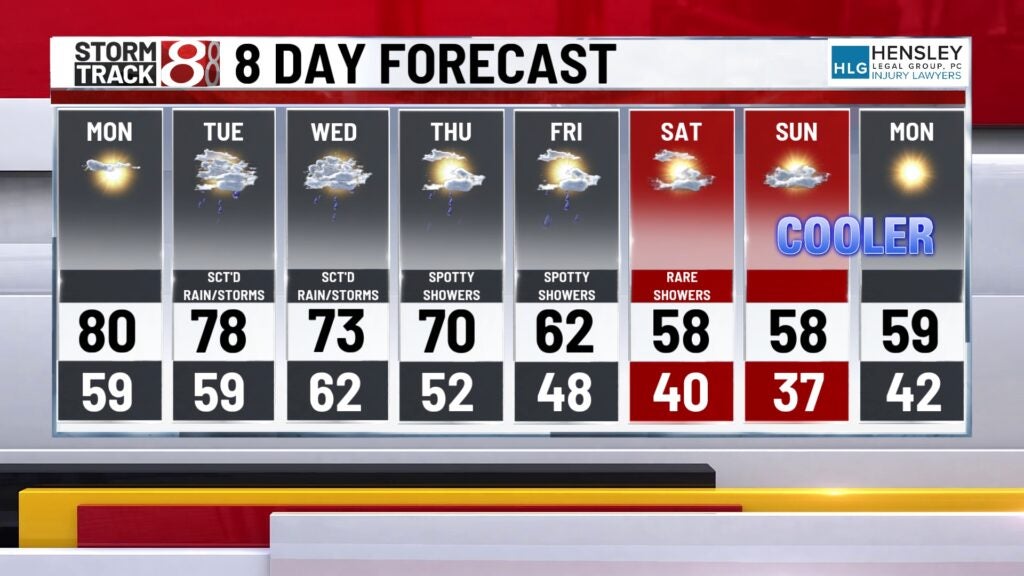
As the workweek progresses, so does the chance of showers, peaking on Thursday with a 30% likelihood. Cooler air moves in, dropping temperatures to a high of 68°F. It’s a reminder that, just like our financial climate, our weather is subject to change. But looking ahead, the forecast hints at clearer skies—just in time for us to appreciate the returns of our labor, both fiscal and agricultural.