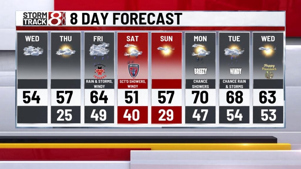
Quiet and bright day!
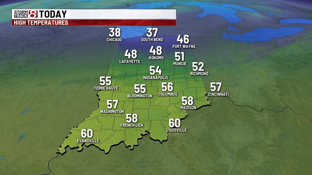
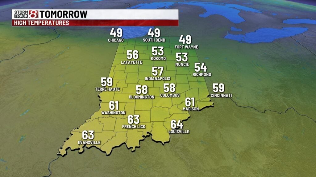
A chilly start to the morning with temperatures in the lower 30s with a wind chill in the mid 20s! Should be a seasonal day with highs in the mid 50s! A cold front will pass through this afternoon and evening with a stray shower chance as the front passes through. Lows wll bottom out in the mid 20s. Highs Thursday will hit the seasonal high with most spots in the upper 50s with some usn and clouds.


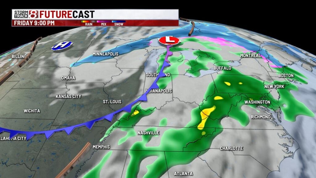
Friday will be an active weather day with highs in the mid 60s. Winds will be windy during the day with a cold front approaching. This cold front will also generate storms that could turn strong to severe. The main threat with these storms will be damaging winds. There is a slight risk in central parts of the state while areas west have an enhanced risk.


There could be a stray shower left over Saturday morning but we will salvage the afternoon with winds sticking around through the afternoon. Highs will cool to the lower 50s. Highs Sunday will warm to the upper 50s with sunshine. Rain chances return Monday but highs warm significantly to the lower 70s. Rain stick around through Tuesday with highs in the upper 60s.