Several rain and storm chances ahead
INDIANAPOLIS (WISH) — We were greeted with a refreshing Tuesday across the region with warmer temperatures and some sunshine.
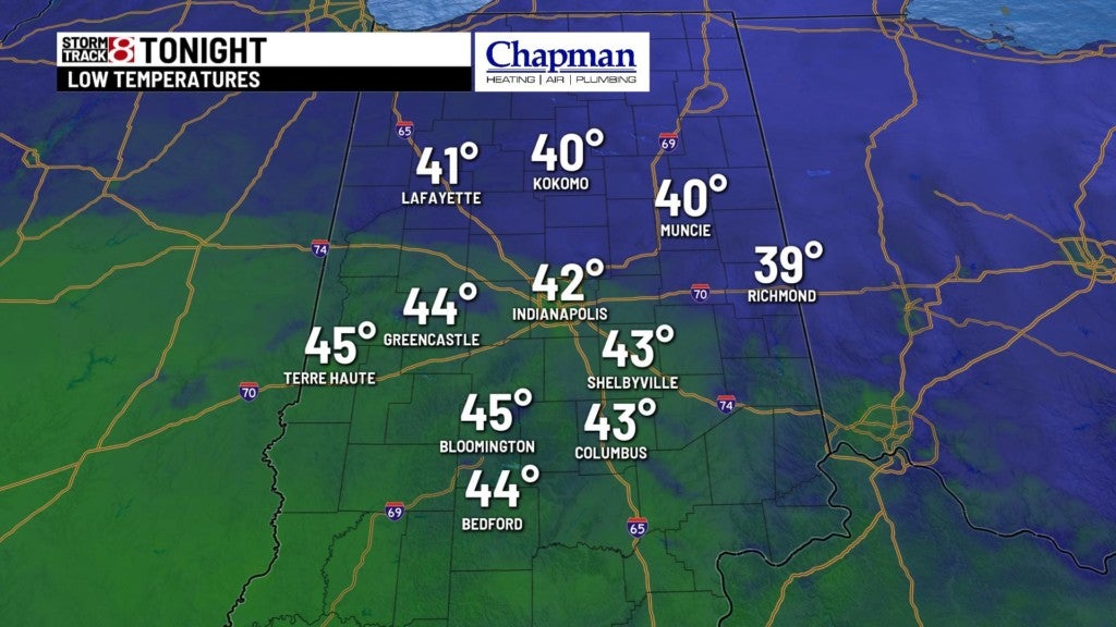
Tuesday night:
Expect a dry and cool night under partly cloudy skies. Lows bottom out in the low 40s.
Wednesday:
We have the chance to see spotty showers before sunrise Wednesday morning. Rain chances and winds will increase throughout the day with mostly cloudy skies.
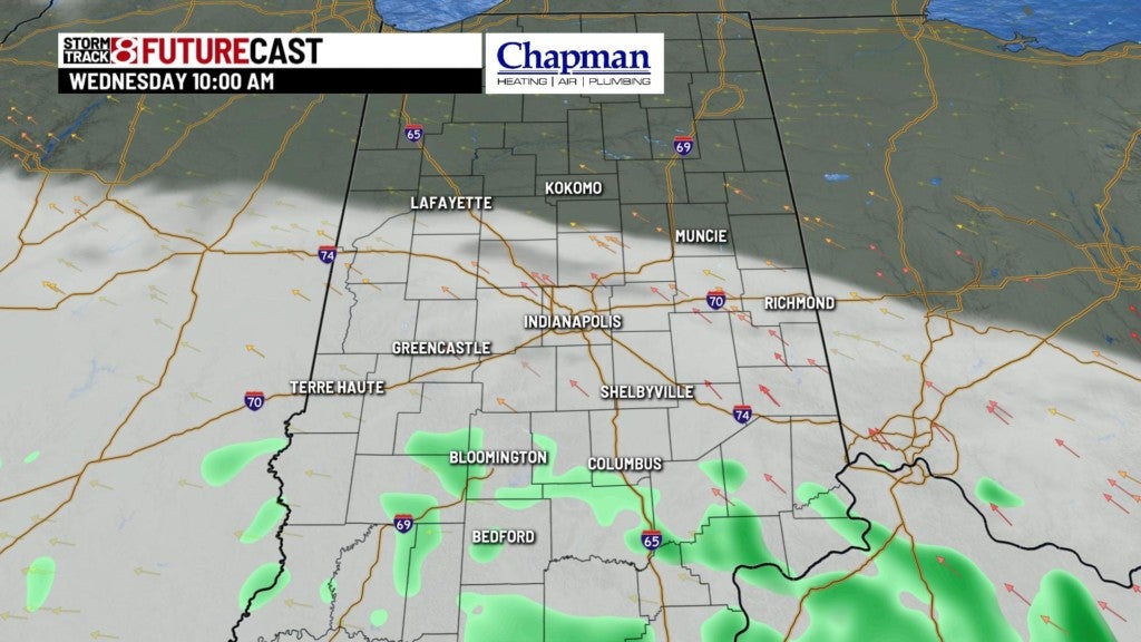
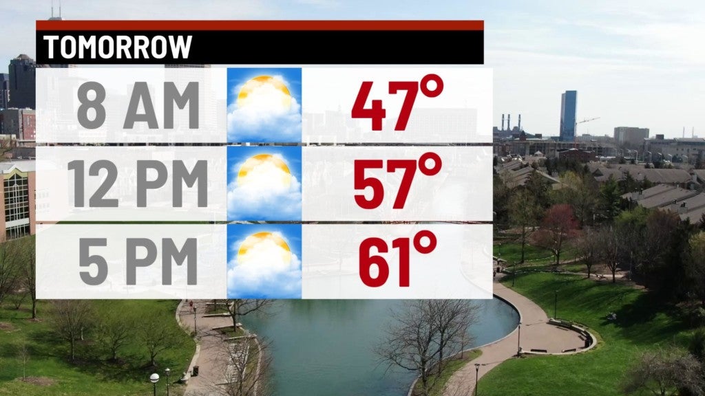
Temperatures will remain mild as our highs top out in the upper 50s to low 60s.
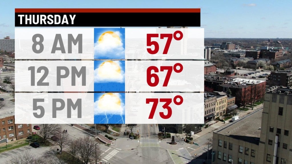
Thursday:
The active weather pattern will ramp up through your Thursday with much warmer air moving into central Indiana. Showers and storms will become numerous in the afternoon hours with the potential for an isolated strong to severe storm west of Indianapolis. There is a Marginal Risk in place for western Indiana with the main threats being isolated damaging wind gusts and hail.
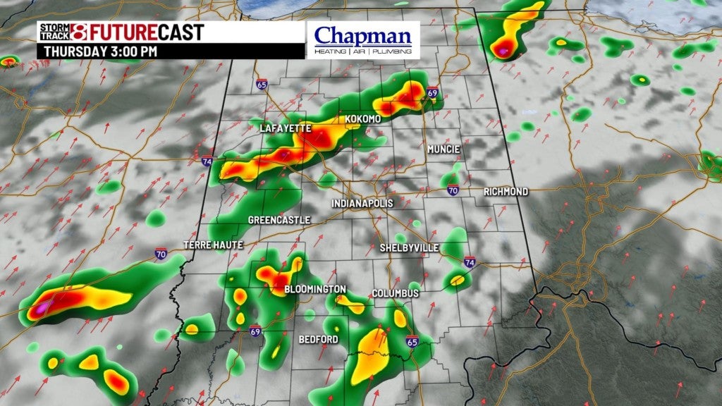

Highs will climb into the mid to upper 70s.
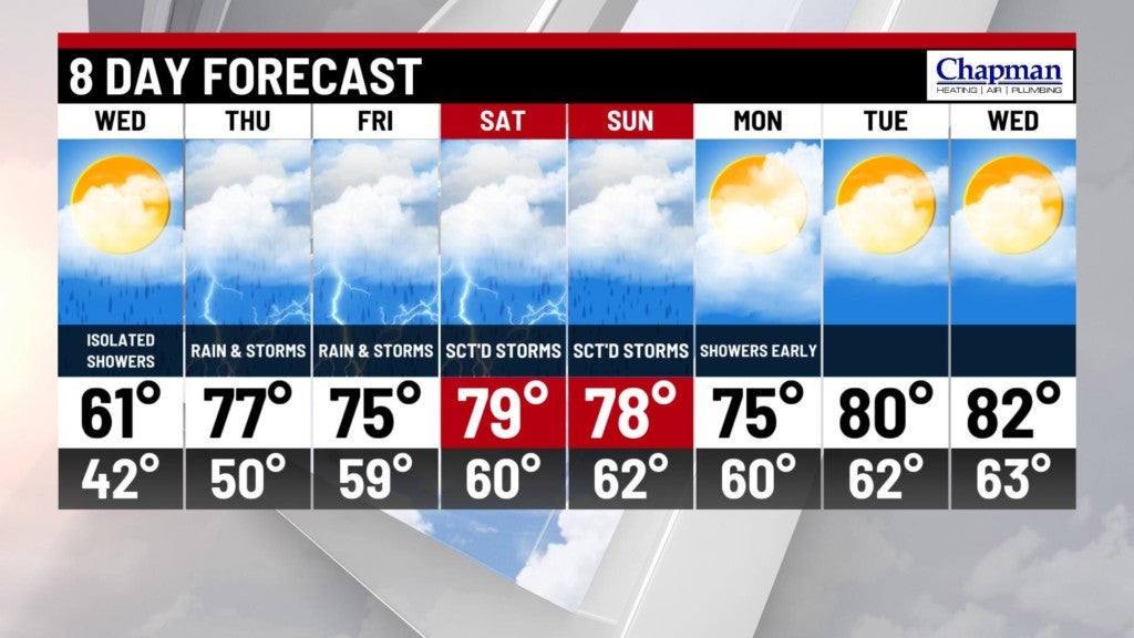
8 Day Forecast:
Expect our active weather pattern to continue into the weekend as you will want to keep the rain gear in handy. Showers are likely throughout the day Friday with rain chances continuing through the weekend and into next Monday, eventually drying out by Monday afternoon. High temperatures look to approach the 80° mark for your Saturday and Sunday.