Several rain chances for the rest of the week
INDIANAPOLIS (WISH) — Much of the state will pick up at least 1″ of rainfall through the end of the week.
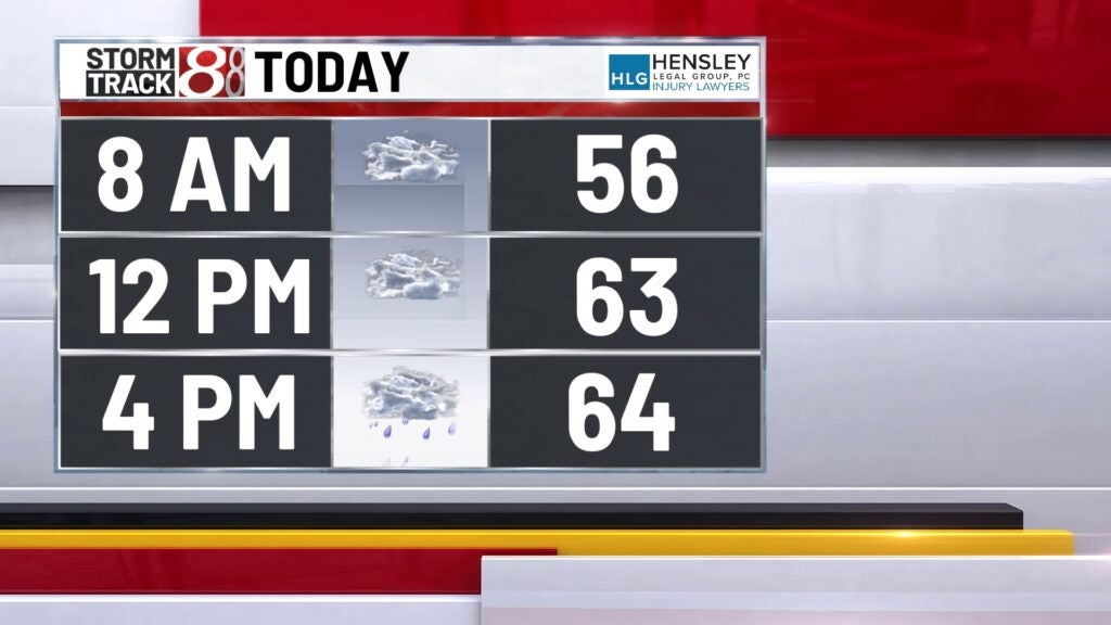
This morning:
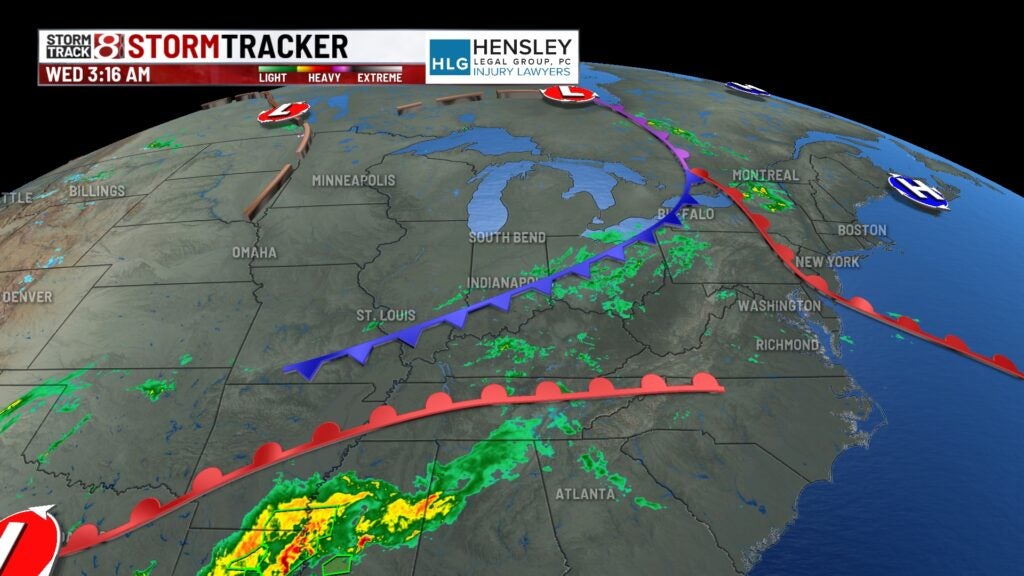
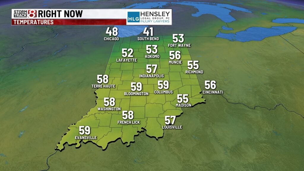
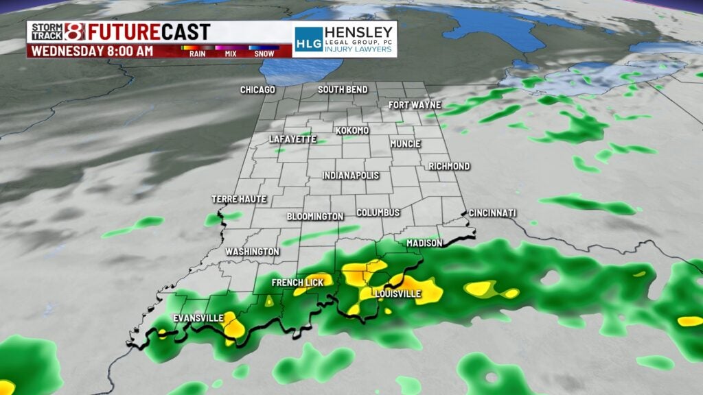
We’re starting the morning off with showers and thunderstorms across the area. This rain should be relatively light, but it will likely linger on for much of the early morning hours.
Wednesday:
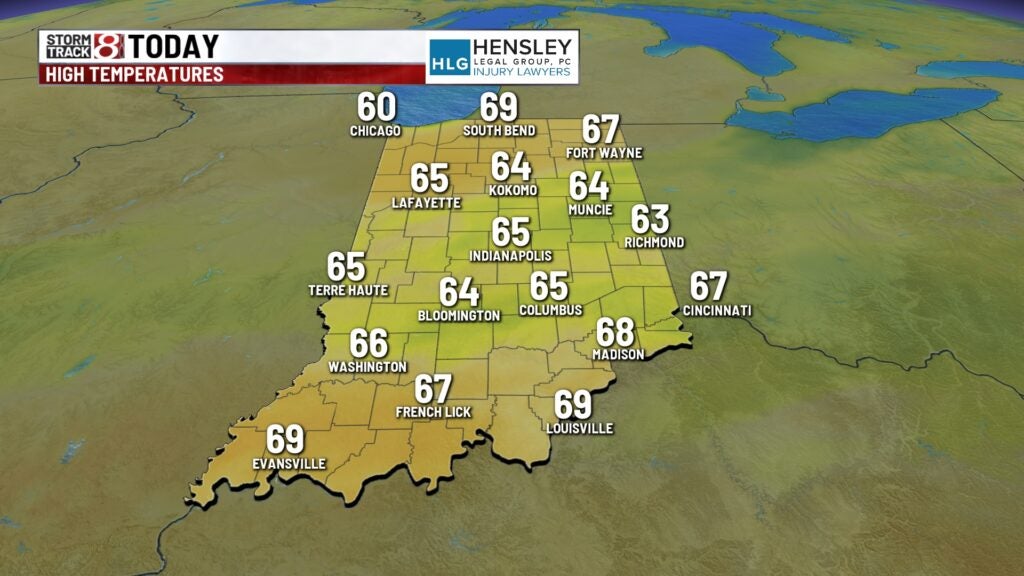
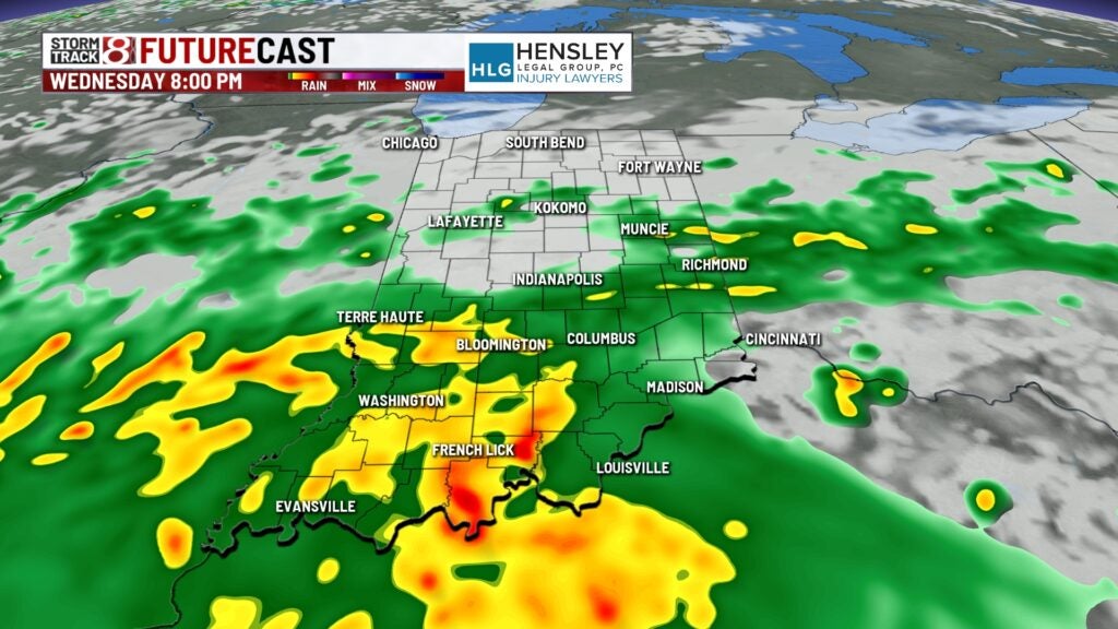
Area low pressure will continue to strengthen to our west. Showers and thunderstorms are expected to increase by late afternoon. High temperatures will pop out into the mid-60s later today.
Wednesday night:
Rain chances will become much more widespread as we get into the evening and overnight hours as low pressure continues to get closer to our area. The rumbles of thunder, but any storms should be below severe limits.
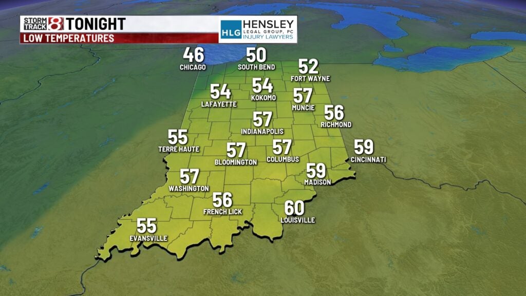
Overnight fall to the mid-upper 50s.
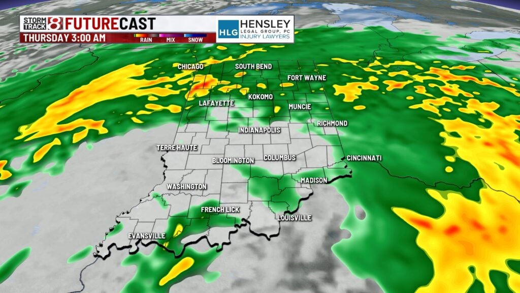
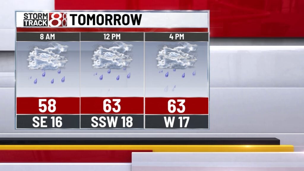
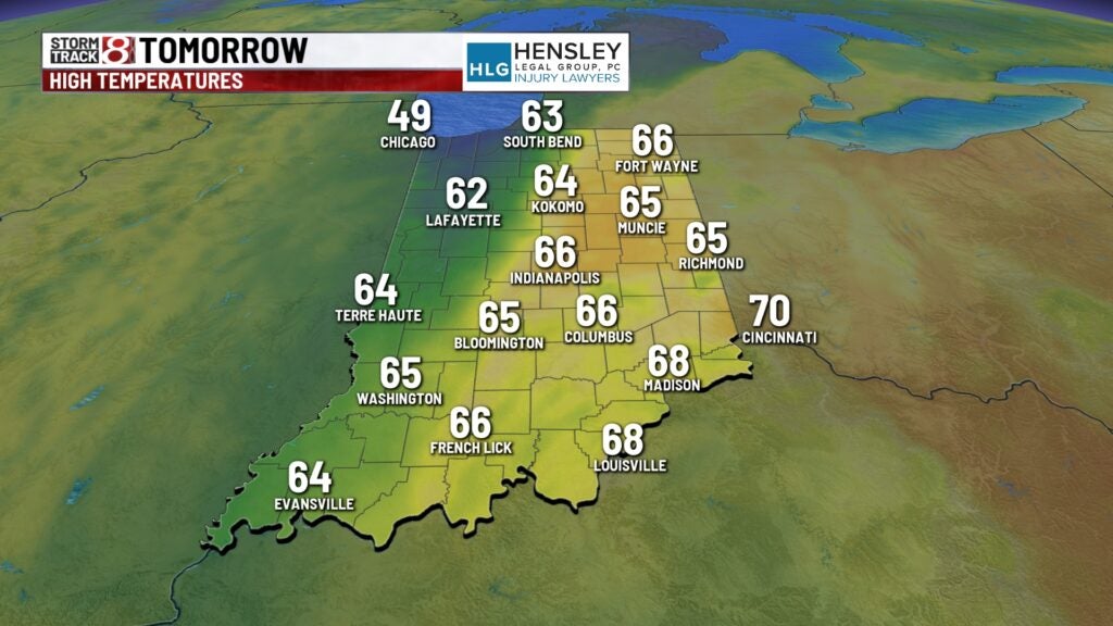
Thursday:
Surface low continues to roll over the state on Thursday, bringing widespread rain and a few scattered thunderstorms.
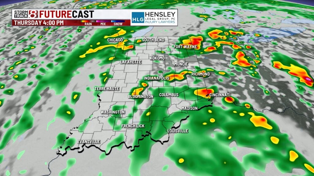
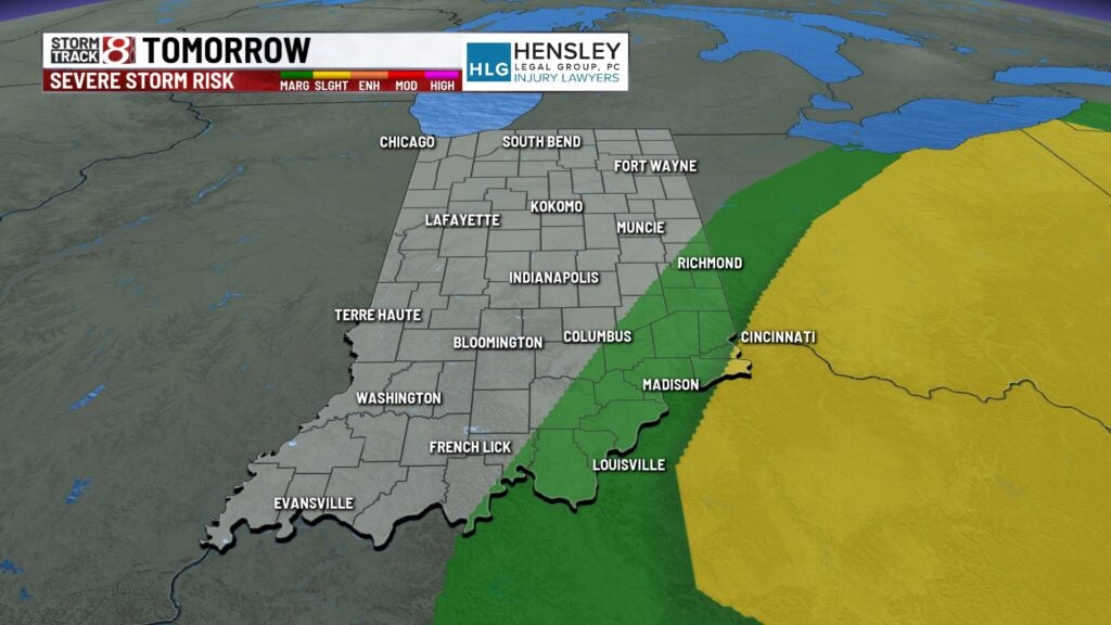
There is also potential for some gusty winds and maybe some large hail, especially in the eastern portions of the state, where there is a level one out of five threat for severe weather.
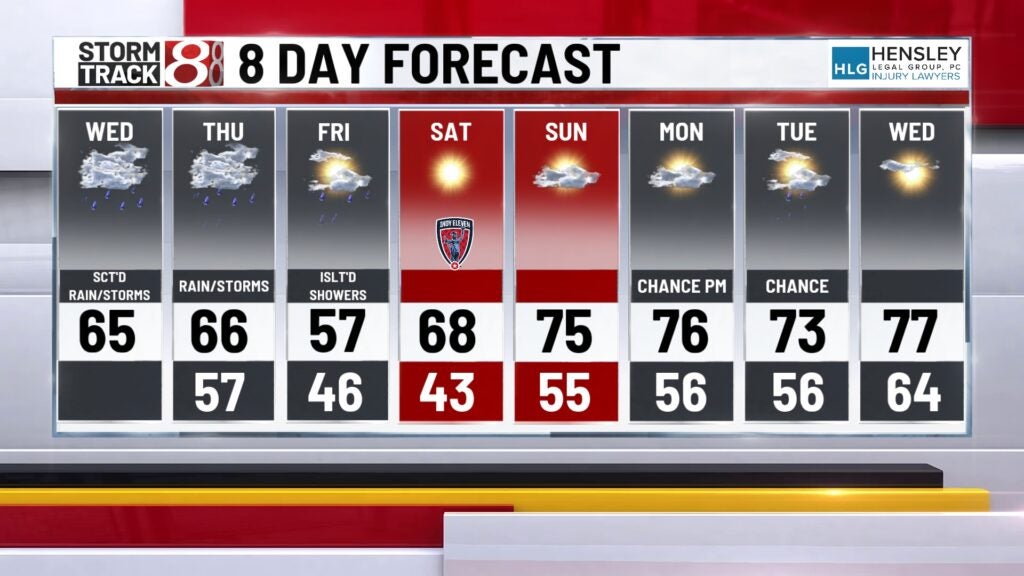
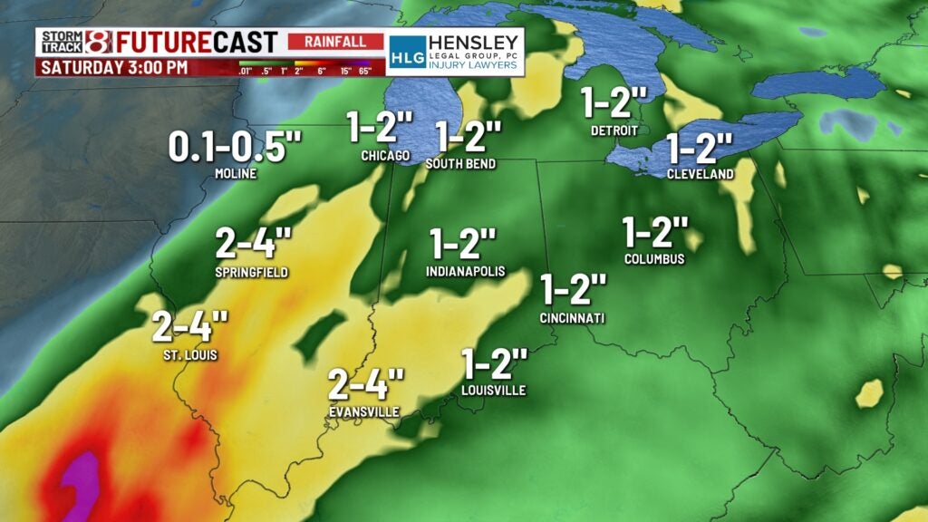
Total rainfall could be in the range of one to two inches through Friday.
High temperatures out in the mid-60s Thursday afternoon.
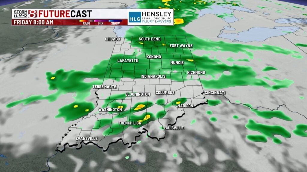
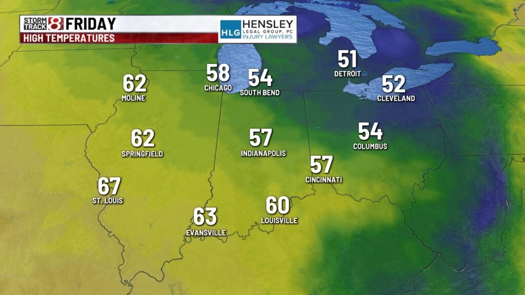
Friday:
Leftover showers will linger on Friday with one cloud, cooler temperatures, and some gusty winds at times.
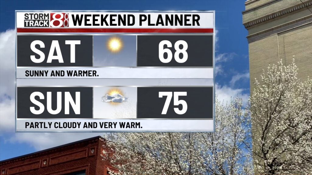
Weekend:
The weekend looks much better as high pressure settles in. Sunshine returns for Saturday, with Heisner 70 and mid-70s on the way for Sunday.
8 day forecast:
The pattern looks smiley as we open up the new work week with Heisen of the mid-70s on Monday, Tuesday, and Wednesday. There will be a few rounds of showers and thunderstorms, possibly starting Monday night through Tuesday.