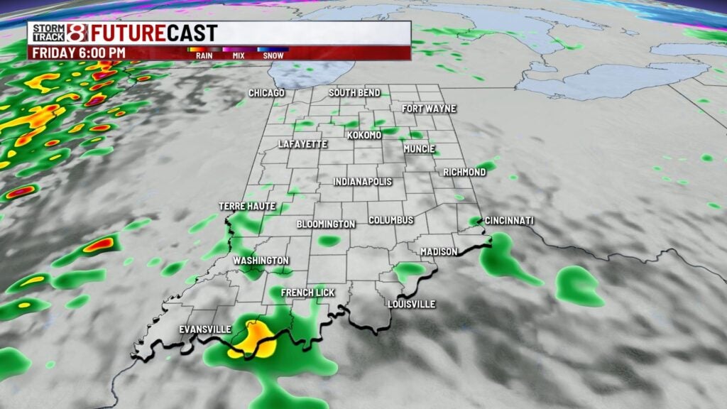
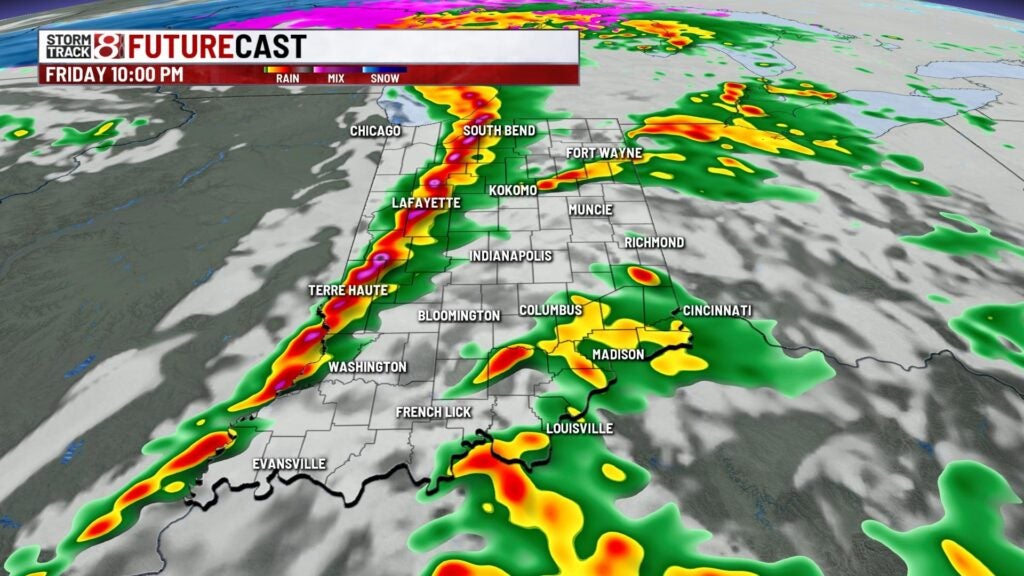
Severe storm chance this evening
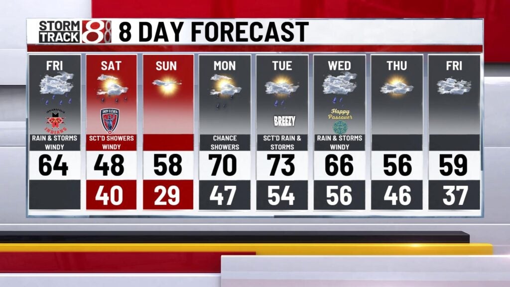
A wet start to the morning with scattered showers around for the morning drive. Nothing too heavy heavy and nothing severe this morning. Rain comes to an end late this morning and we should see a lull this afternoon and through the evening drive. Highs will warm to the mid 60s with einds picking up this afternoon with gusts around 40-45 mph.


Severe Weather Threat:
Severe weather risk will ramp up this evening with a few scatered cells popping beofre the main line moves through. This could produce a few gusty storms with a spin up tornado possible. The main threat with the storms that develop will be damaging winds with the tornado threat mainly in western Indiana and Illinois. There is a slight risk (2/5) in central parts of the state and an enhanced risk (3/5) in western parts of the state through this evening. The main line and cold front moves through late evening with the damaging wind threat. Lows will bottom out in the lower 40s.


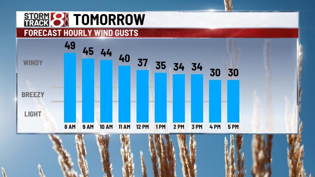
Weekend looks chilly with highs cooling to the upper 40s with gusty winds. We’ll have a wind advisory in play through the day with gusts around 40-50 mph. Sunday will be pleasant and comfy with highs in the upper 50s with sunshine!


It gets even warmer early next week with highs in the lower 70s Monday and Tuesday with rian and storms chances in the mix through mid week next week. We cool it off to the upper 50s through the later part of the work week but we should be dry.