Showers continue Thursday, cooling down Friday
INDIANAPOLIS (WISH) — Another 1-2″ of rainfall is possible through Friday.
This morning:
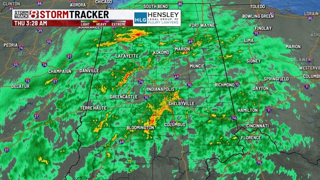
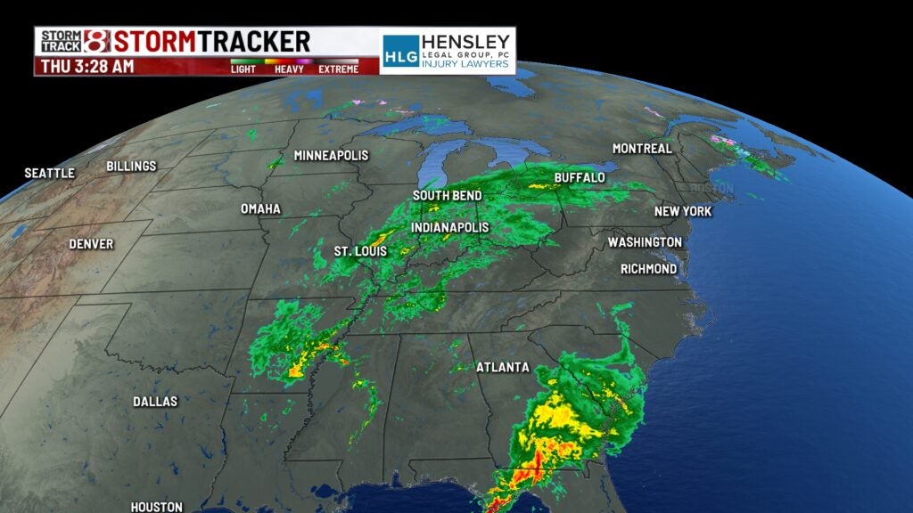
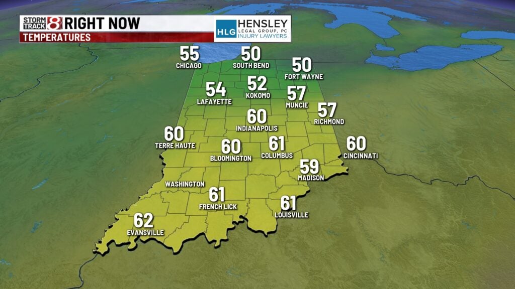
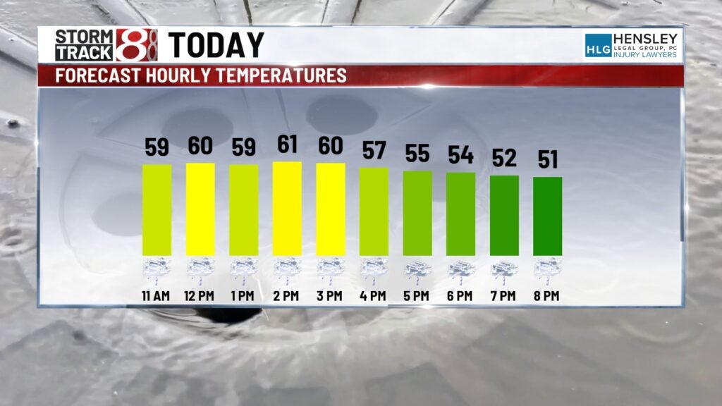
Radar this morning is showing showers across much of central Indiana, with a few rumbles of thunder as well. Temperatures are hovering in the upper 50s and lower 60s currently.
Thursday:
Steady rain continues through mid-morning as low pressure moves overhead. We will likely see rain chances start to break up and become a bit more scattered as we progress through the remainder of the afternoon.
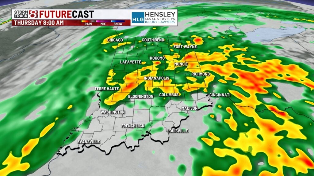
Meanwhile, winds will gradually pick up through the day, and temperatures will slowly fall as we head into the early to mid-afternoon hours.
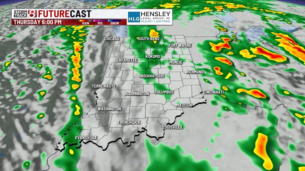
Thursday night:
Rain chances will likely continue into the night, but they should be much more isolated and relatively light. The winds will continue to pick up through the night.
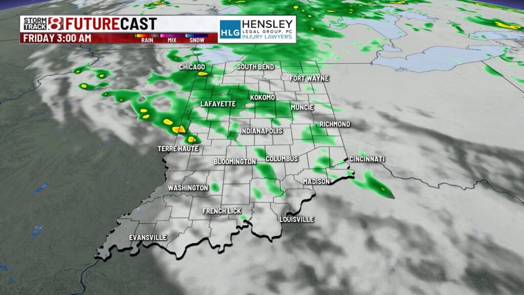
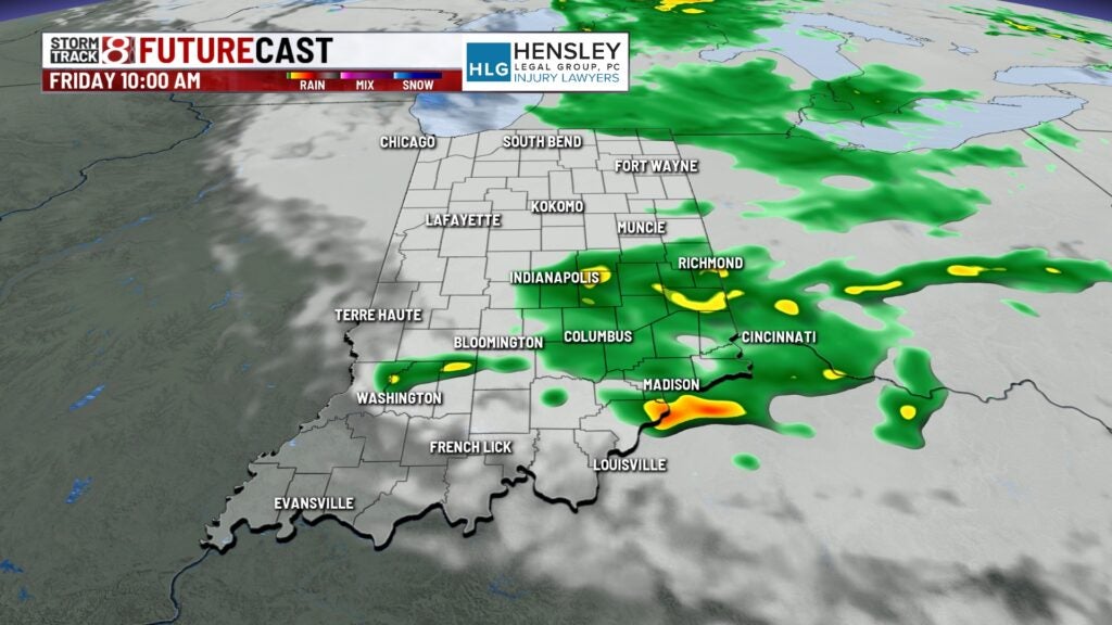
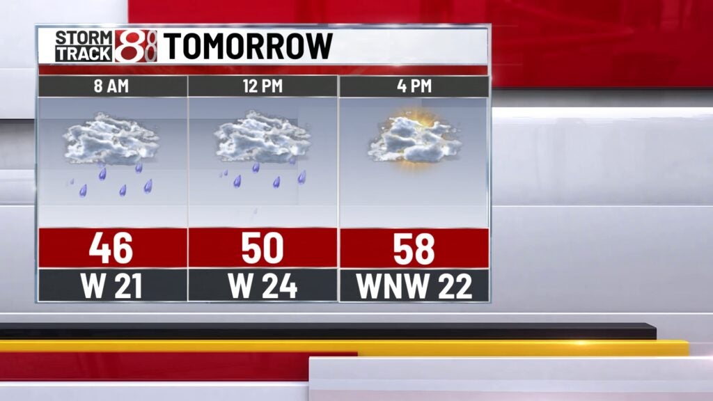
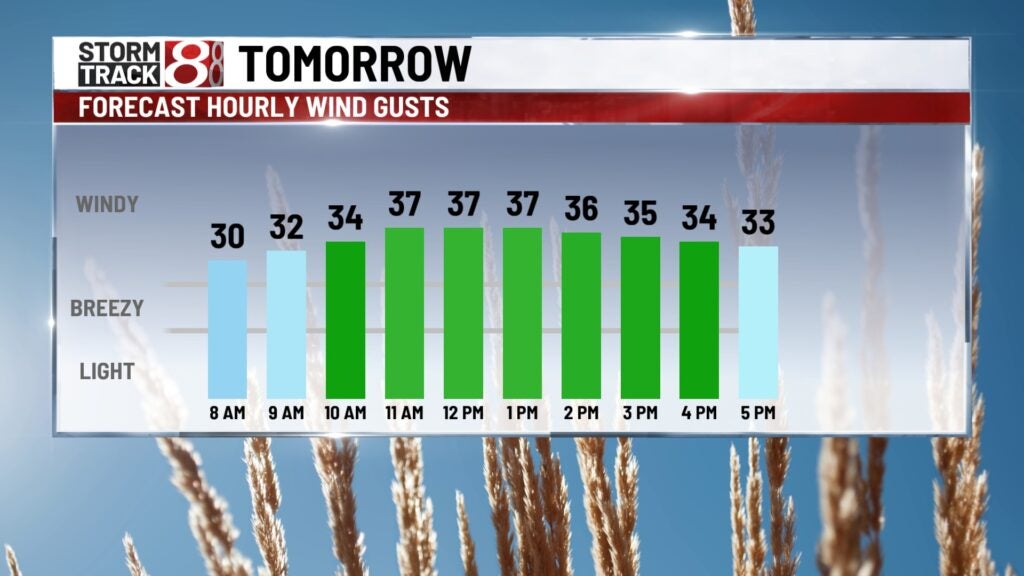
Friday:
A big trough will dig through the Midwest after the low-pressure center moves east of us. This means much cooler temperatures. scattered showers throughout the day, and some gusty winds. Wind Gusts could get up to his highest speed of 30 to 35 mph.
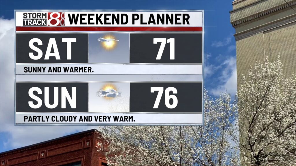
This weekend:
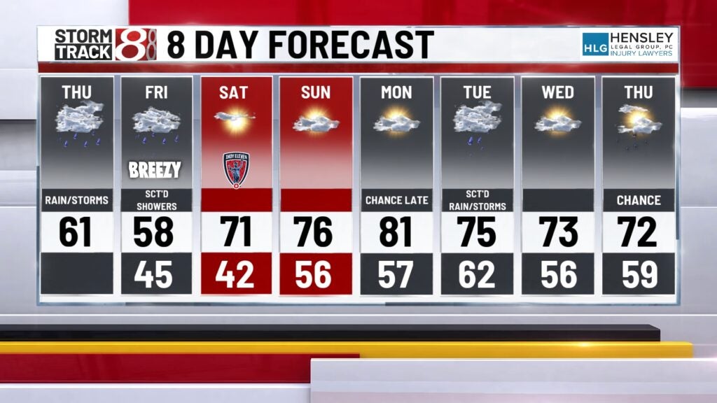
The weekend looks beautiful as high pressure settles in and much warmer temperatures push into the Midwest. High will be around 70 on Saturday and into the mid-70s on Sunday.
8 day forecast:
Early next week, high temperatures could surge into the lower 80s to kick things off on Monday. The active weather pattern looks to continue, with a few rain opportunities for Tuesday and Thursday of next week.