


Showers return Friday, beautiful weather on tap this weekend
INDIANAPOLIS (WISH) — A quick hitting cold front will bring showers and a few storms to close out the week. Very pleasant weather settles in for the long term.
Friday:
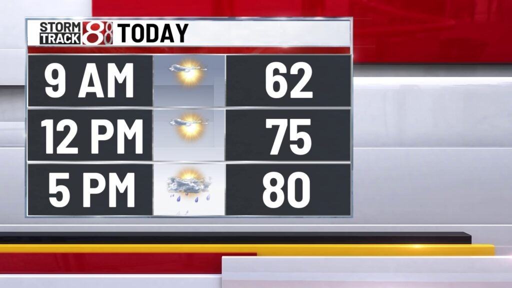
Dry start to the morning with clouds slowly increasing through the day. A few pockets of showers and storms could slide into the state by late afternoon.
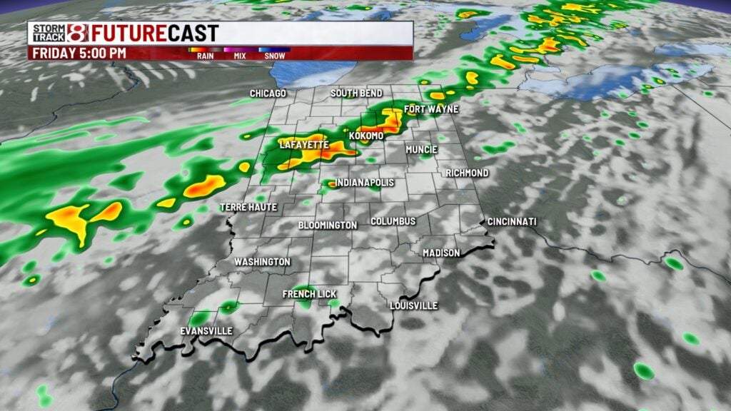

Highs top out in the upper 70s/lower80s.

Friday night:
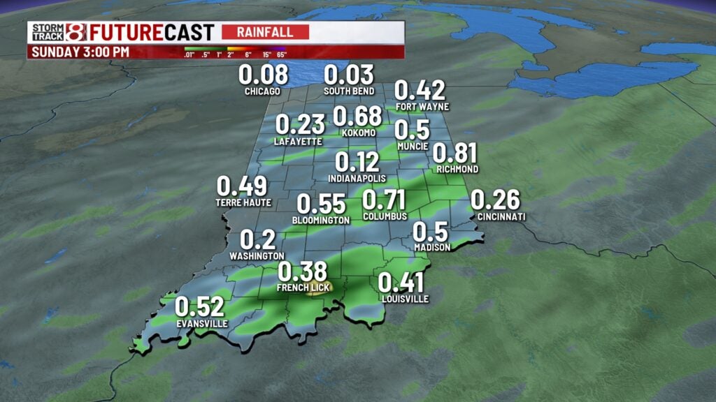
Cold front will move through the state, bringing widespread showers and a few thunderstorms to the area. Rain shield should clear central Indiana after Midnight. Some rain may hang around southern Indiana through daybreak, Saturday.
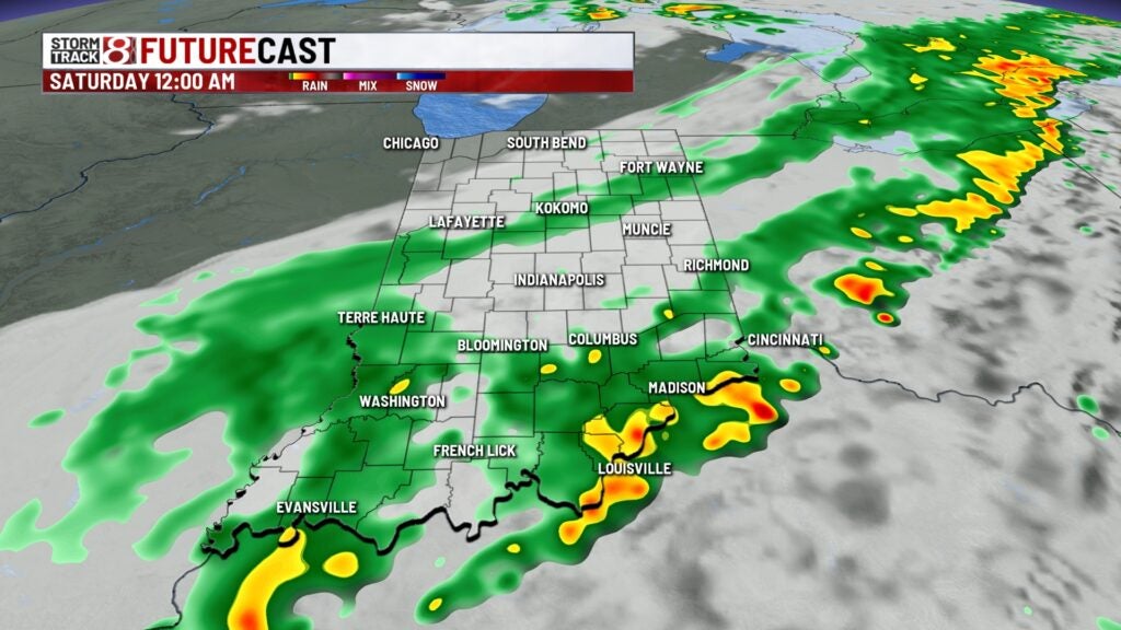
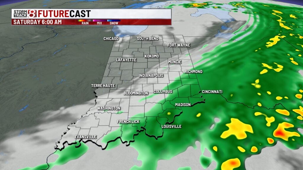
Total rainfall should be less than 0.5″ for most.
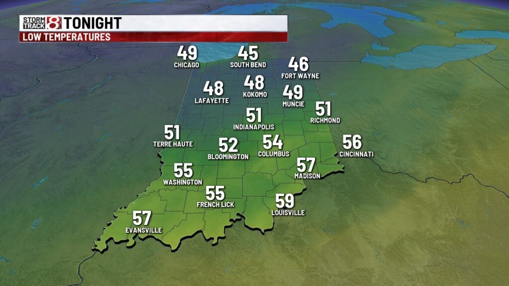
Lows fall to the lower 50s.
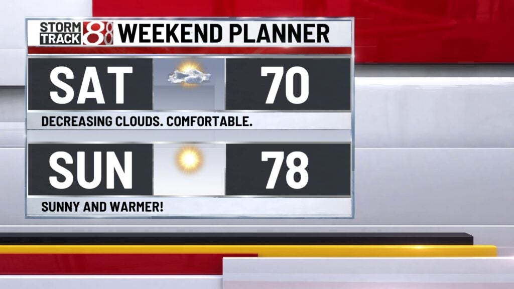
Weekend:
Cooler, but refreshing air follows the Friday cold front. Expect decreasing clouds and comfortable temperatures Saturday afternoon with highs near 70°. We’ll start warming up quickly starting Sunday, with highs returning to the upper 70s.
8 day forecast:
Very quiet pattern for the long term. Expect mostly sunny conditions through the work week. Temperatures will gradually warm to the mid 80s by late week – with some areas possibly climbing to the upper 80s!
