Soggy weekend ahead
INDIANAPOLIS (WISH) — Several rain chances move into central Indiana over the weekend, with much cooler temperatures to follow.
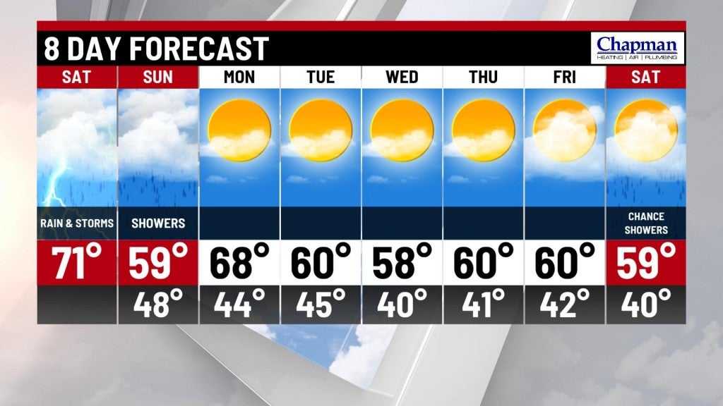
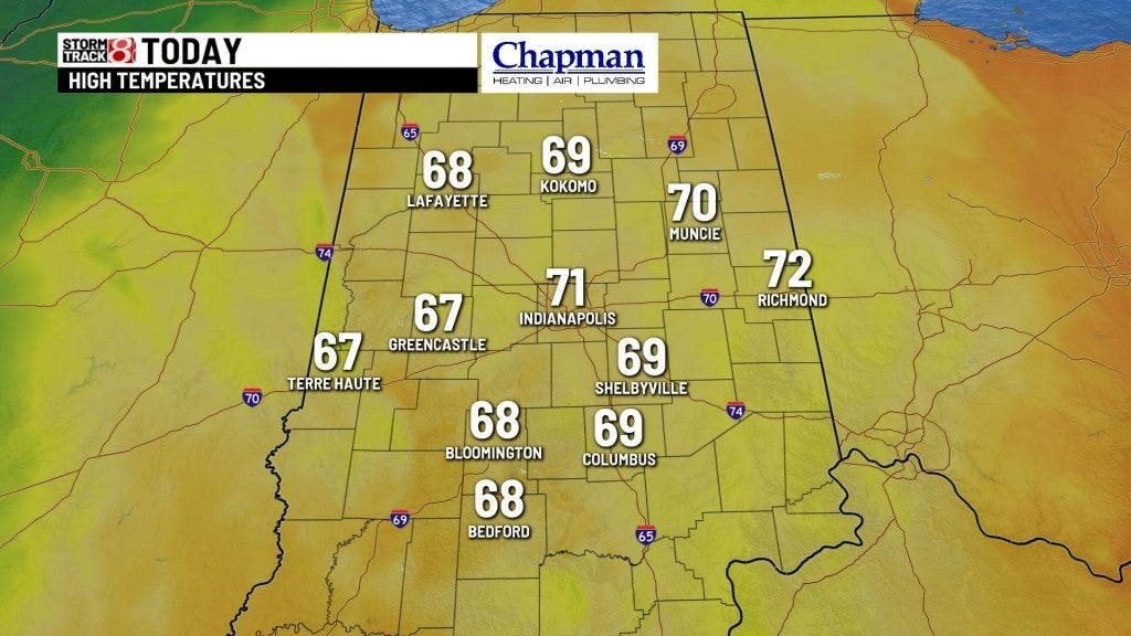
Saturday:
An approaching cold front and upper level low will move into the Midwest, sparking widespread showers late this morning into the afternoon across the state. Locally, heavy downpours, along with a few strong thunderstorms, will be possible through the day.
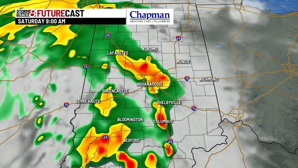
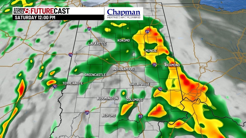
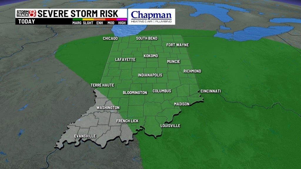
The Storm Prediction Center has highlighted most of the state for a marginal risk for severe storms this afternoon. Damaging winds and an isolated tornado will be possible with any storm that turns severe.
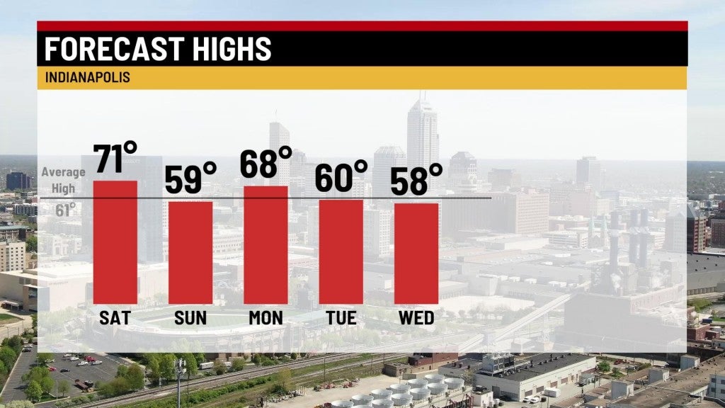
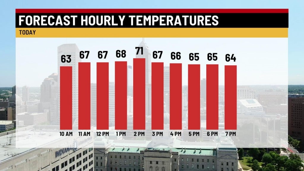
Highs top out in the lower 70s.
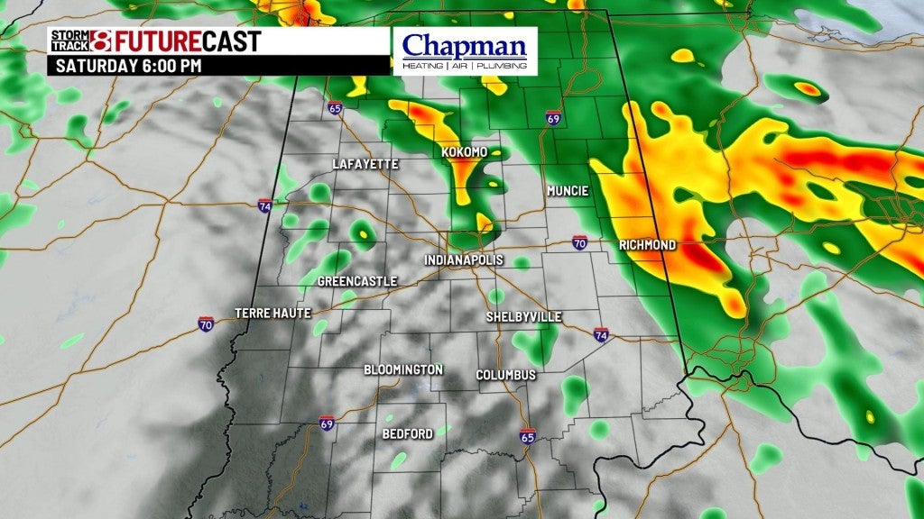
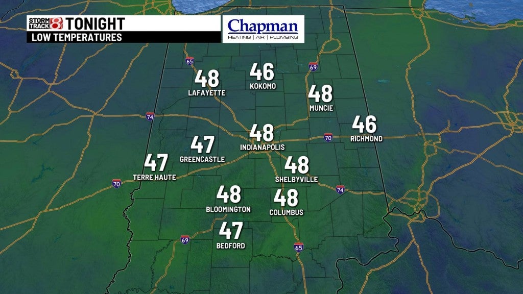
Saturday night:
Showers should become a bit more isolated through the overnight hours, but again, a few rumbles of thunder can’t be ruled out. Lows fall to the upper 40s.
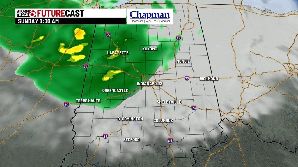
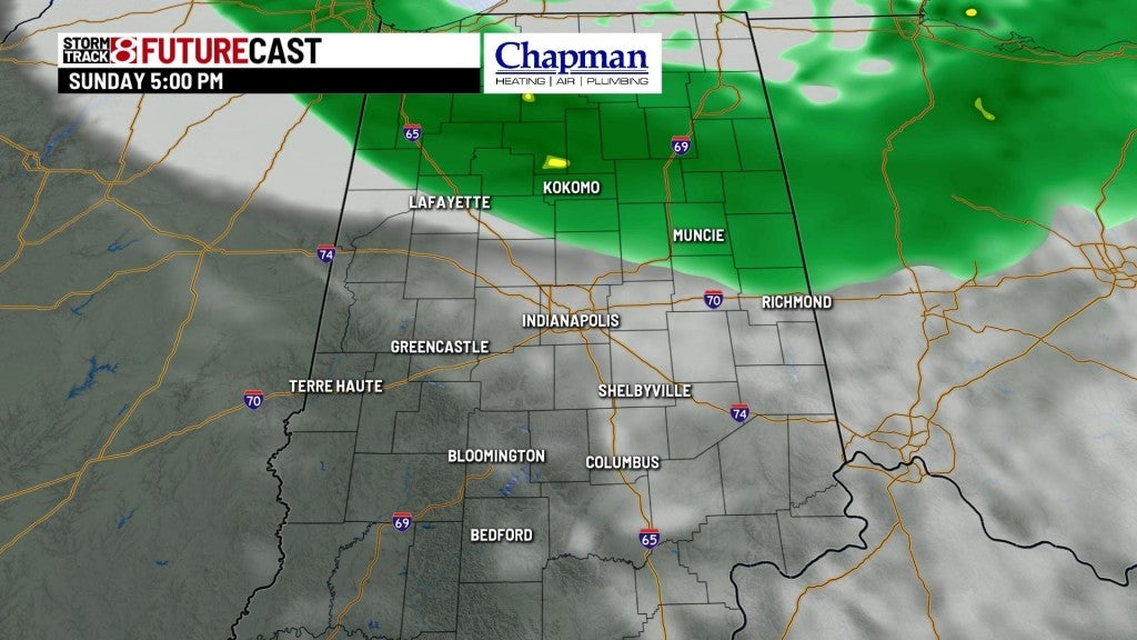
Sunday:
Upper level low slides to our north, bringing in much cooler air, along with scattered light showers for the northern half of the state for much of the day. Highs top out in the upper 50s north of I-70 and in the lower 60s to the south.
8 day forecast:
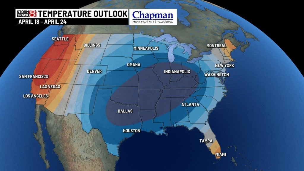
We’ll warm up to open the work week, with highs in the upper 60s and lower 70s on Monday. Much cooler air for the rest of the extended forecast, with highs in the upper 50s and lower 60s through the rest of the week into the weekend. Quiet weather through the work week, with a chance of showers arriving next Saturday.