Warmup with rain, storm chances later this week
INDIANAPOLIS (WISH) — We had a gloomy start to the workweek Monday with cloudy skies and chilly temperatures.
Monday night:
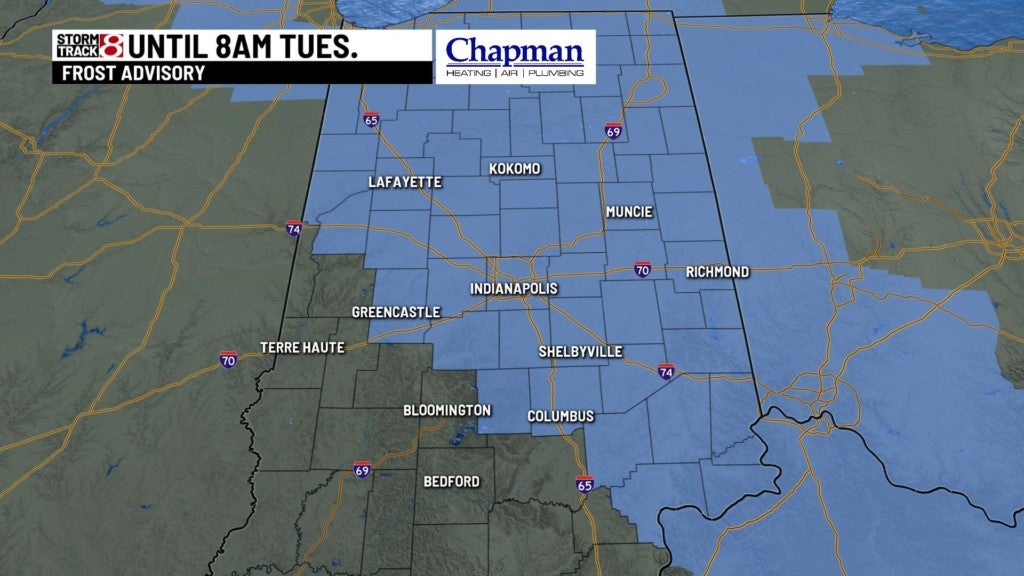
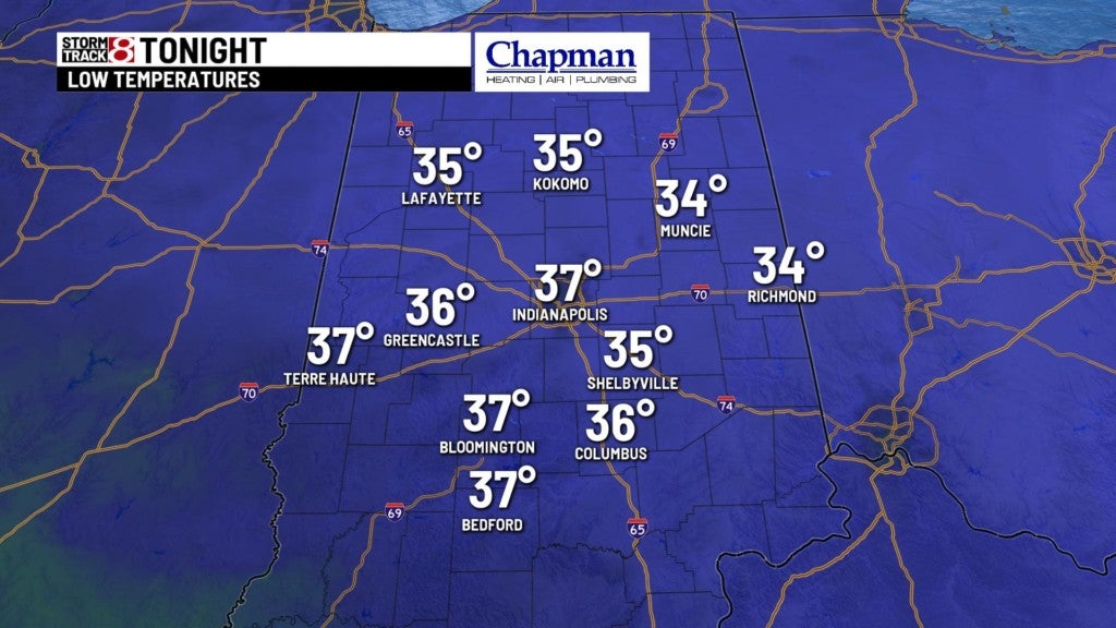
We will see skies partially clear out and it will become partly cloudy tonight. Prepare for another cold night with low temperatures falling into the mid to upper 30s. A Frost Advisory will be in effect from 2 AM to 8 AM Tuesday morning for most of central Indiana.
Tuesday:
Enjoy a much better and refreshing day with a mix of sun and clouds. Clouds will build in by nighttime ahead of the next chance for rain.
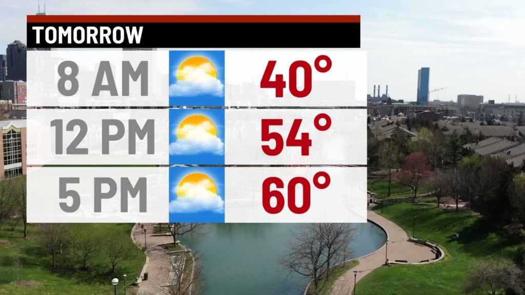
Highs will top out in the upper 50s to low 60s.
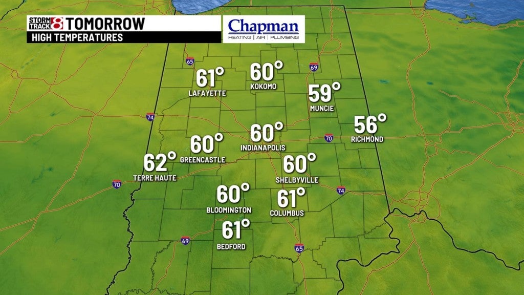
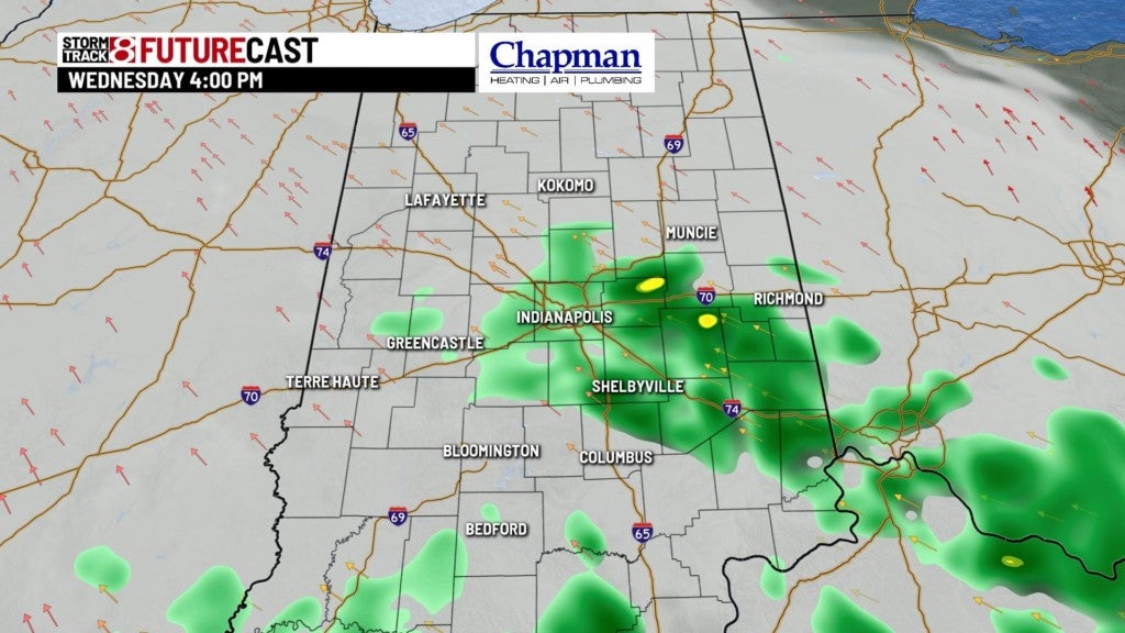
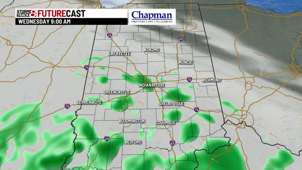
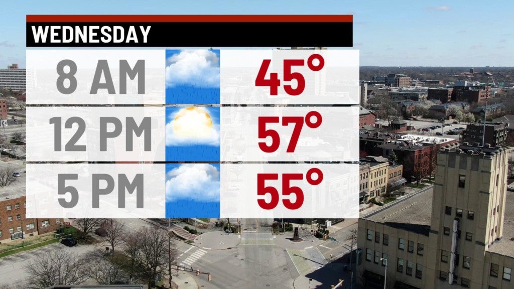
Wednesday:
We will have mostly cloudy skies with isolated showers in the morning hours. Shower and storm coverage will increase by the evening.
Our warming trend will continue with highs reaching the low 60s.
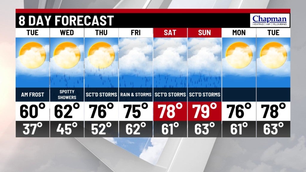
8 Day Forecast:
As our warming trend continues through the end of the workweek, rain chances will increase. High temperatures will be near normal for this time of the year in the 70s. Showers are likely Thursday and Friday with isolated storms possible containing heavy downpours and gusty winds. This active weather pattern will continue into the weekend.