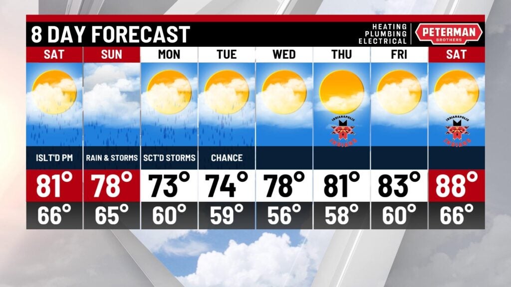
Active weather this weekend with a short cooldown
INDIANAPOLIS (WISH) — We are tracking active weather and increasing humidity this weekend. Cooler air will also briefly enter the area before another warmup moves in.
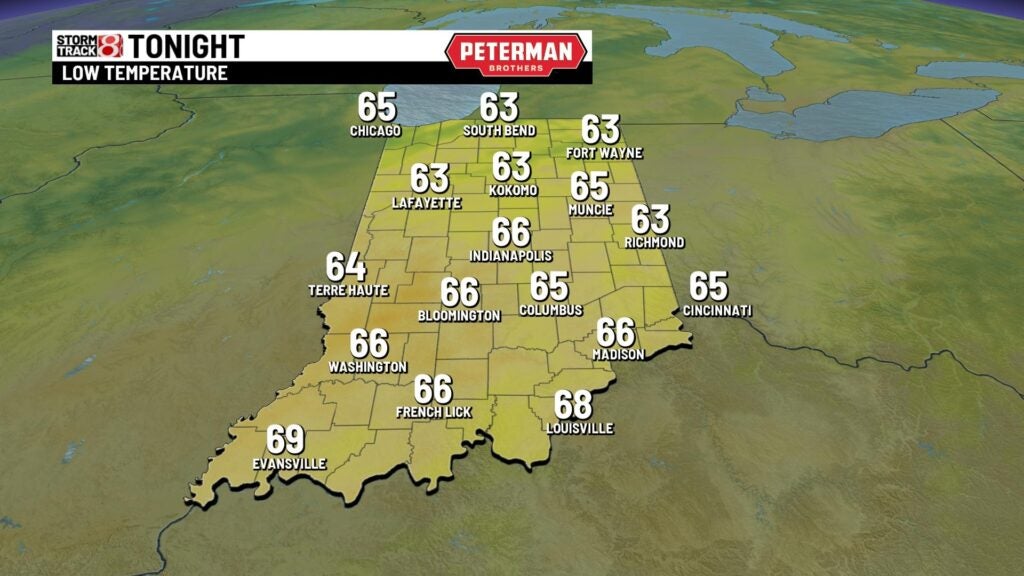
Friday night: A mild and partly cloudy night is expected with lows bottoming out in the mid 60s. Winds are set to remain light out of the south as well.

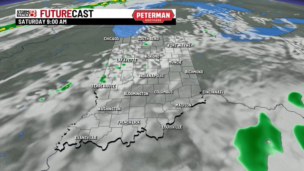
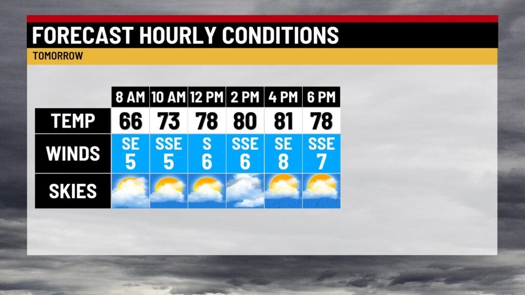
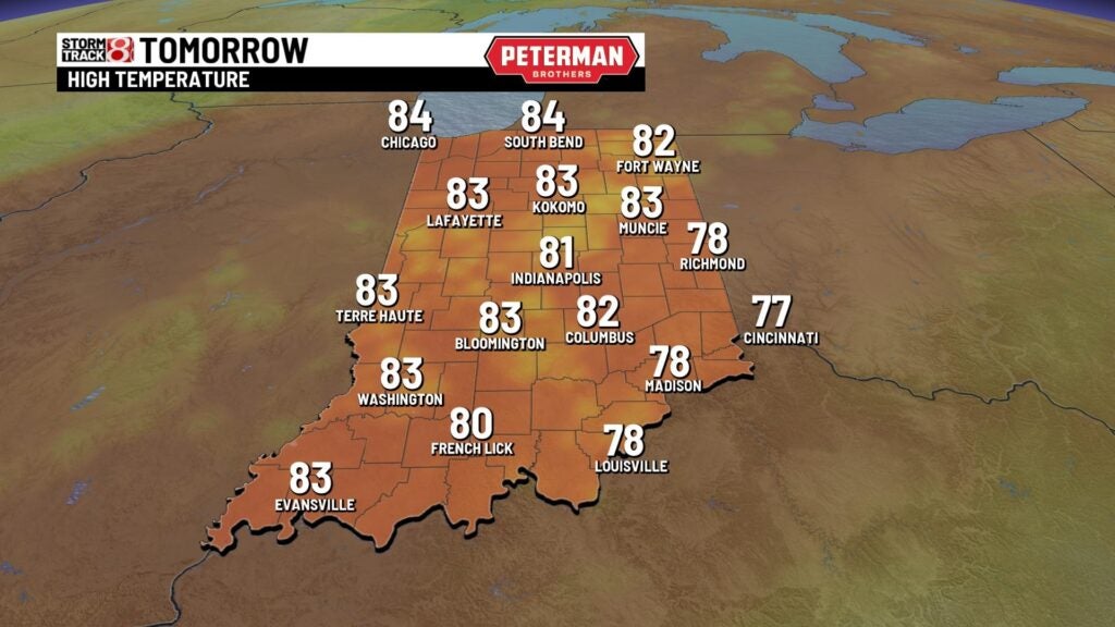
Saturday: Cloud cover will continue to increase ahead of our next system. Isolated showers look to begin developing during the morning hours before coverage becomes scattered in the afternoon hours. Activity will gradually wind down by the nighttime hours. Locally heavier rainfall is possible at times.

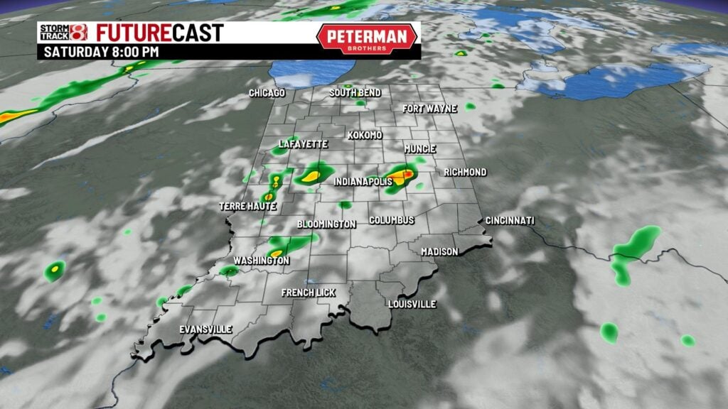
Highs look to top out in the low 80s, and it will feel more uncomfortable due to a higher muggy meter.
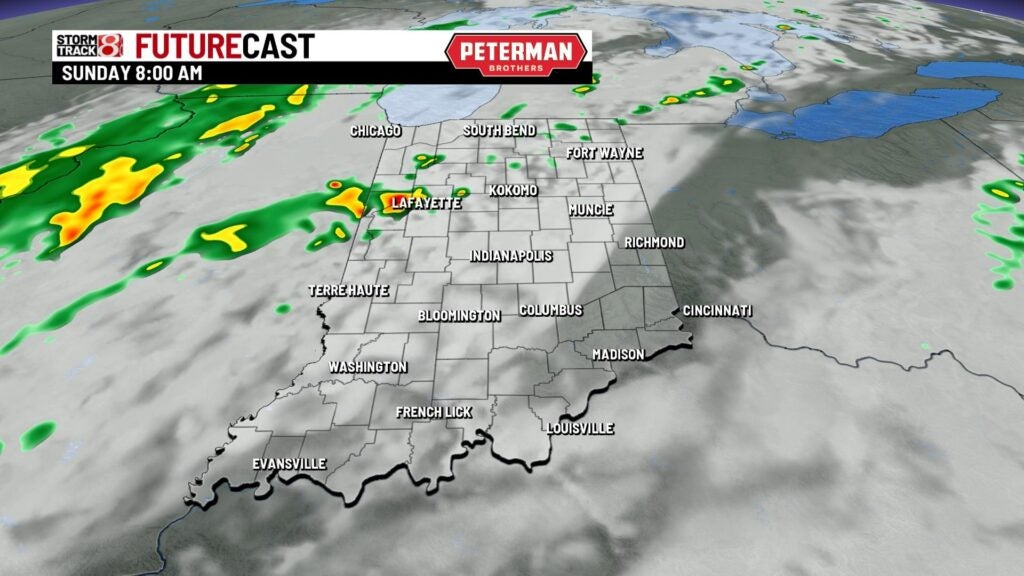
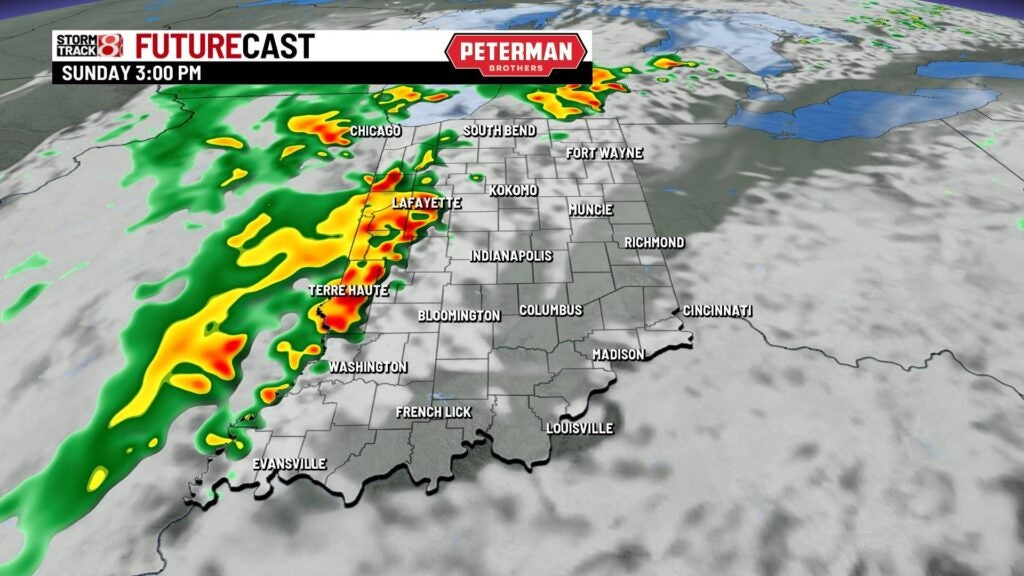
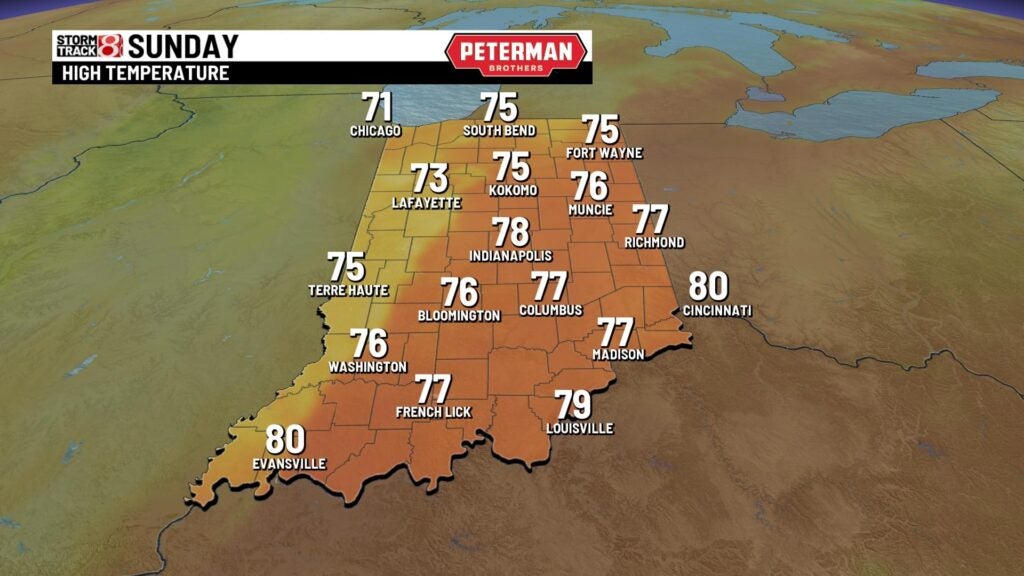
Sunday: The best chance for more widespread rain and storms arrives for Sunday. Expect on and off activity throughout the day. During the afternoon hours, there is even the chance for an isolated stronger storm or two. If any storm does become strong, gusty winds and torrential rainfall will be the main concerns. At this time, there is no severe weather risk outline for any part of Indiana.

We will cool things down slightly with highs only rising into the mid to upper 70s.
8-Day Forecast: Lingering showers will remain possible through Monday. Highs will only rise into the low to mid 70s due to breezy winds out of the north. A gradual warming trend will then slide in for the remainder of the extended forecast with 80s set to return by midweek next week.