Bitter cold on the way
INDIANAPOLIS (WISH) — After a blustery Wednesday with falling temperatures throughout the day, we are tracking the coldest air of the season to swing in over the next day.
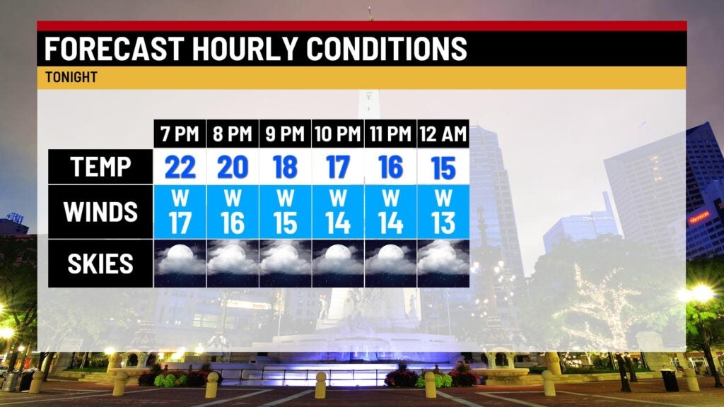
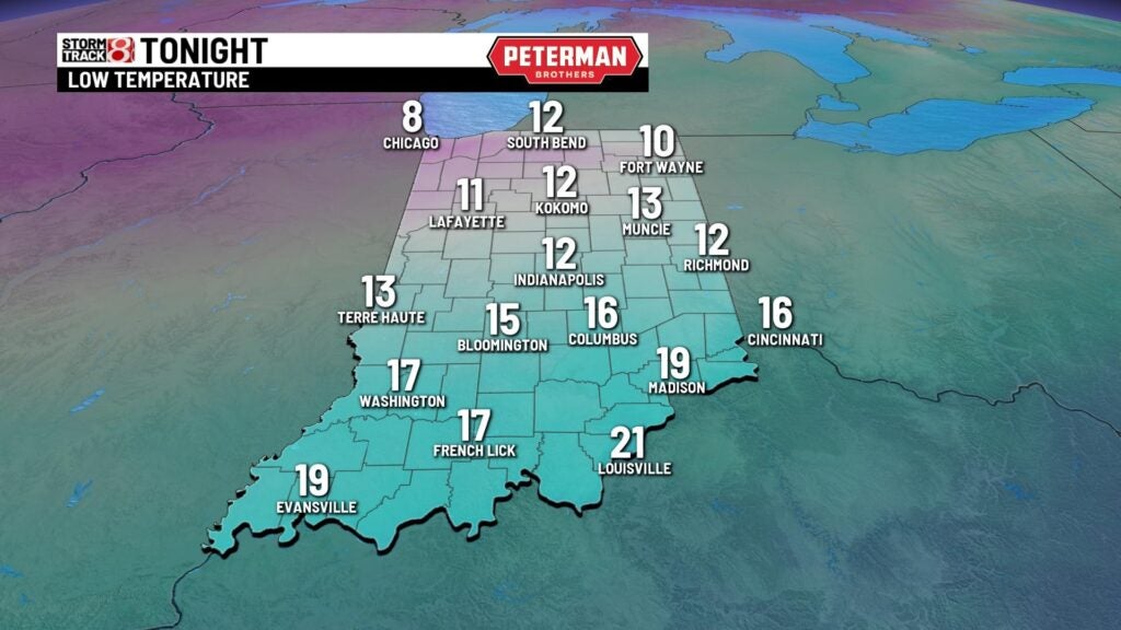
Wednesday night: We will continue our temperature tumble into tonight with winds eventually dying down a bit in the overnight hours. Lows will fall into the low teens with some areas even dropping into the single digits.
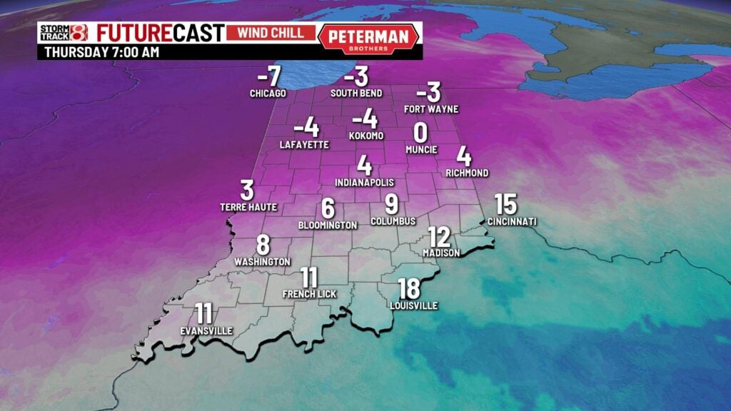
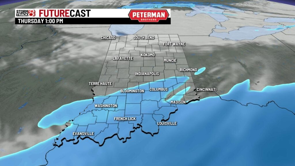
Thursday: A very cold start to Thursday is expected with wind chill values possibly below zero in some spots.
Mainly dry weather will be in place for the day with the exception of a few flurries. Better snow chances and potential accumulation reside in southern Indiana.

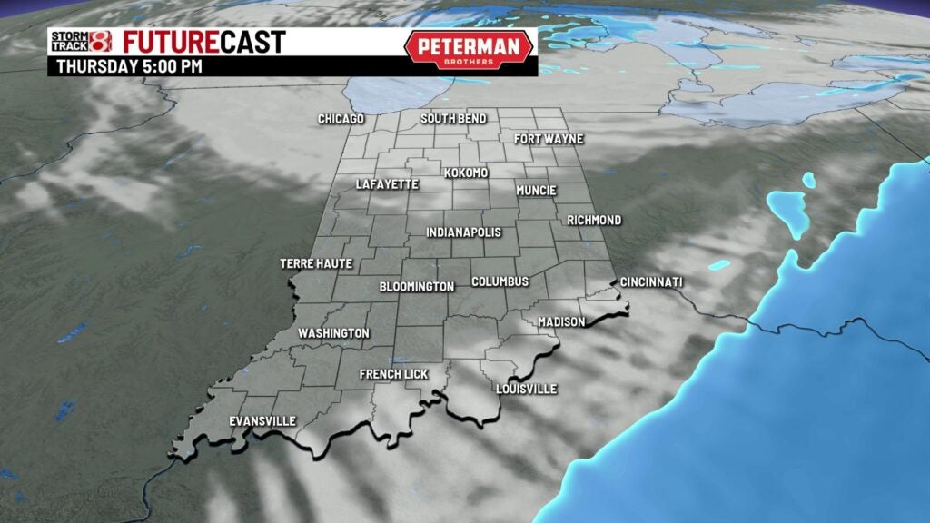
Temperatures will struggle to warm into the upper teens to low 20s.

Friday: Prepare for a bitter Friday morning with temperatures in the single digits. Wind chill values will be below zero in the morning hours as well. You will want to have the heavy winter coat, hats, and thick gloves throughout the day overall as Thursday’s highs will rinse and repeat for our Friday.


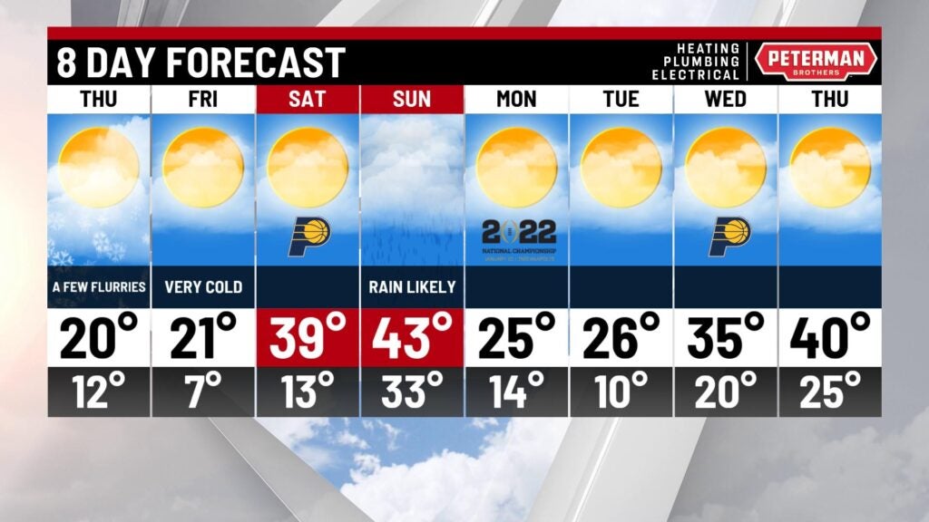
8-Day Forecast: We look to quickly usher in a warmup for the weekend. Numbers will be slightly above average with upper 30s for Saturday and low 40s for Sunday. This fast warmup will lead way for more rain chances late Saturday and into Sunday. There could even be a brief switchover to snow on Sunday as much colder air scoots back into the state. The new workweek will kick off on a cold note with highs in the mid 20s.