


Central Indiana braces for up to 8 inches of snow, dicey travel
INDIANAPOLIS (WISH) — We are on our way toward an active Wednesday with accumulating snow and mixed precipitation.
This will create rather sloppy conditions and dicey travel.
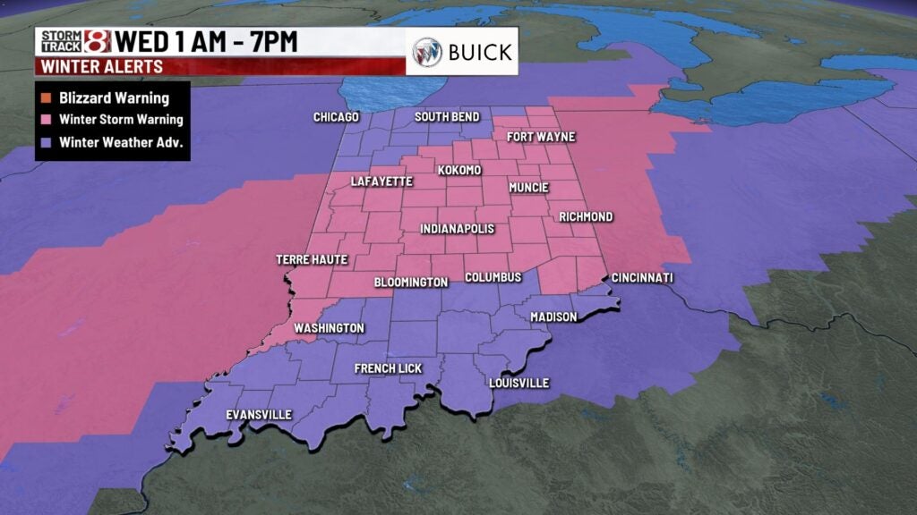
Winter storm warnings will be in effect from 1 a.m.-7 p.m. EST Wednesday for all of central Indiana. Much of the remainder of the state will be under winter weather advisories from 1 a.m.-7 p.m. EST Wednesday as well.
- National Weather Service pushes to provide more information in Spanish
- 60 Indy Snow Force drivers hitting the streets ahead of winter storm
- Check the Storm Track 8 interactive radar
- Check closings and delays
- Indy Snow Force Viewer Map
- Indiana’s travel advisory map
Tuesday night: A mix of rain and snow is set to move into the state well after sunset. By the overnight hours, a changeover to all snow will take place. Snow will be heavy at times with some snowfall rates up to 1 inch per hour.


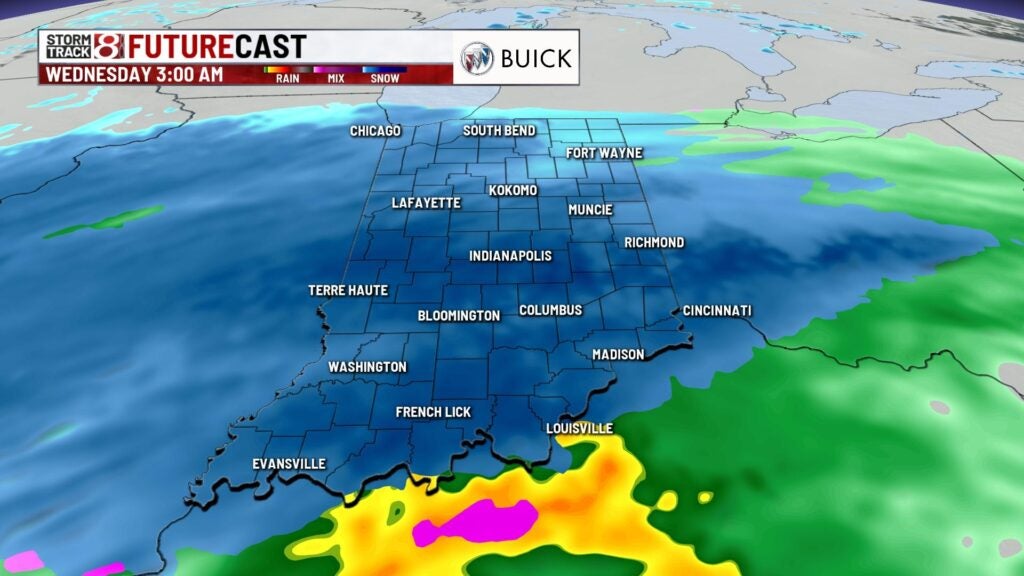
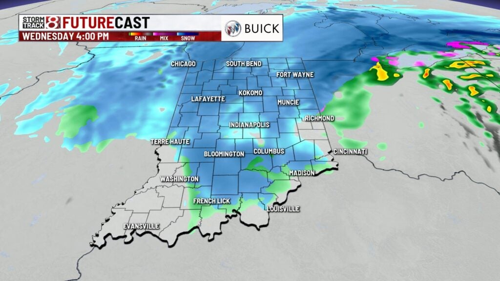
Wednesday: Expect messy roads for the morning commute as snow and mixed precipitation persist through the morning hours. Areas of heavy snow will continue as well. By the afternoon hours, the bulk of the activity will be making its exit out of the state. Lingering mixed precipitation will remain possible for the rest of Wednesday.


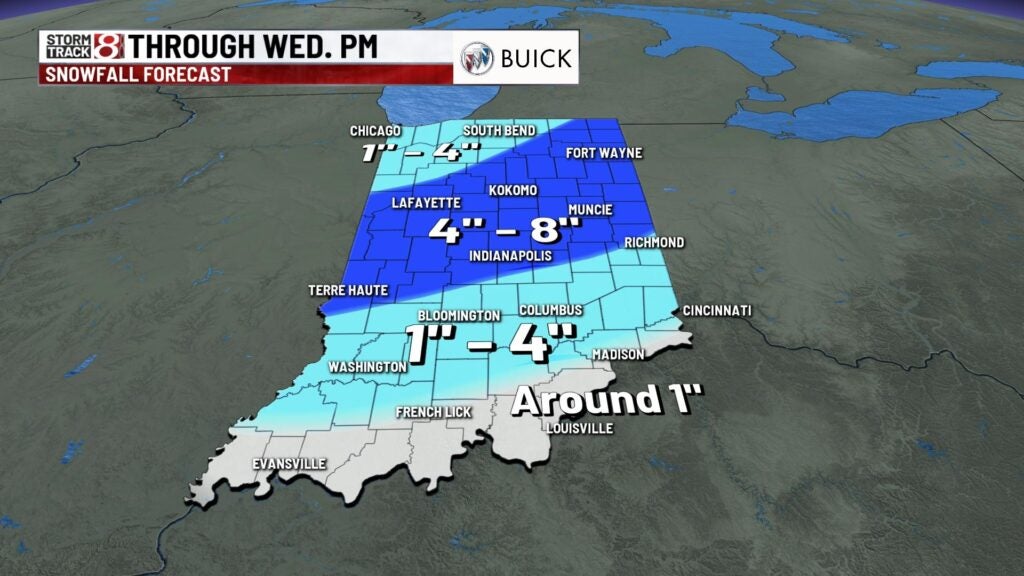
SNOW TOTALS: We have not changed our stance on snow accumulation potential for any of Indiana. Central Indiana may potentially receive from 4-8 inches of snow, but it is important to note that a little bit of the snow will melt before final official measurements take place due to temperatures being just above freezing for much of the day. There could be locally higher amounts as well.
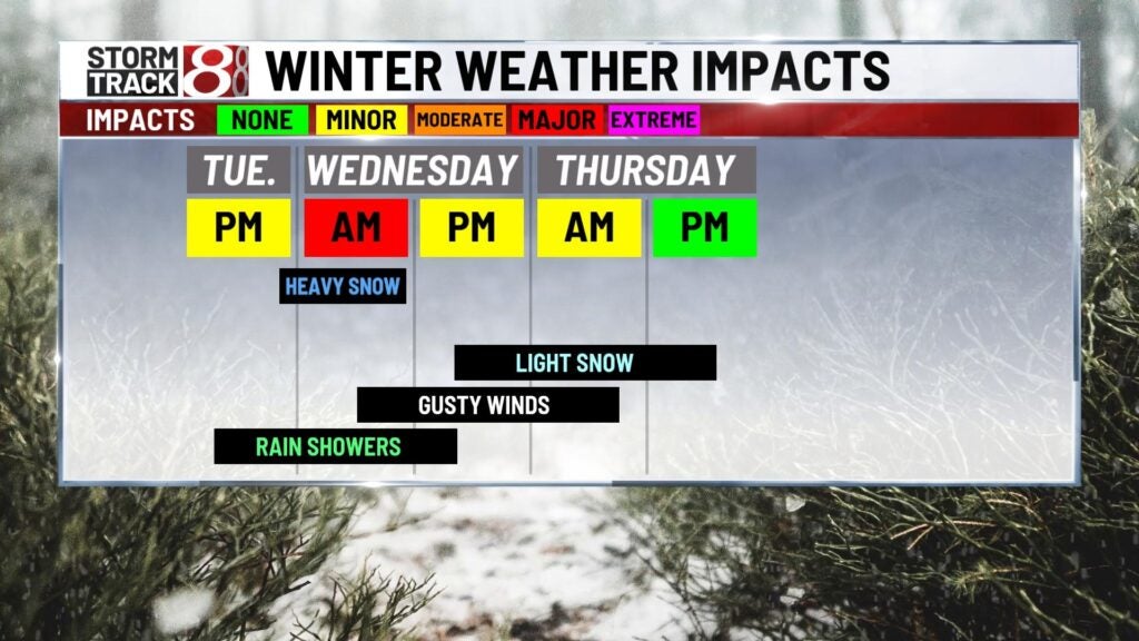
Temperatures will hang around the low to mid 30s throughout Wednesday with gusty winds of from 20-30 mph at times.


Thursday: Scattered flurries and snow showers are expected for much of the day with little to no accumulation. Cold and breezy will also persist with highs only in the low 30s.

8-Day Forecast: Windy and cold conditions are expected to end the workweek with scattered snow chances. Snow chances will stick around through the final weekend of January with highs in the mid to upper 30s. Even colder air with temps in the 20s will slide in by early next week.
