Cold temperatures tonight; wintry mess returns Thursday

INDIANAPOLIS (WISH) — Some slick spots are anticipated for the Thursday morning commute.
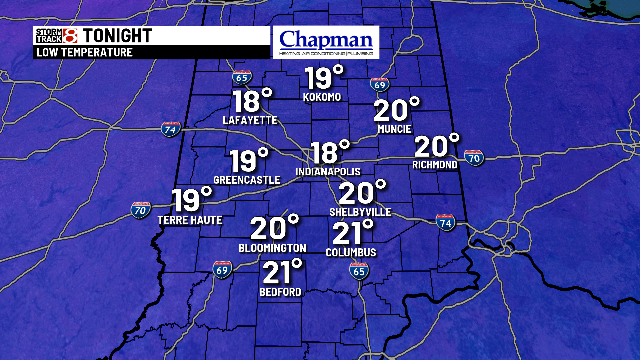
Tonight:
Skies will eventually clear. Combined with lighter winds, our temperatures will drop quickly. Look for overnight lows into the upper teens and lower 20s. Wind chills fall to the middle teens.


Wednesday:
An overall quiet, and chilly day. Partly cloudy for much of the day, with increasing clouds in the evening. Highs top out in the middle 30s.

Thursday:
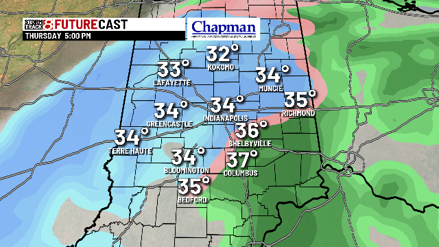
Next winter system takes aim on the area – starting during the pre-dawn hours. As the system slides in from the south, we will be on the cold section of the storm system. Most should see all snow before daybreak, but some freezing rain can’t be ruled out – especially for southern portions of central Indiana. We should see just enough in the way of either ice or snow accumulation to make the Thursday morning commute slick.
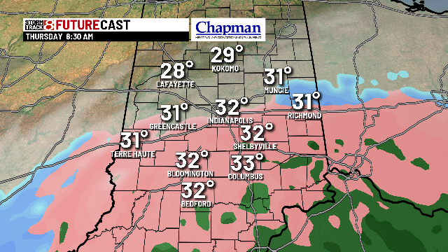
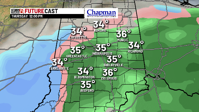
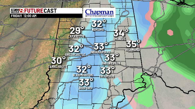
Eventually we’ll see a transition to rain for most of the area by mid/late morning, before the colder air wins out and we go back to snow in time for the evening drive on Thursday.
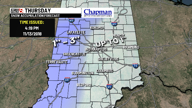
This is an Early look at snowfall accumulations -and will likely change as we continue to fine tune the forecast over the next 24-36 hours. Please check back for updates.
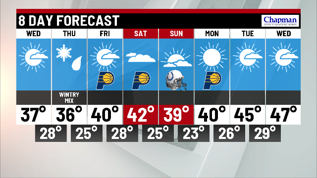
8 day forecast:
After our Thursday system, the pattern turns more quiet. We’re back to the 40s for Friday and Saturday, before a brief setback on Sunday. Should also see temperatures moderate a bit heading into the holiday week.