


Dry Thursday, rain and storms Friday
INDIANAPOLIS (WISH) — One more dry day will be on deck before we see a strong system bring rain and storm chances, strong winds, and even stronger storm potential.
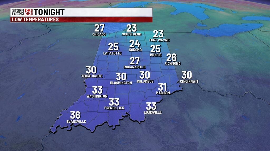
Wednesday night: We’ll turn partly cloudy tonight with temperatures dropping into the mid to upper 20s.

Thursday: Skies will become mostly clear to start our Thursday. Cloud cover will eventually increase in the latter half of the day ahead of our next weather system. Winds are also going to get a little bit breezy by Thursday night. Highs are set to rise into the upper 50s to low 60s.


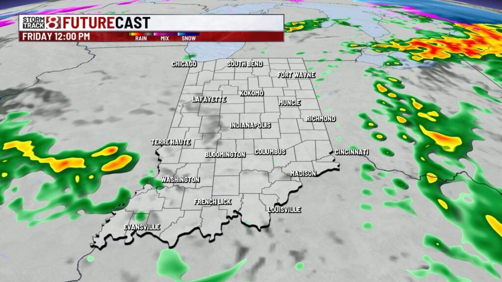
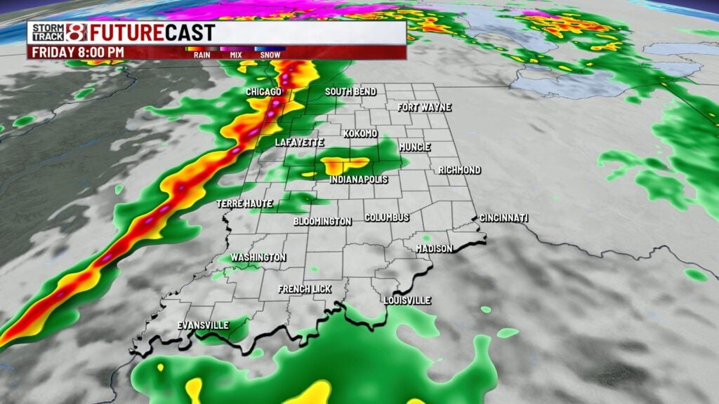
Friday: Prepare for an active day with on and off showers and isolated storms. Winds will also become stronger with gusts pushing towards 35-40 MPH at times during the day. The best chance for storms will come late Friday as a strong cold front approaches the state.


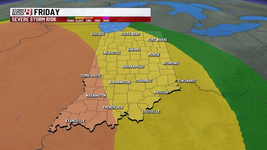
This is when we will track the potential for strong to severe storms as there is a Slight Risk (level 2/5) for much of the state. An Enhanced Risk (level 3/5) sits along and west of a Terre Haute-Jasper line. Damaging winds are the primary concern, but we can’t rule out a quick spin-up of a tornado.
Highs are expected to occur late on Friday as well with temperatures pushing into the low to mid 60s.

8-Day Forecast: As we get into Saturday, it’ll become even more windy with gusts up to 50 MPH before winds gradually die down going into Saturday evening. Sunday looks to be a much more calm and bright day with highs in the upper 50s. We’re in the upper 60s to low 70s to start the new workweek next week. Additional rain and storm chances will roll in for the first half of next week.
