Frigid Friday, much warmer for the weekend
INDIANAPOLIS (WISH) — You want to talk about a day that calls for staying inside? Today was it for sure as it was gloomy and fairly brisk as temperatures struggled to get into the upper teens. This arctic air will continue for our Friday before temperatures take on a big rebound.
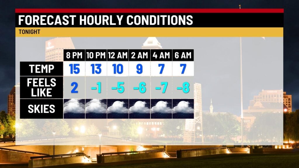
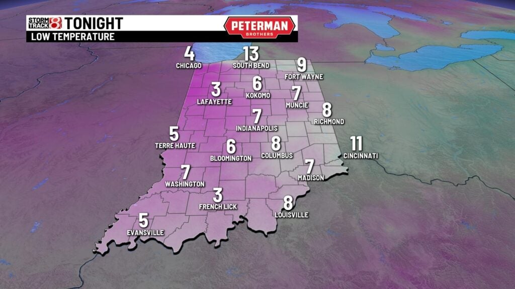
Thursday night: If you are heading out tonight, be sure to bundle up from head to toe as it will be exceptionally cold. Skies will remain mostly cloudy as lows fall into the single digits. Subzero wind chill values are expected overnight.
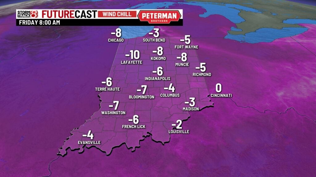
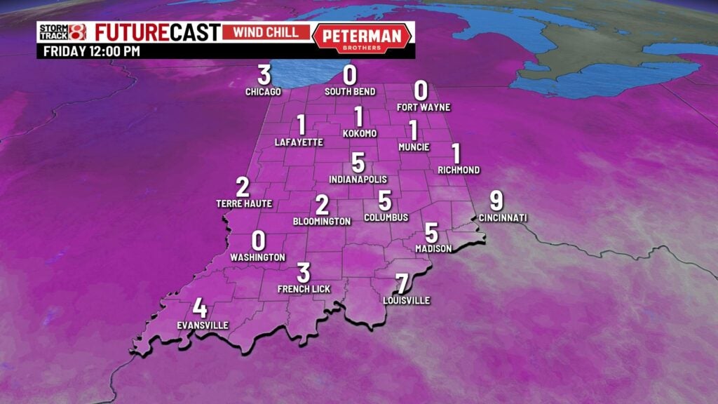
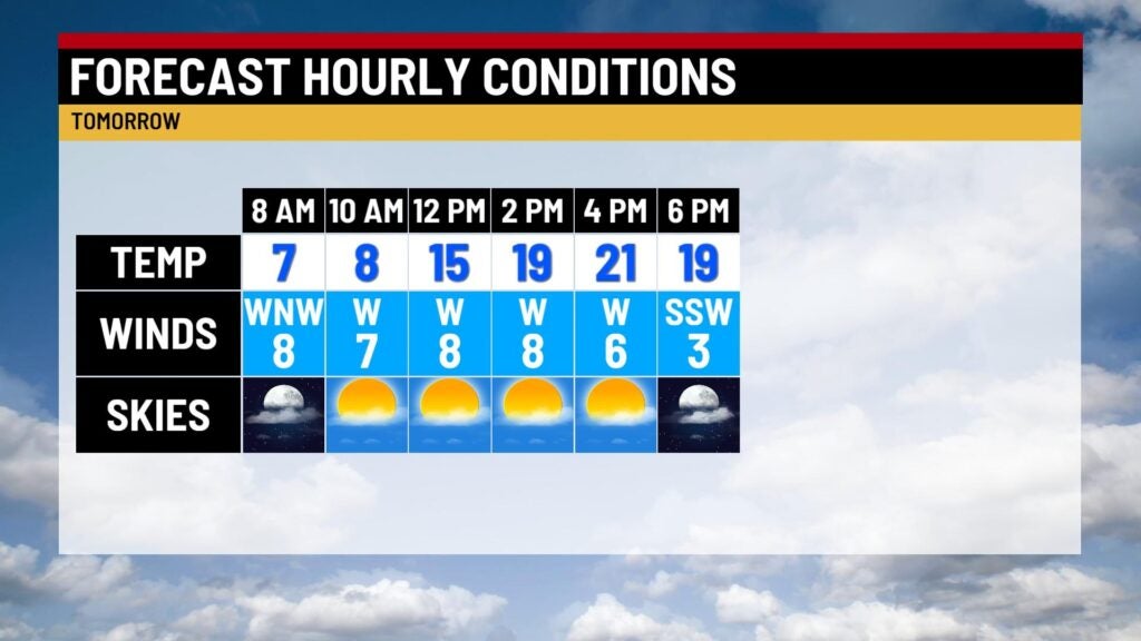
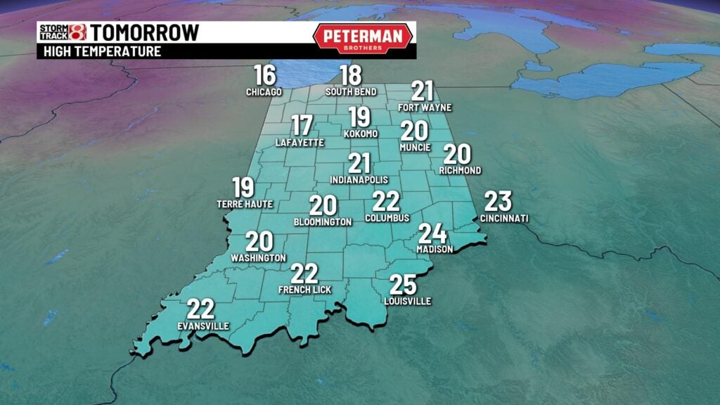
Friday: Prepare for the coldest morning of the season as wind chill values will continue to stay below zero for a majority of Friday morning. Cloud cover is set to break up a bit, which will lead way to a mostly sunny afternoon. Highs will struggle to reach the low 20s.
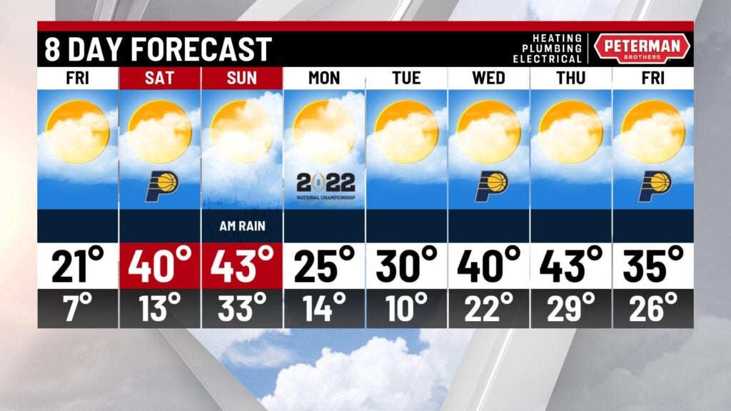
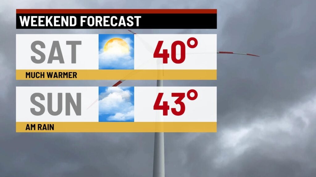
Weekend: After a bitter end to the week, temperatures will make a large leap back into the 40s for the upcoming weekend. However, this quick warmup will open the door for likely rain chances late Saturday and into early Sunday. With a cold ground, some slick spots on the roads may emerge. We could even see a brief changeover to snow Sunday as the system moves out.
8-Day Forecast: We wish the bitter cold air could stay away forever, but more of it will swing into the state for the first half of next week. Thankfully, it does appear that we will gradually work our way back into the 40s by midweek next week.