


Heat and humidity to return with continuing storm chances
INDIANAPOLIS (WISH) — We had a rainy Wednesday in which temperatures struggled to warm across much of the state. A flip to summerlike weather is expected for the second half of the week with additional chances for rain and storms on deck.
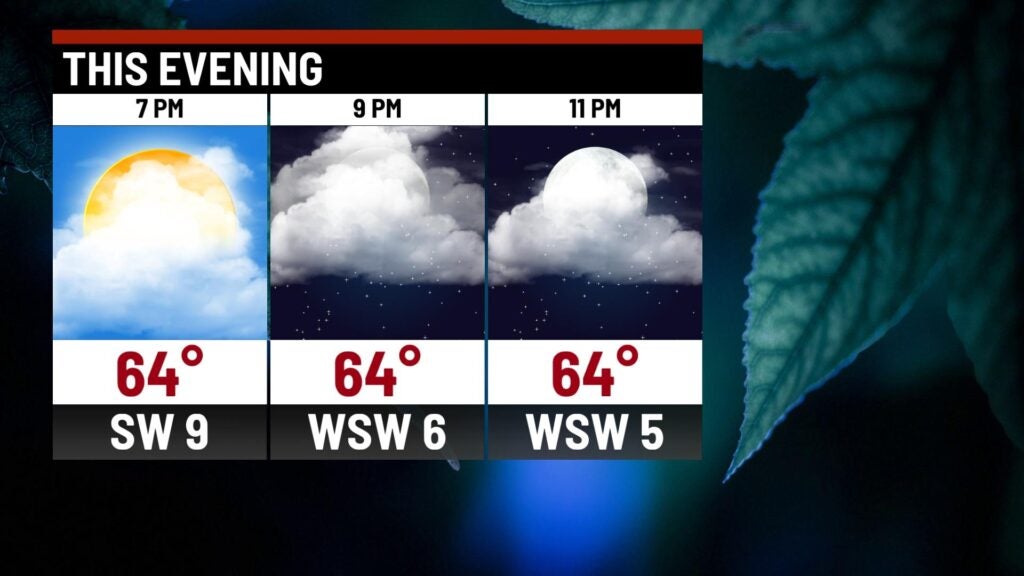
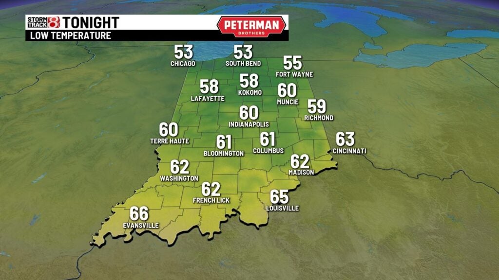
Wednesday night: Cloud cover is set to gradually decrease tonight.

Temperatures are set to be mild with lows dipping into the upper 50s to low 60s.
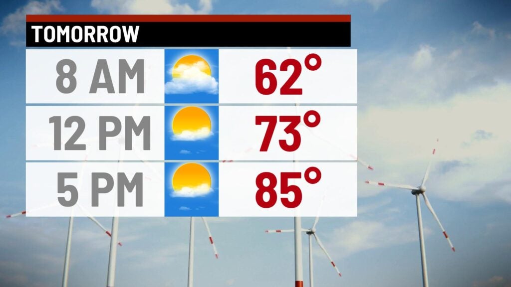
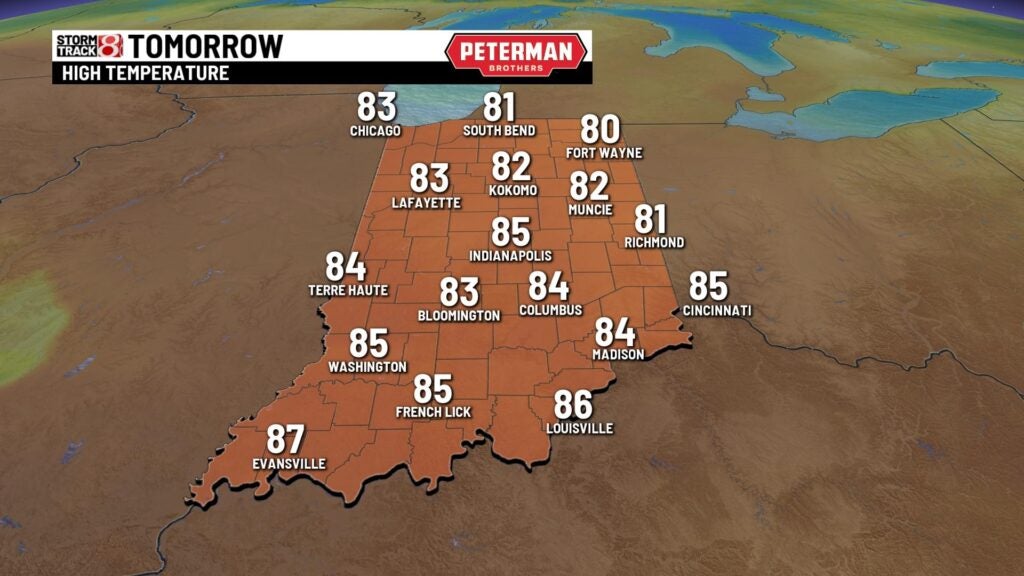
Thursday: We will welcome back the 80s into our forecast with the first half of the day being dry. Skies look to be mostly sunny going into the afternoon hours.


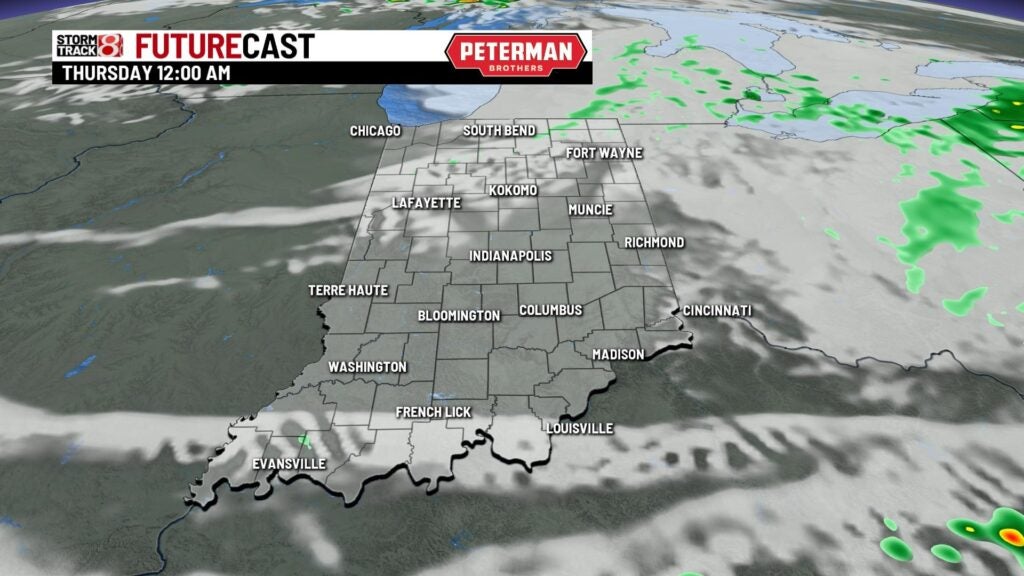
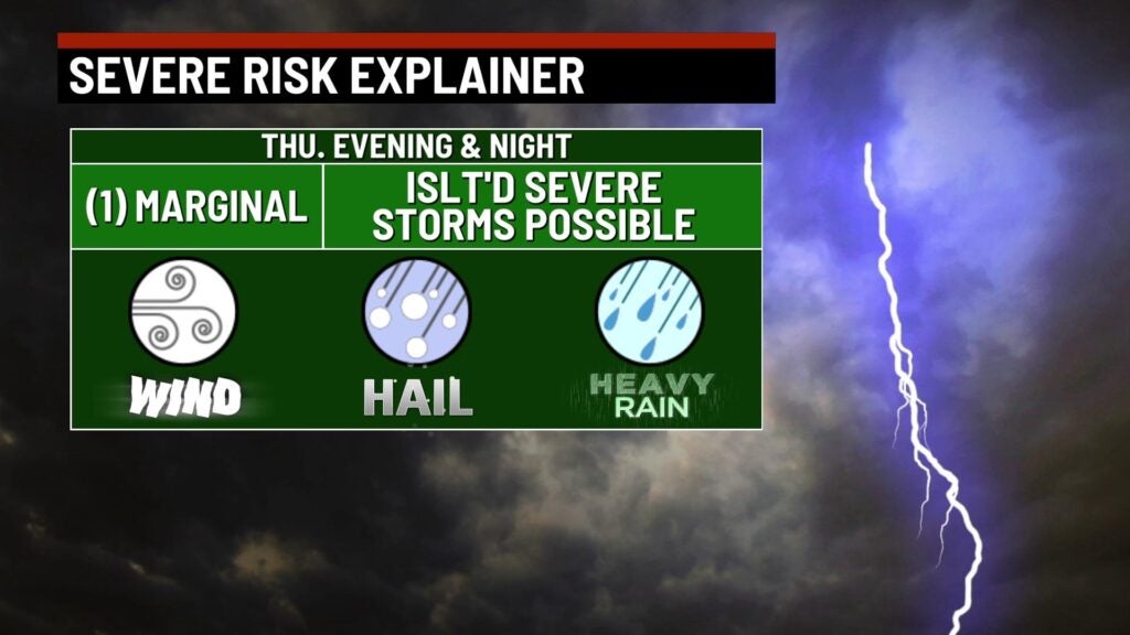
Scattered showers and storms are possible as we get closer to sunset Thursday. These chances will stick with us through the overnight hours.
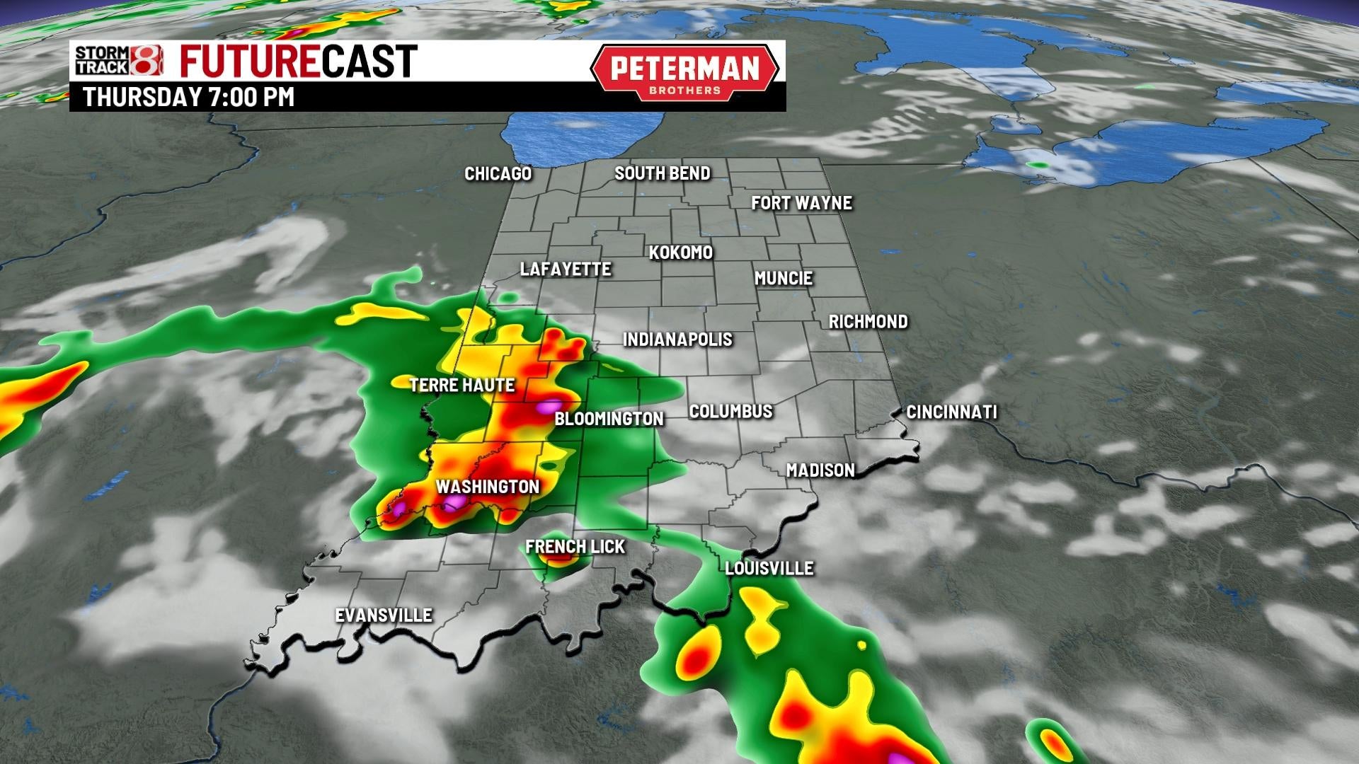
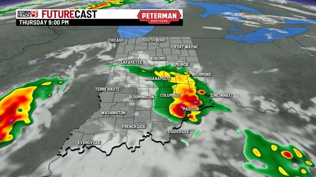
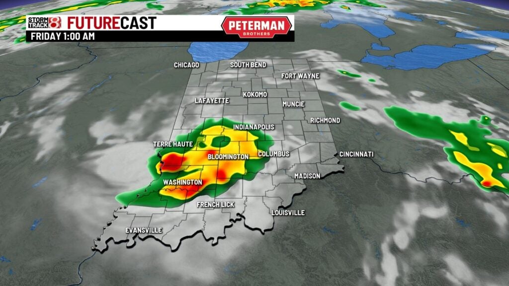
Isolated strong to severe storm potential is in place for areas along a Terre Haute-Columbus line south. The timeline for strong to severe storm potential will be from late Thursday afternoon into the nighttime hours. Damaging winds and hail are the main threats, but an isolated tornado is also possible.

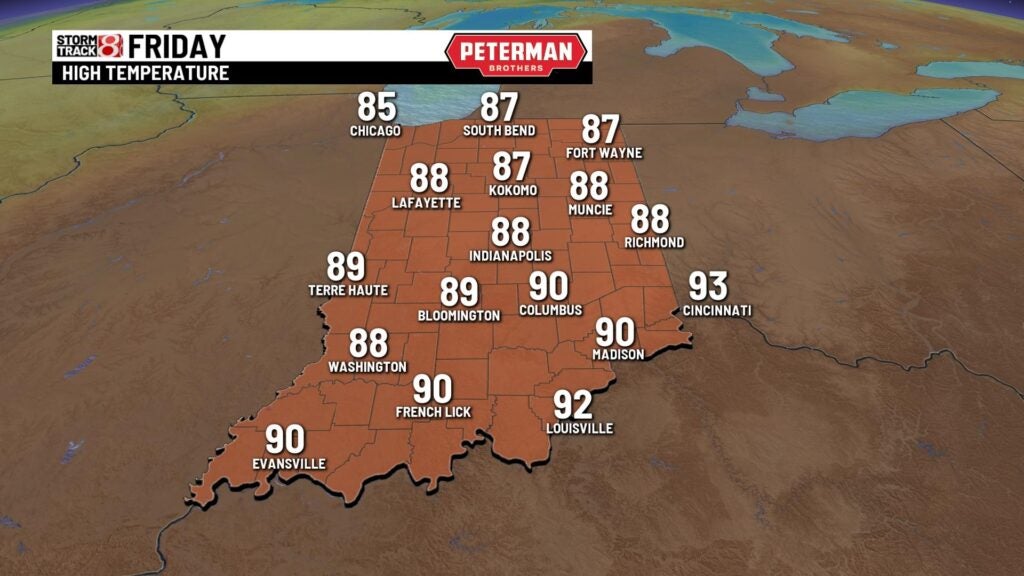
Friday: Near record breaking highs will be the story for our Friday with abundant sunshine and strong winds out of the south (Indy’s record high for May 20th is 90°). Wind gusts look to approach 35 MPH with higher humidity values sliding in as well.
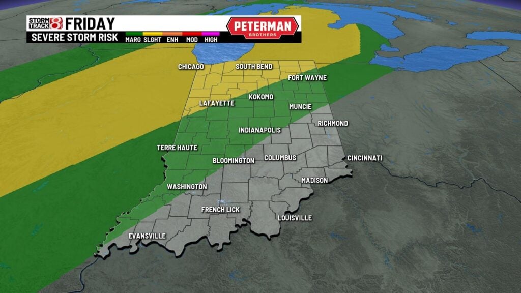
There could be a stray shower or storm or two Friday afternoon before more isolated development takes place Friday night. Isolated strong to severe storms are possible late Friday with damaging wind and hail being the main threats.
8-Day Forecast: An isolated shower or storm or two cannot be ruled out Saturday morning. Then, additional showers and storms will develop by Saturday afternoon with highs rising into the mid 80s. Isolated showers may linger in Sunday morning. A big temperature crash is expected for Sunday as well with highs only getting into the upper 60s. Highs will then get back into the mid 70s by next Tuesday.
