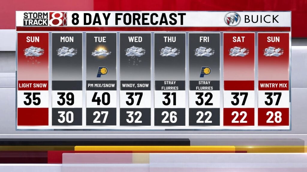
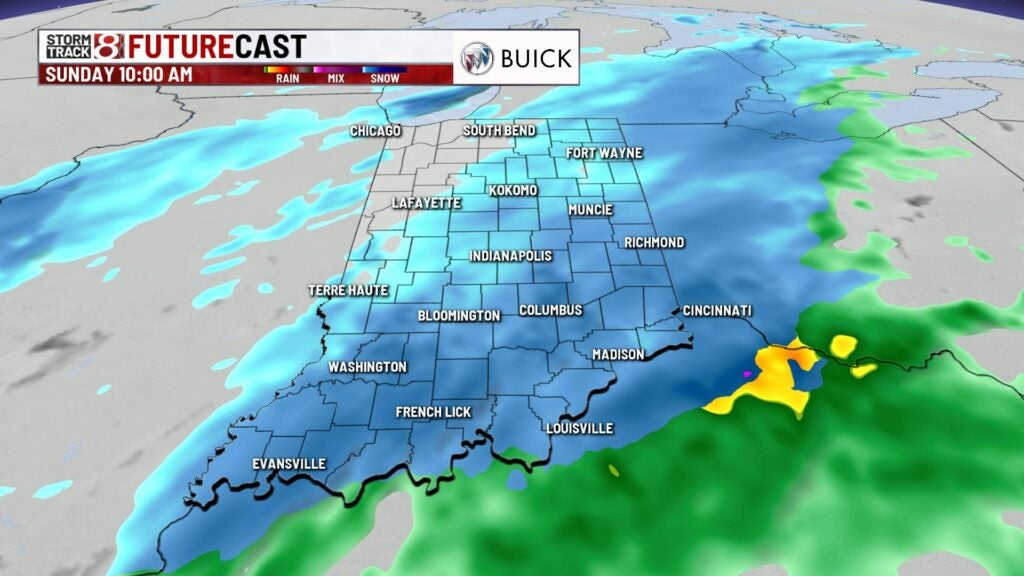
Light snow for Sunday
INDIANAPOLIS (WISH) — Light snow will start off your Sunday. Accumulations will be light but we may see a few slick spots. A more potent storm arrives for the middle of the week.
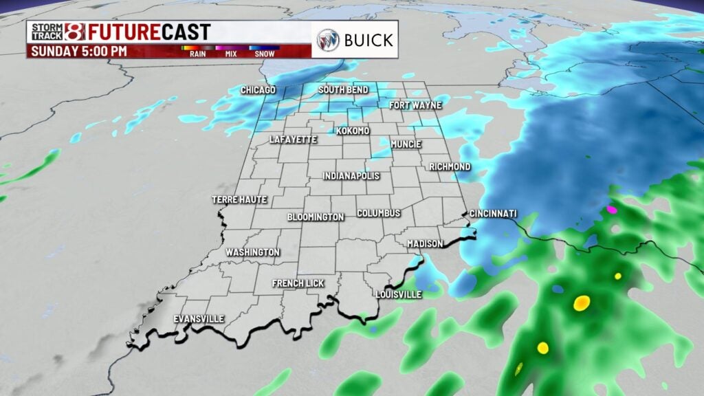
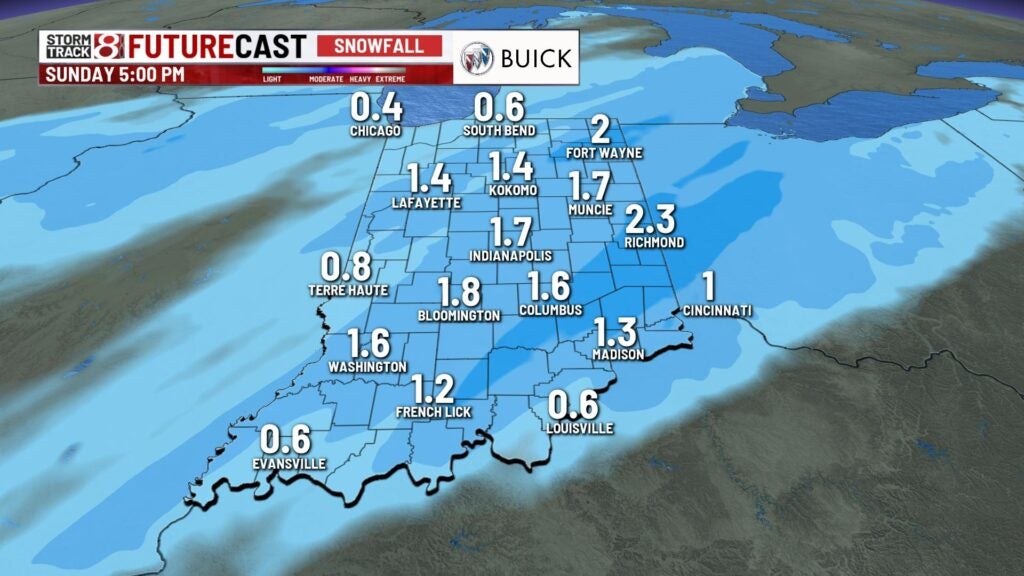
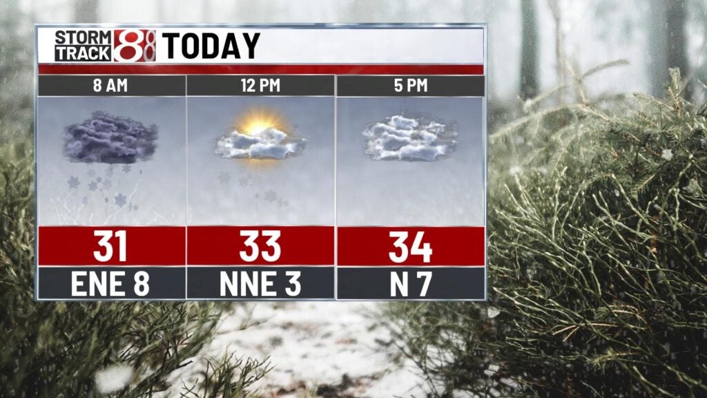
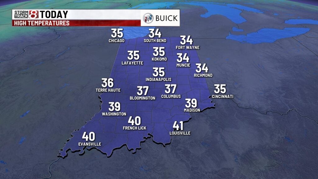
TODAY: Look for some light snow for the first half of the day. Most locations will pick up light accumulations. 1-2″ will be possible for the metro area with 2″ maybe 3″ east of Indianapolis. The snow begins to taper off from west to east around the lunch hour and becomes scattered later this afternoon. Temperatures stay in the low to middle 30s this afternoon.
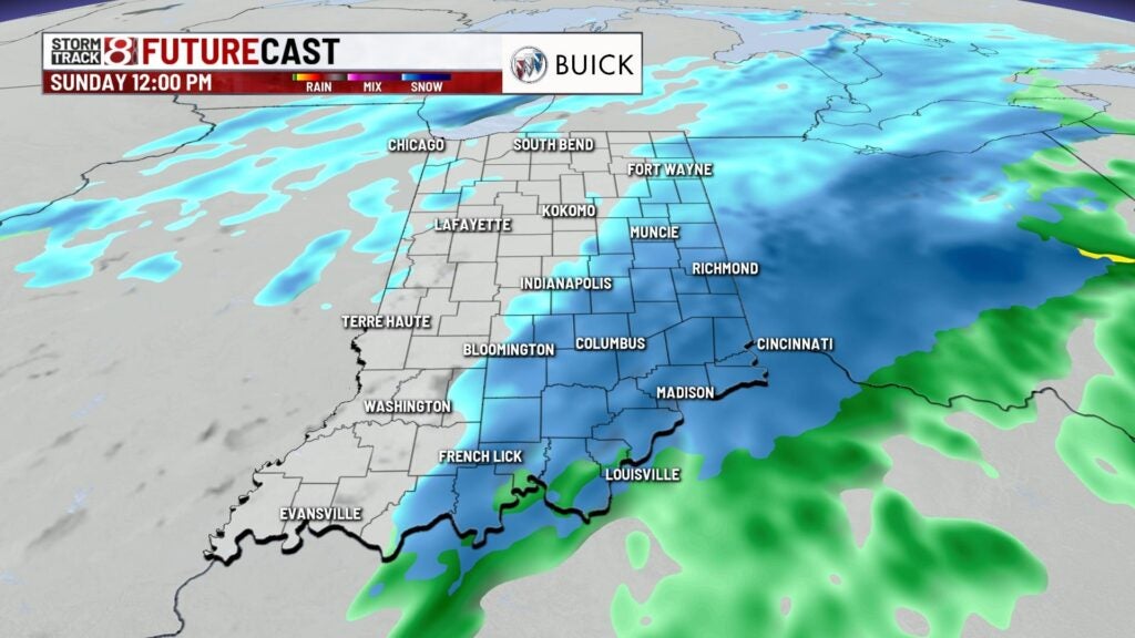
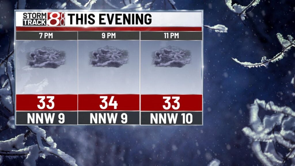
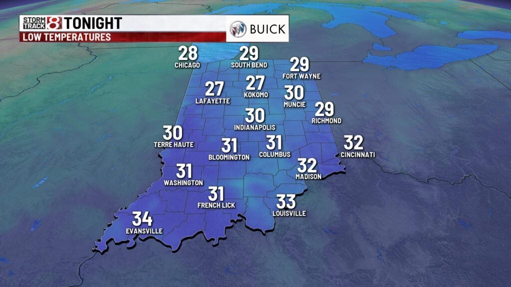
TONIGHT: Look for lots of clouds with a few lingering flurries during the evening. Lows fall close to 30.
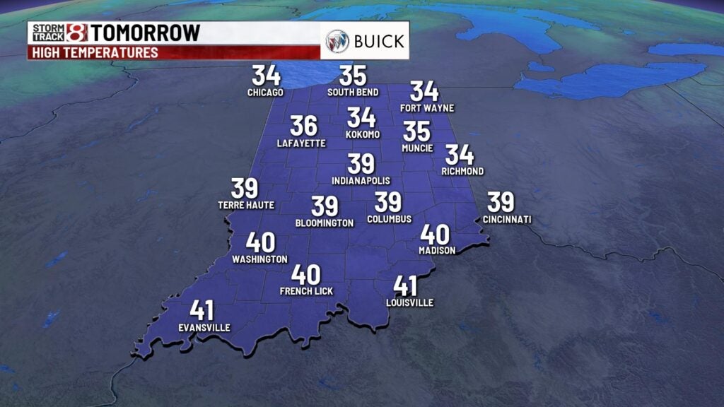
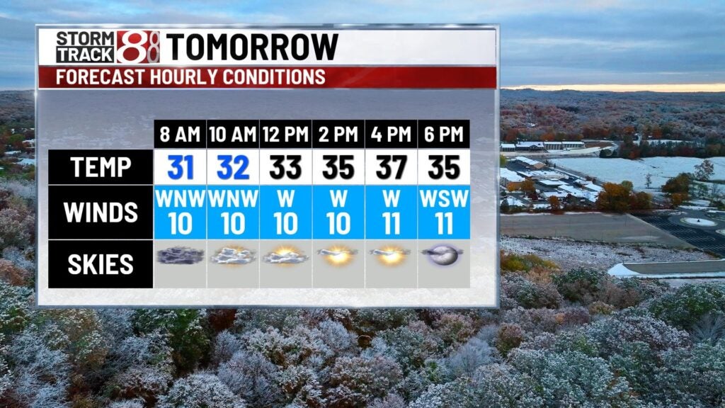
MONDAY: Clouds stick around for much of the day with some clearing later in the afternoon. Temperatures climb a few degrees above normal. Highs reach the upper 30s near 40.
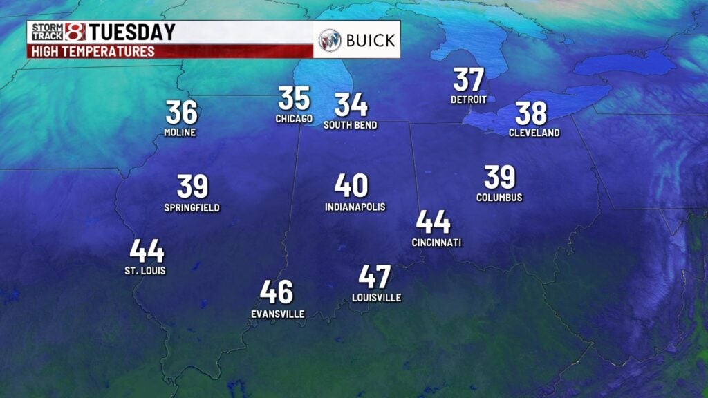
TUESDAY: Look for some sunshine early in the day with highs near 40. Clouds increase later in the day with a chance for a wintry mix late in the evening.
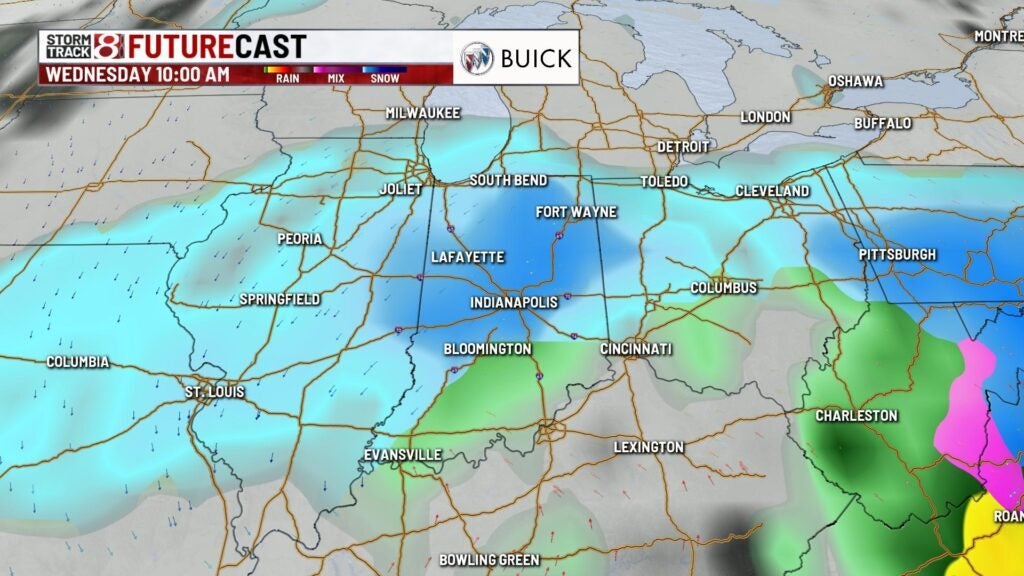
8DAY FORECAST: We’re keeping an eye on a winter storm that will arrive late Tuesday night into the first part of Wednesday. This storm may produce accumulating snow and could cause some travel issues. The exact timing and track are still uncertain but there’s a good chance we may see some accumulating snow beginning Wednesday morning. Winds may also be an issue and could gust to 30-40 mph. Clouds stick around for the end of the week with a few flurries possible and highs near freezing.