Storm chances tonight and Wednesday
INDIANAPOLIS (WISH) — Storm chances later today and tomorrow. Some of the showers and storms may be on the stronger side.
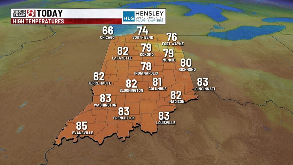
Yesterday we made it up to 82 degrees. This is the warmest day we’ve seen so far this year. We were just two degrees shy of the record yesterday.
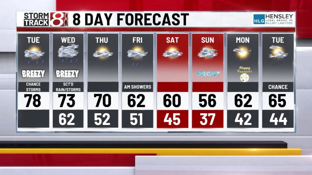
TODAY: We will see more clouds around so temperatures will likely stay in the 70s today. 80s are possible in southern Indiana this afternoon. More clouds than sun today with the best storm chances arriving later this evening.
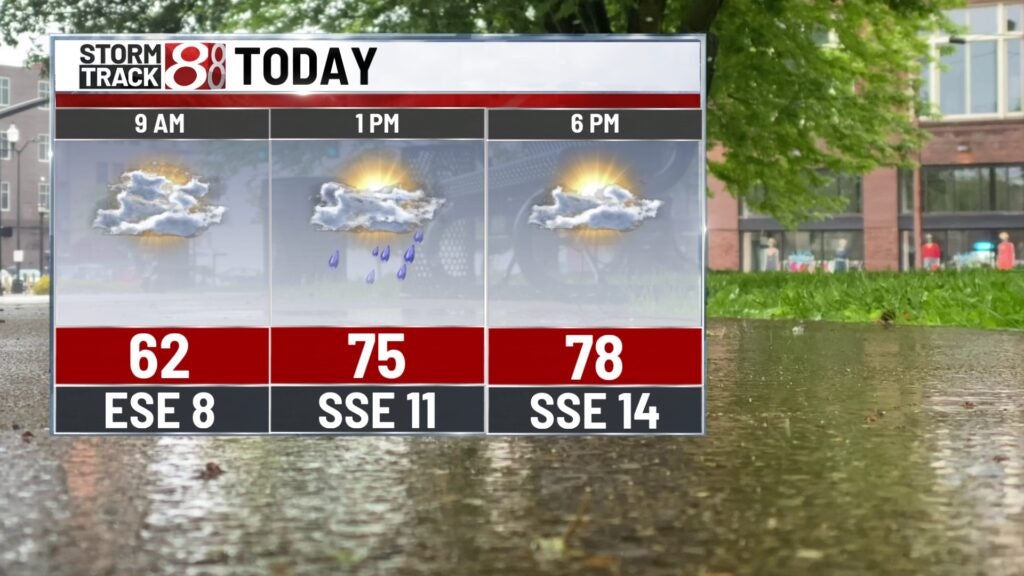
We may see a few showers pop around the lunch hour this afternoon. It is going to be a bit of a breezy day with gusts near 20 miles per hour.
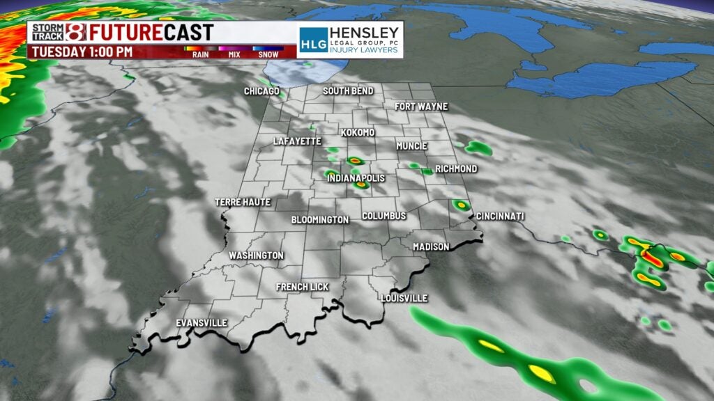
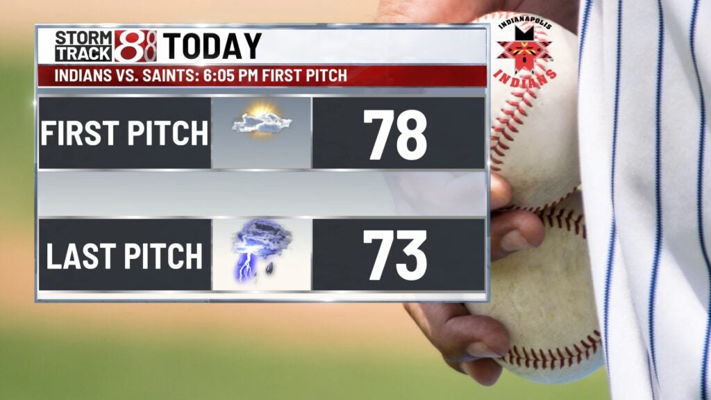
TONIGHT: If you are heading to the Indianapolis Indians game we should be able to get the game in. Temperatures will be above normal into the 70s. Overnight we fall into the lower 60s. Showers and storms develop and some of them may be on the stronger side.
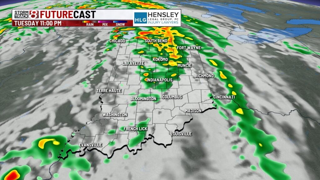
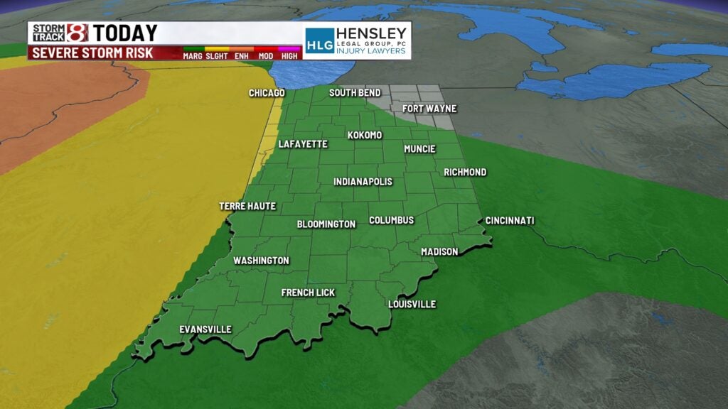
The Storm Prediction Center has much of Indiana under a marginal risk that these thunderstorms may reach severe criteria.
STORM CHANCES
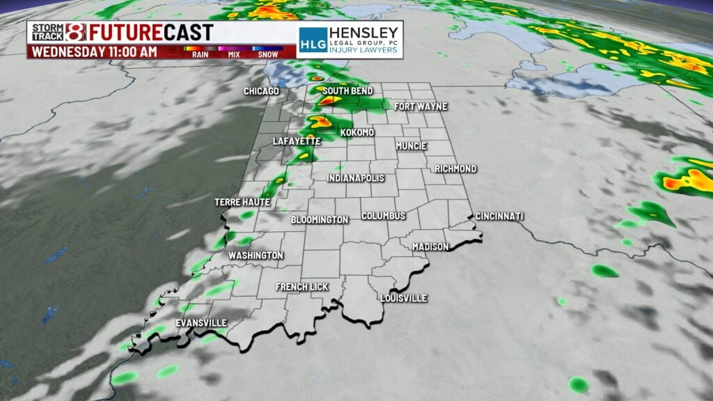
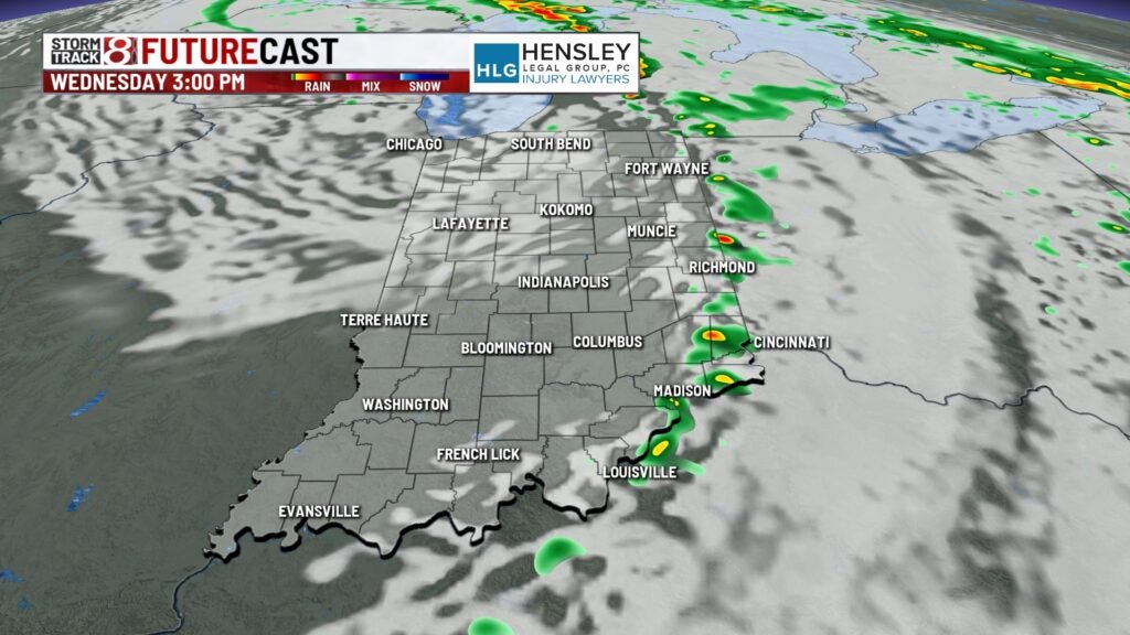
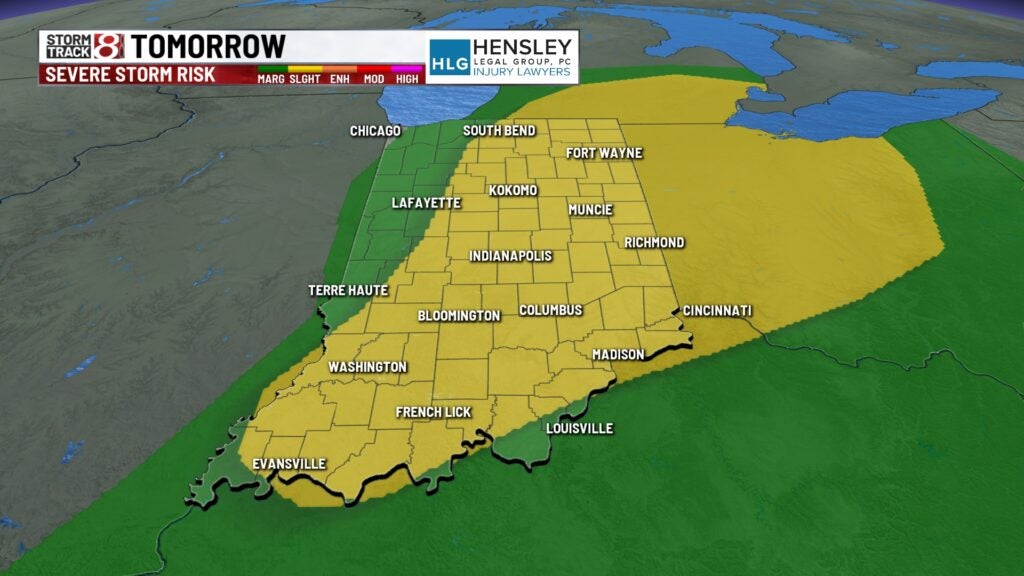
More storm chances move into the state for Wednesday. Showers and evening a few thunderstorms are possible between 11 a.m. and 3 p.m. Some of these thunderstorms may be on the stronger side with gusty winds. The Storm Prediction Center has much of the state under a slight risk.
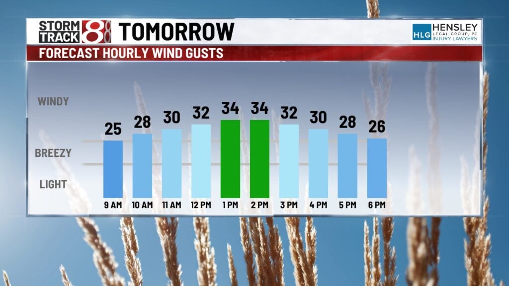
It will be a gusty day with winds near 30 miles per hour at times. Highs climb into the lower 70s.
THURSDAY: Much of Thursday looks dry with a few showers late Thursday into Friday morning. Highs on Thursday fall close to 70.
Temperatures continue to drop and stay below normal for the end of the week and into the weekend. We may even see a few areas of frost Sunday morning.