Stormy Sunday evening
INDIANAPOLIS (WISH) — It’s going to be hot and humid for the end of the weekend with showers and storms developing this evening.
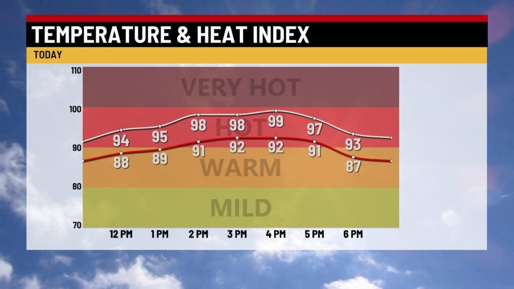
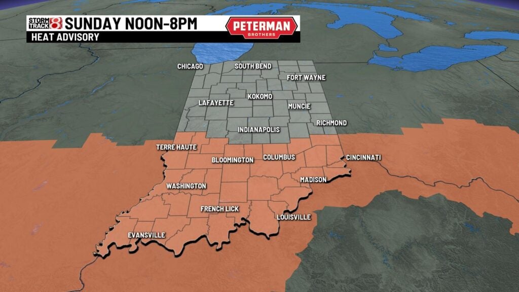
TODAY: We’ll see partly cloudy skies with a chance for a few showers in northern Indiana during the first part of the day. Much of the state will see highs in the upper 80s and lower 90s. It’s going to be humid with feels like temperatures in the middle and upper 90s. For parts of southern Indiana heat index values climb near 100. There’s a Heat Advisory in place from noon to 7 p.m. for southern Indiana.
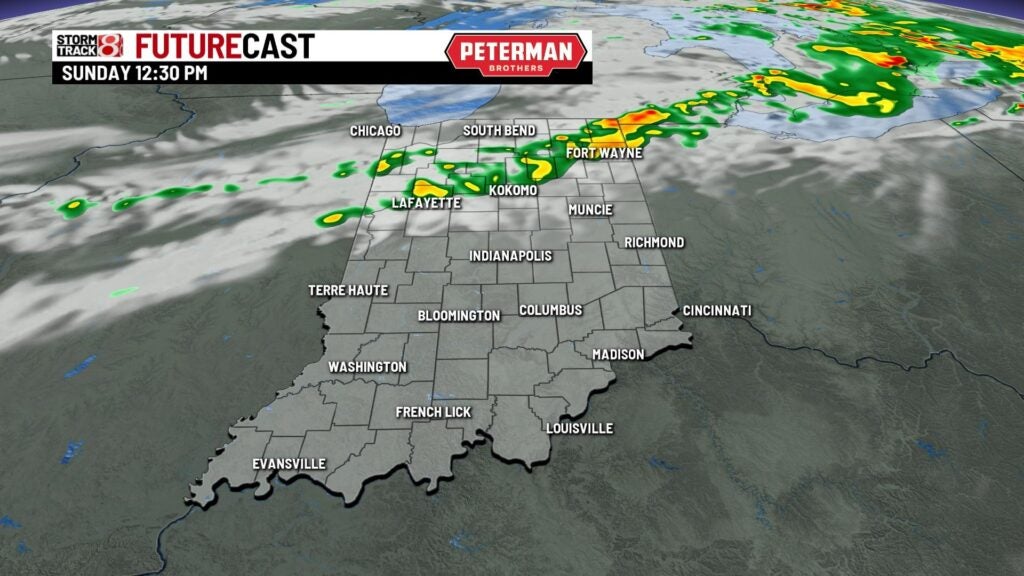
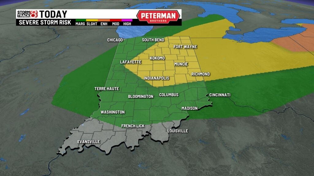
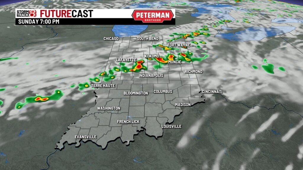
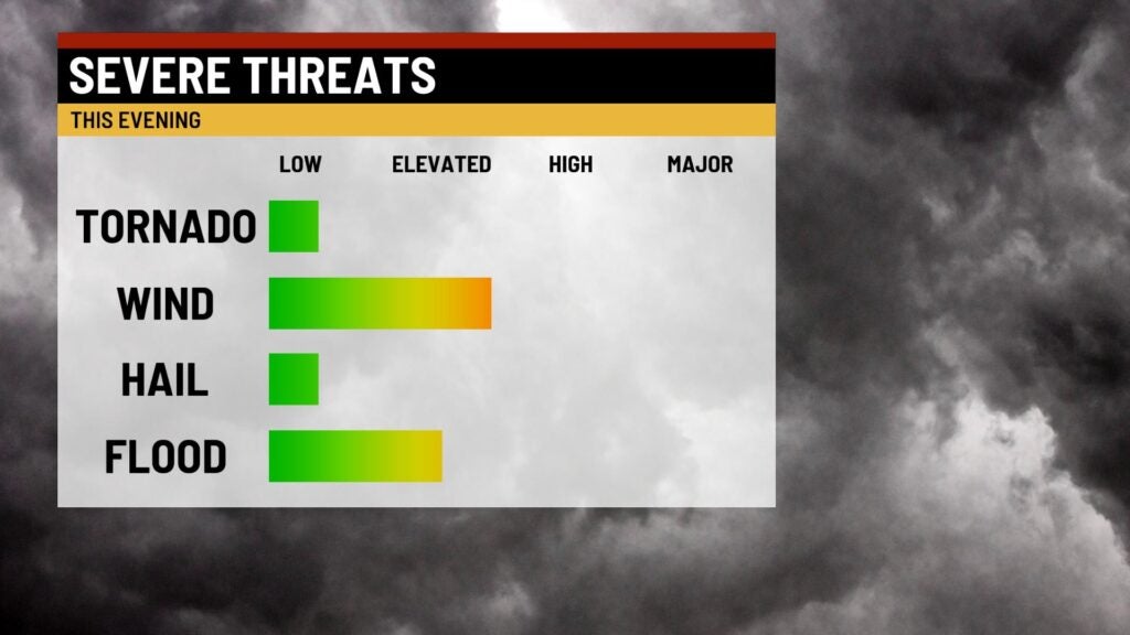
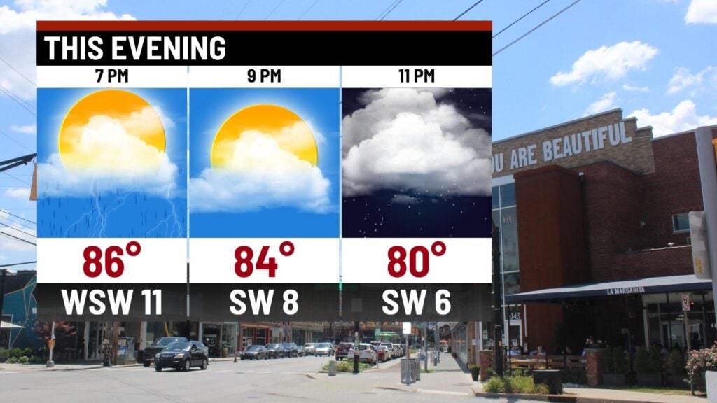
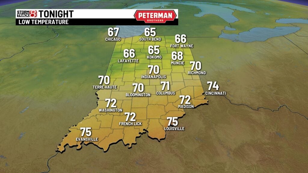
TONIGHT: Showers and thunderstorms develop as a cold front sweeps across the state. Some of the thunderstorms may be strong with gusty winds and very heavy rainfall. The Storm Prediction Center does have the central and northeastern part of the state under a slight risk that some of the storms may reach severe criteria. Lows fall into the upper 60s near 70.
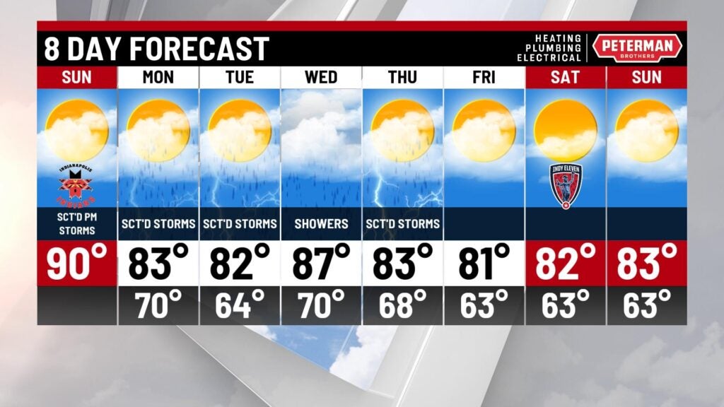
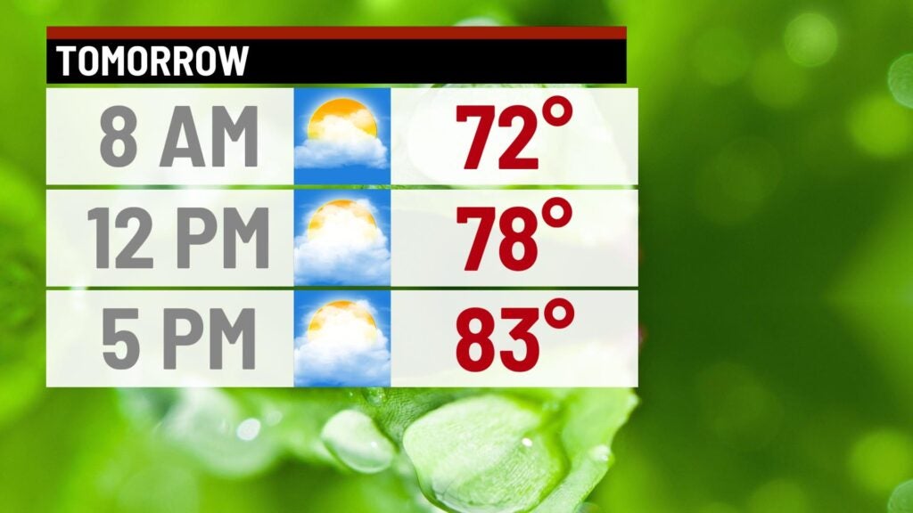
MONDAY: Humidity drops for the start of the workweek. We’ll see partly cloudy skies with a few showers or storms scattered. Highs stay in the lower 80s.


TUESDAY: We’ll see a good chance for some much needed rain around the area Tuesday. Look for mostly cloudy skies, with on/off showers or storms. Humidity values increase slightly but it will still be comfortable. Highs climb into the lower 80s.
8DAY FORECAST: Rain chances continue Wednesday and Thursday. We begin to dry out for the next weekend. It looks great with lower humidity, sunshine and highs in the 80s.