


Strong storms possible Thursday night
INDIANAPOLIS (WISH) — Strong storms possible later tonight. Much of the day will be dry with sunny skies and temperatures above normal. Cooler temperatures head this way for the weekend.
TODAY: It is a cool start around the state with temperatures into the 40s near 50 as you wake up. Look for sunny skies throughout much of the day. It will be warm with temperatures well above normal. Highs climb into the upper 70s near 80.


Winds won’t be as bad today either.
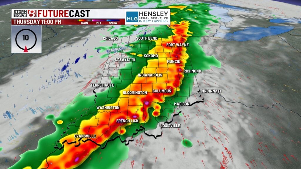
STRONG STORMS
A line of strong and severe thunderstorms is possible later tonight. The best chance of seeing the line moving through is between 7 p.m. and 1 a.m. This line will produce the chance for all severe weather elements, strong gusty winds, moderate to heavy rainfall, hail and even a few rotating storms. Best chance of any tornadic activity is south and west of Indianapolis.


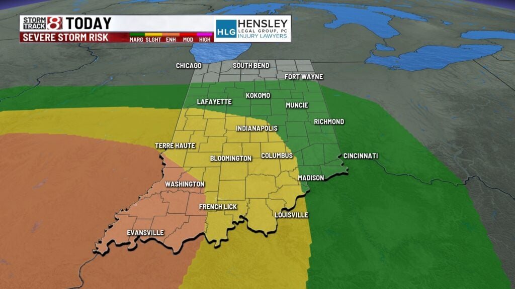
The Storm Prediction Center has much of the state under a weather risk. The enhanced risk is southwest Indiana, Indianapolis is under a slight risk which is a level 2 out of a level 5.
The Indianapolis Indians are playing tonight with the first pitch at 6:35 p.m. While the game may start dry depending on the speed of the line we may see some rain moving in before the game ends.

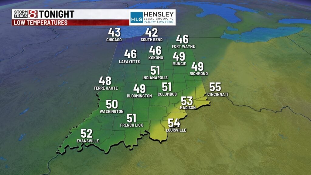
Temperatures overnight fall into the lower 50s.
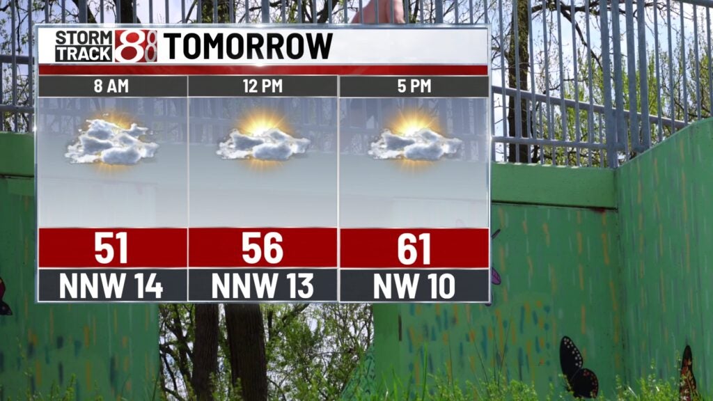
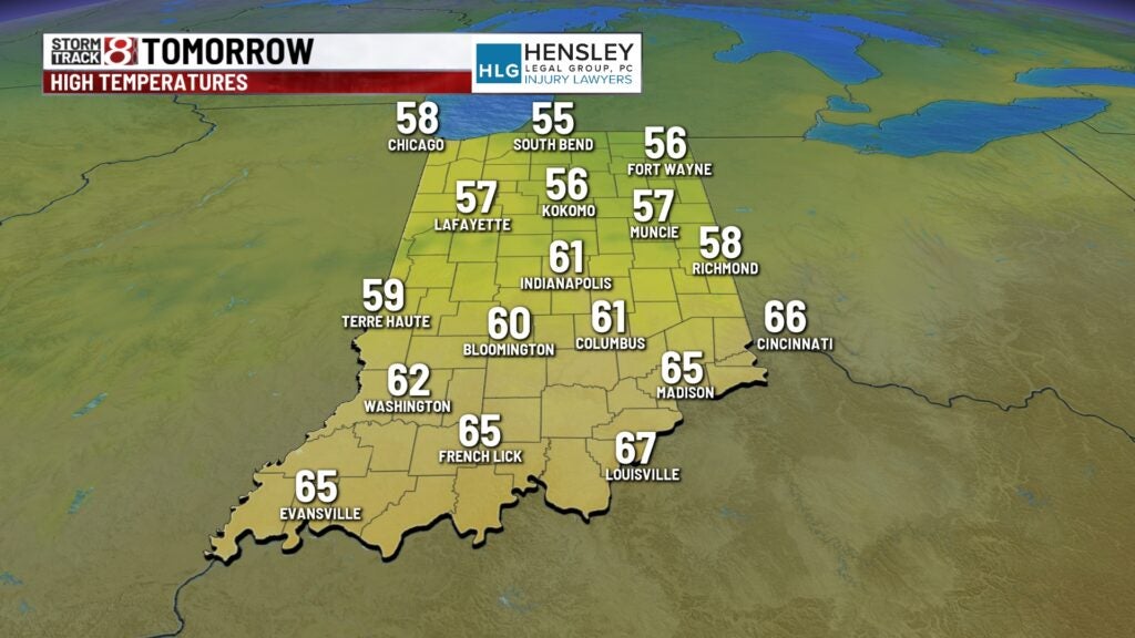
FRIDAY: A few morning showers are possible early Friday. Look for a partly cloudy sky. Winds will be a touch breezy out of the north and northwest. It will be notably cooler Friday afternoon. Temperatures only climb into the lower 60s for the afternoon which is actually below normal for this time of the year.
WEEKEND FORECAST
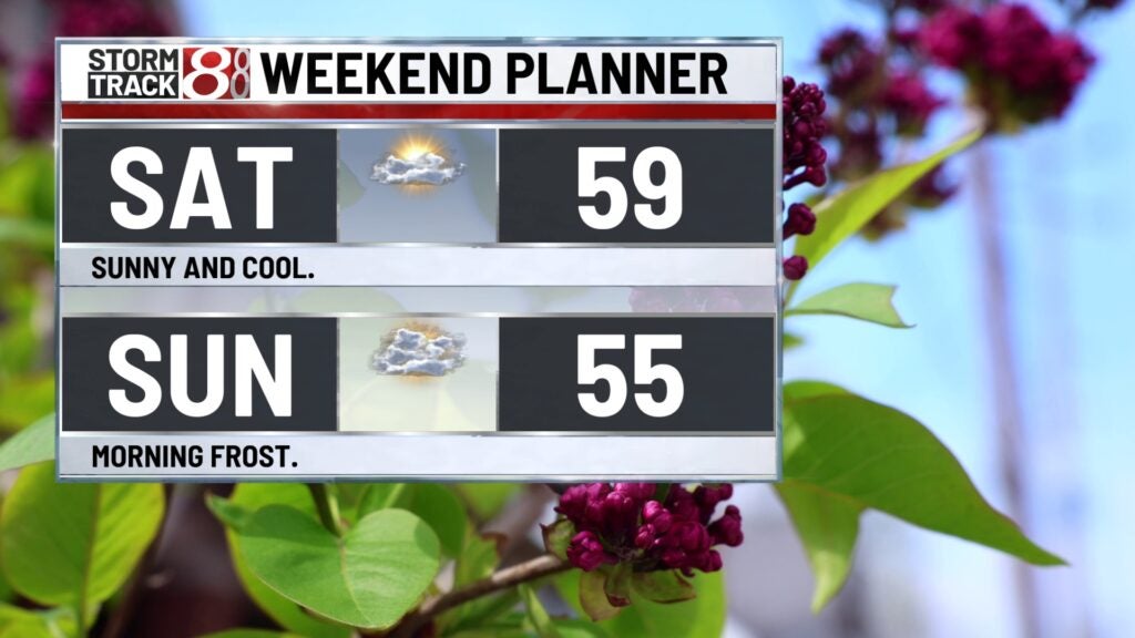
This weekend look dry but cooler. Highs on Saturday stay in the upper 50s near 60. Look for partly cloudy skies. Early Sunday morning temperatures dip into the 30s. Frost may be possible early Sunday morning. So if you have already planted be sure to cover them up before you head to bed Saturday night. Sunday afternoon stays cool with highs in the middle 50s.
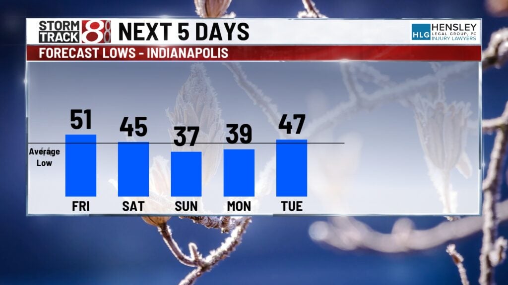
Next week temperatures return to the 60s. Monday looks dry with partly cloudy skies. Highs limb into the lower 60s.
A few showers are possible on Tuesday with partly to mostly cloudy skies. Highs climb near normal into the middle 60s.
