Transitioning back to muggy air this weekend
INDIANAPOLIS (WISH) — Today felt practically light years better weather-wise with much less humidity and near average temperatures. We are looking to end the workweek on a hot note before the muggy meter gradually turns up again this weekend.
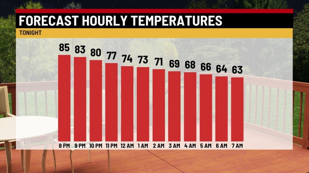
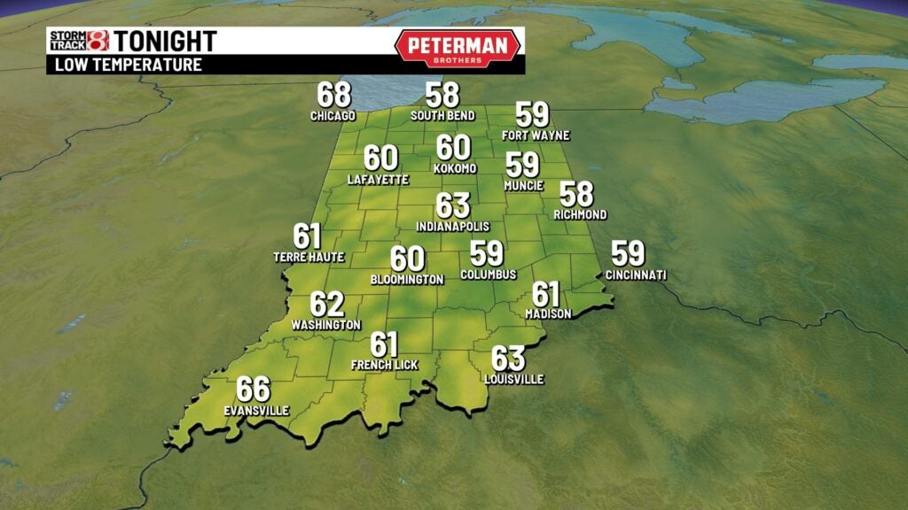
Thursday night: A comfortable night will be on deck under mainly clear skies. Lows will slip into the low 60s.
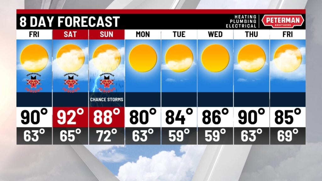
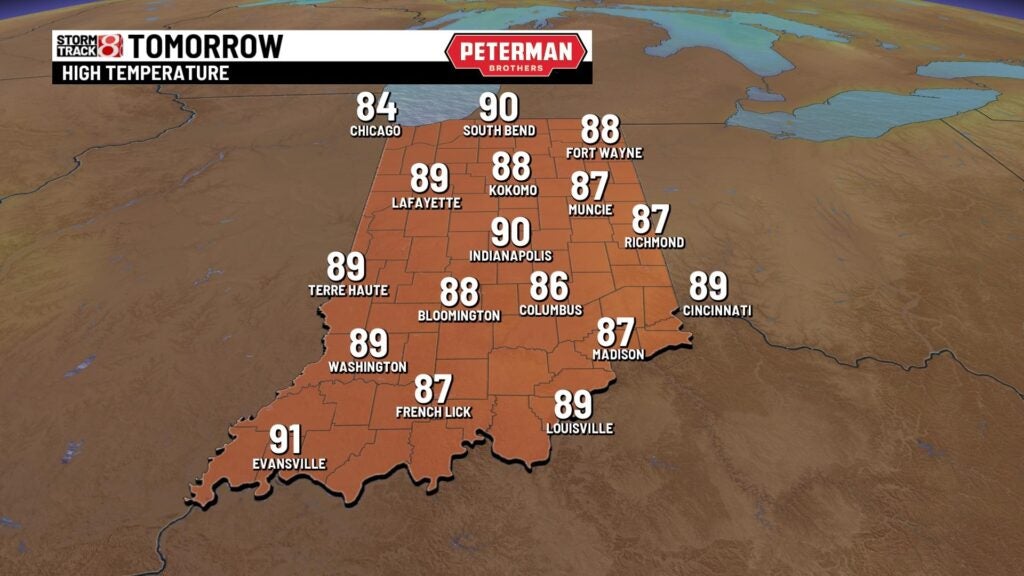
Friday: We keep the abundant sunshine trend going into our Friday with slightly above average temperatures expected. Although it will be toasty with highs in the upper 80s to low 90s, the humidity levels are going to stay low.

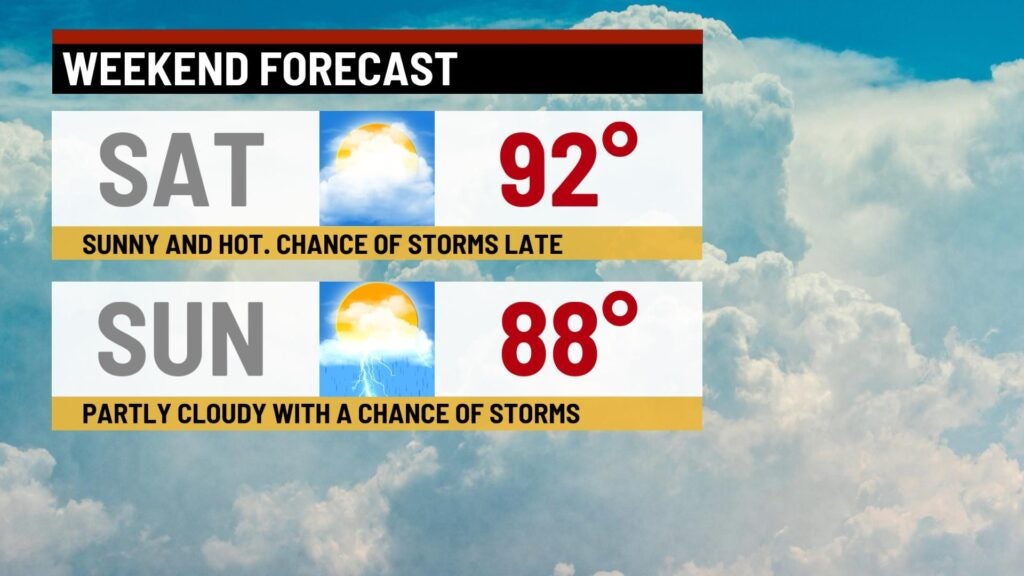
Weekend: Slightly hotter conditions look to move in for our Saturday. Cloud cover and humidity will both gradually increase throughout the day. Highs are set to rise into the low 90s. We can’t rule out spotty storms late Saturday. Sunday features a transition point in this forecast as we see a front scoot in. This will better chances for rain and storms during the afternoon and evening hours. Severe weather is still not expected at this time for Sunday.
8-Day Forecast: Sunday’s front will bring refreshing air back into the picture going into next week. Monday is shaping up to be fantastic to start the new workweek with highs in the low 80s. A gradual warmup will then slide in through midweek next week.