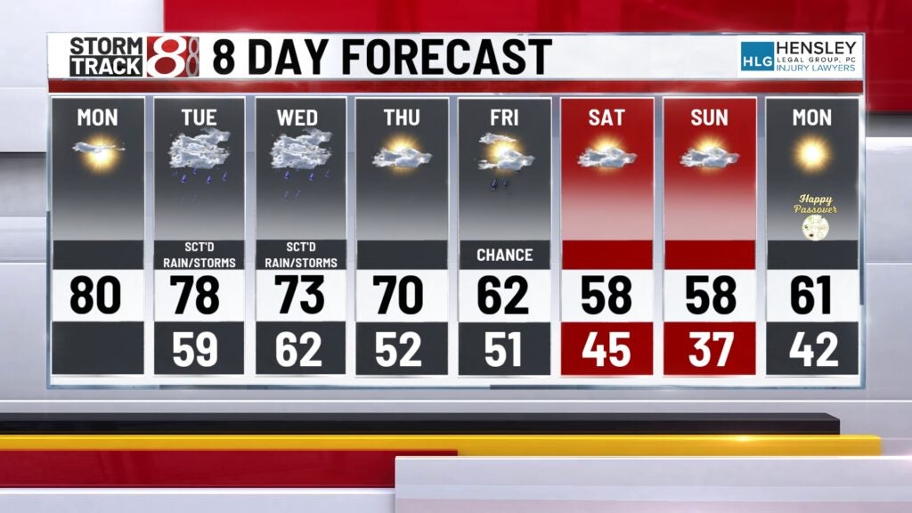
Warm, dry day before rain returns
INDIANAPOLIS (WISH) — Another day in the 80s with dry conditions. Rain returns for Tuesday and into the middle part of the week.
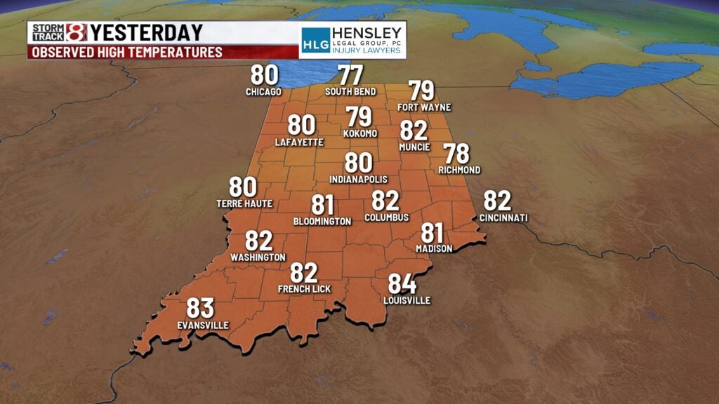
We saw the first 80 degree reading of the year yesterday. Highs reach 80 on the nose Sunday with sunny skies. We’re in store for much of the same today.
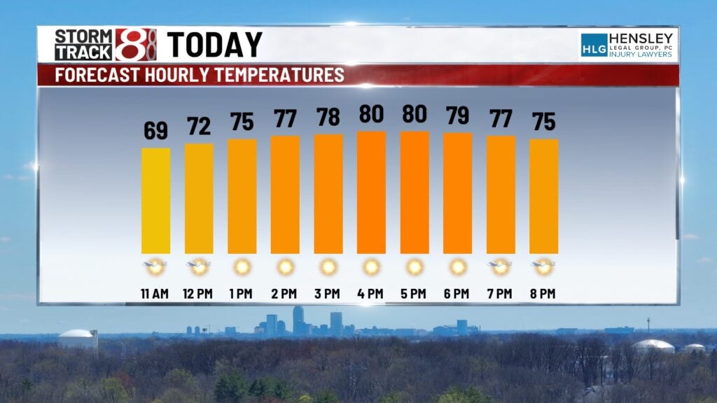
TODAY: Look for lots of sunshine and dry conditions all day long. It’s going to be a beautiful day with highs climbing once again near 80. It looks like we will be short of the record high but still well above normal. Winds will be fairly light today.
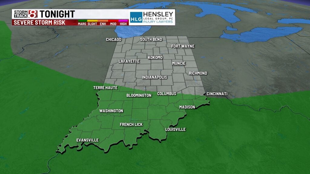
TONIGHT: Clouds increase ahead of our next rain chance. If you are heading to downtown Indianapolis for the WNBA Fever watch party it will be mild and dry. Temperatures will be into the lower 70s this evening. Clouds increase but it stays dry. There is a rain or thunderstorm chance farther southward along the Ohio River.
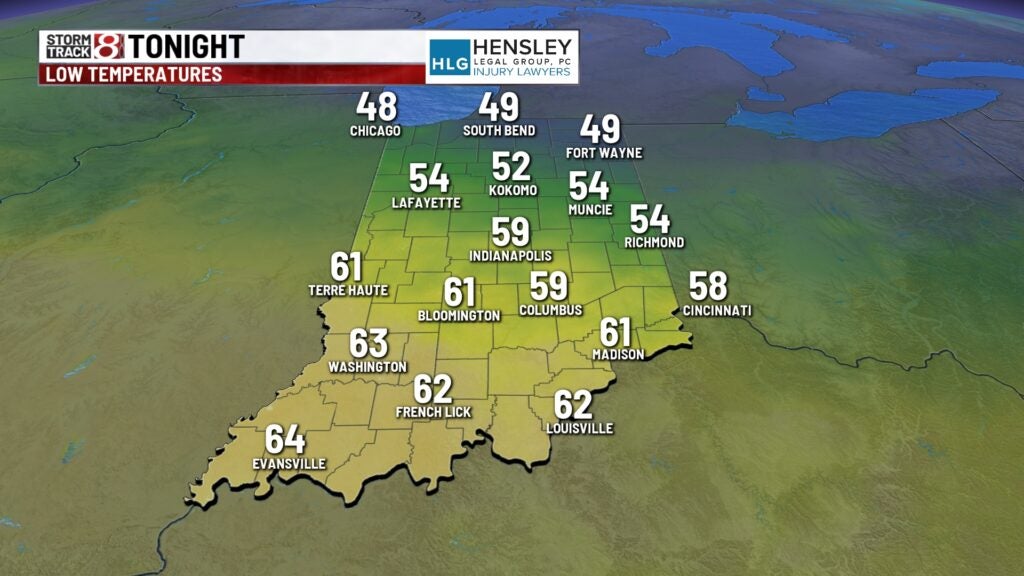
One or two of those thunderstorms may be on the stronger side. Which is why southern Indiana is under a marginal risk of strong storms.
RAIN RETURNS
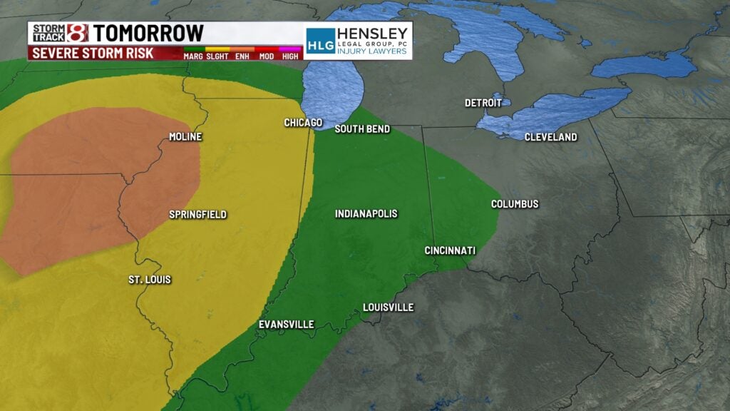
TUESDAY: Rain returns for Tuesday and Wednesday across the state. We will see a chance for showers and thunderstorms early on Tuesday. We will get a break and then another chance for showers and storms later in the day. Some of these thunderstorms may be on the stronger side. We have a marginal risk across the entire state.
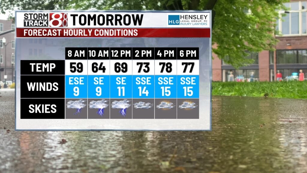
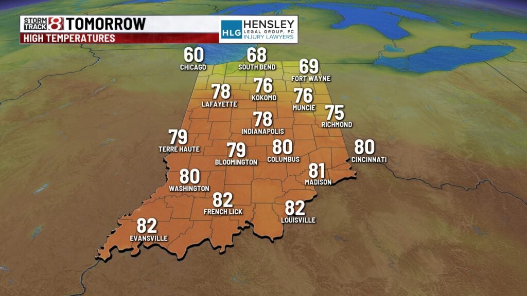
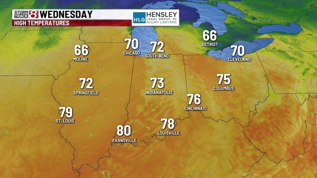
Highs on Tuesday climb into the upper 70s which is still above normal for this time of the year.
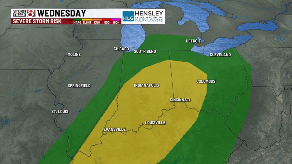
WEDNESDAY: It’s going to be a windy Wednesday with gusts near 20 to 30 miles per hour. As the cold front approaches Indiana showers and thunderstorms develop. Some of these thunderstorms may be on the stronger side. A slight risk is in place across much of the state. This is a level 2 out of a level 5.
8DAY FORECAST: Cooler temperatures heading this way for the weekend. We will see highs in the 50s both Saturday and Sunday. We may even see some frost early Sunday morning.