Tracking the chance for much needed rain
INDIANAPOLIS (WISH) — We could really use rain around the state. There’s a slight chance we may see some later tonight and for the end of the weekend.
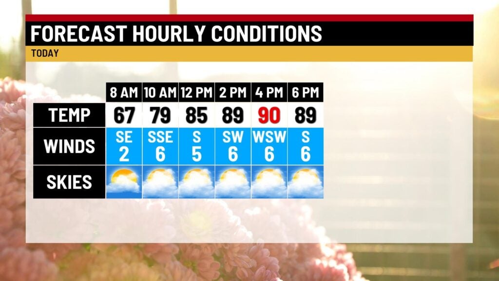
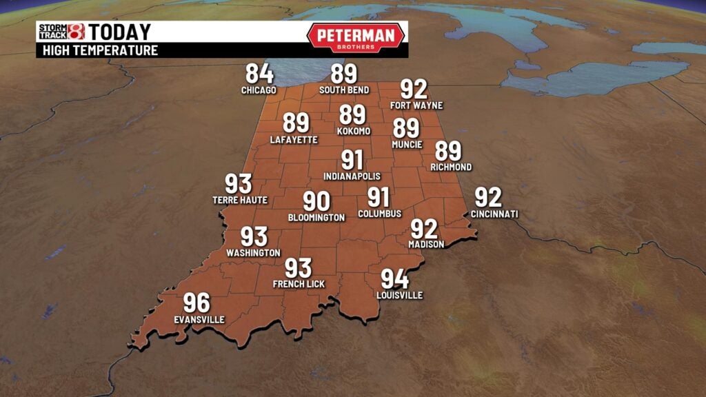
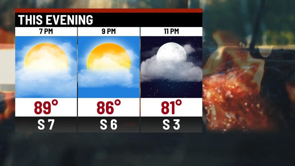
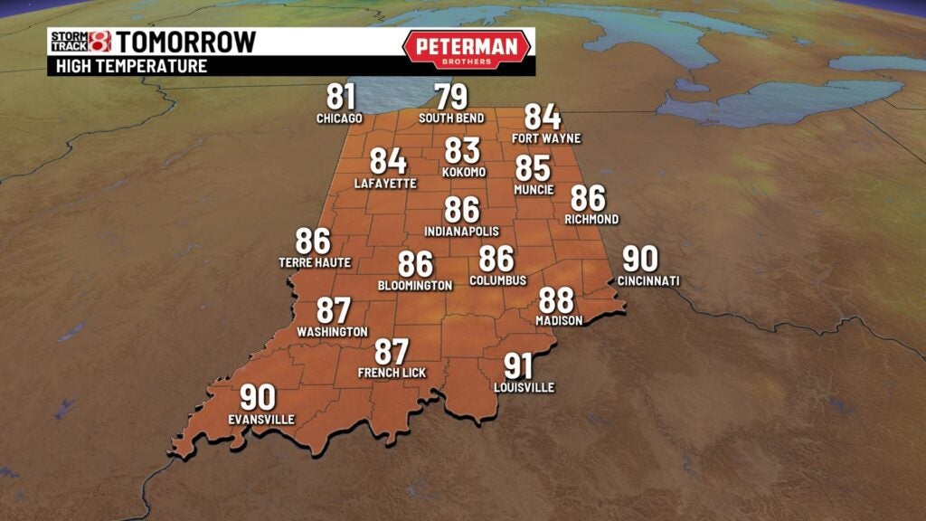
TODAY: We’ll see a batch of clouds move across much of Indiana from a line of showers and thunderstorms off to our west. Much of the day will be dry with partly cloudy skies. Highs climb into the upper 80s and lower 90s. Humidity values begin to increase slightly.
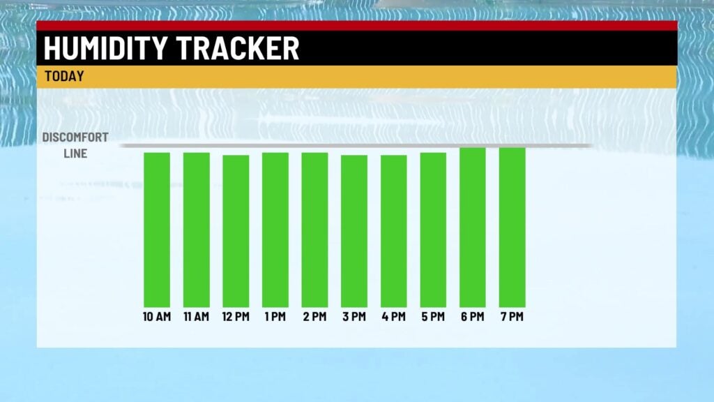
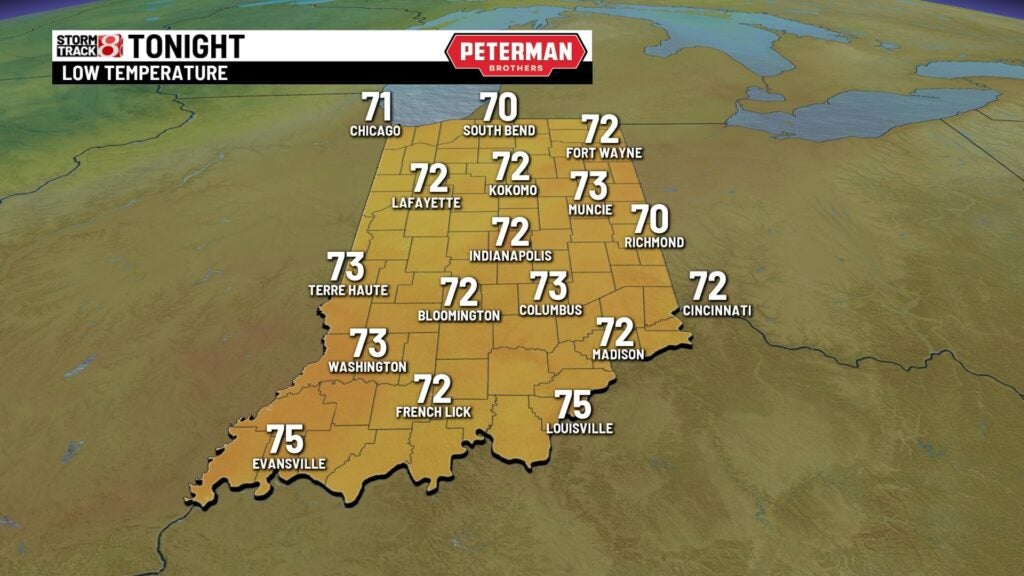
TONIGHT: It starts to feel more muggy later this evening. Clouds begin to increase and there’s a slight chance we may see a few showers or storms late tonight. Lows fall into the lower 70s.
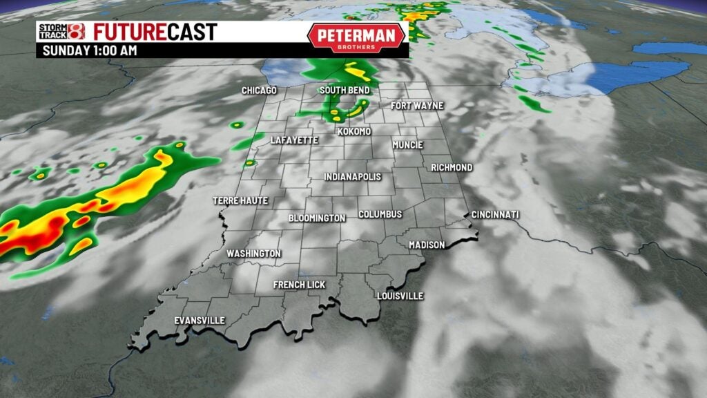
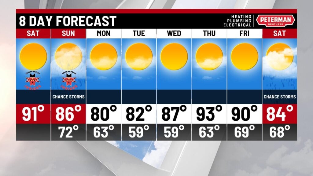
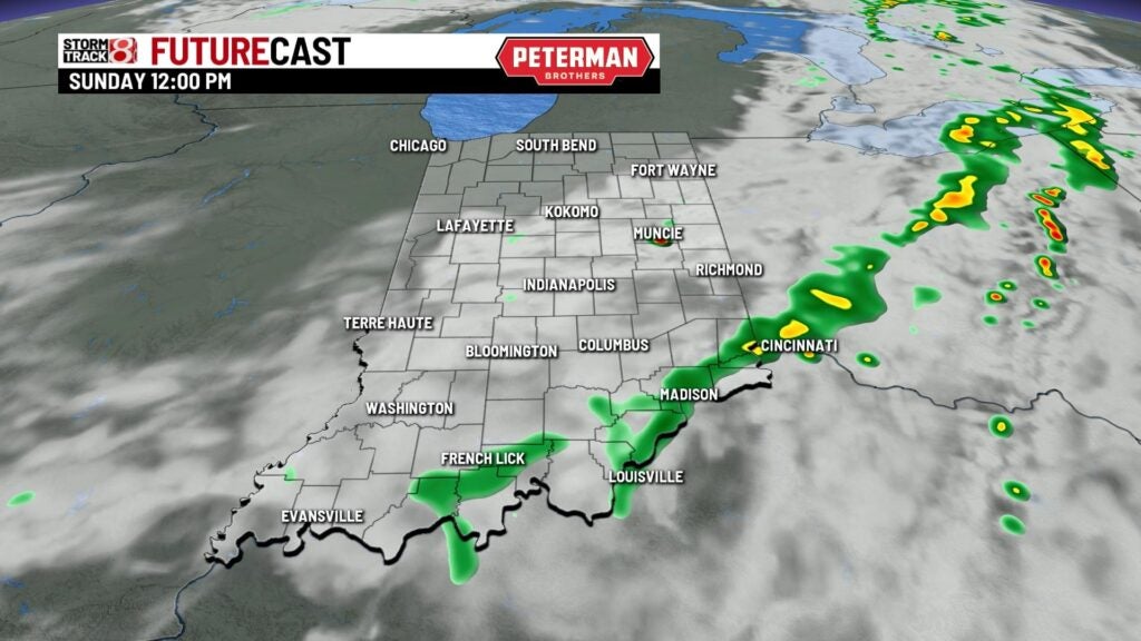
SUNDAY: We’re tracking a cold front moving across the state on Sunday. This will provide a spotty shower or storm especially in the southern part of Indiana during the late afternoon and evening. Highs climb into the middle 80s and it will be noticeably more humid.
MONDAY: A comfortable air mass works into the state for the start of the workweek. Humidity drops and temperatures fall below normal in the upper 70s near 80.
8DAY FORECAST: The quiet and dry weather continues for the rest of the workweek. Highs start in the lower 80s Tuesday. They gradually climb into the upper 80s and lower 90s again for the end of the week. Next chance of rain won’t be until next weekend.