Hurricane Ian makes historic landfall in Florida as strong Category 4
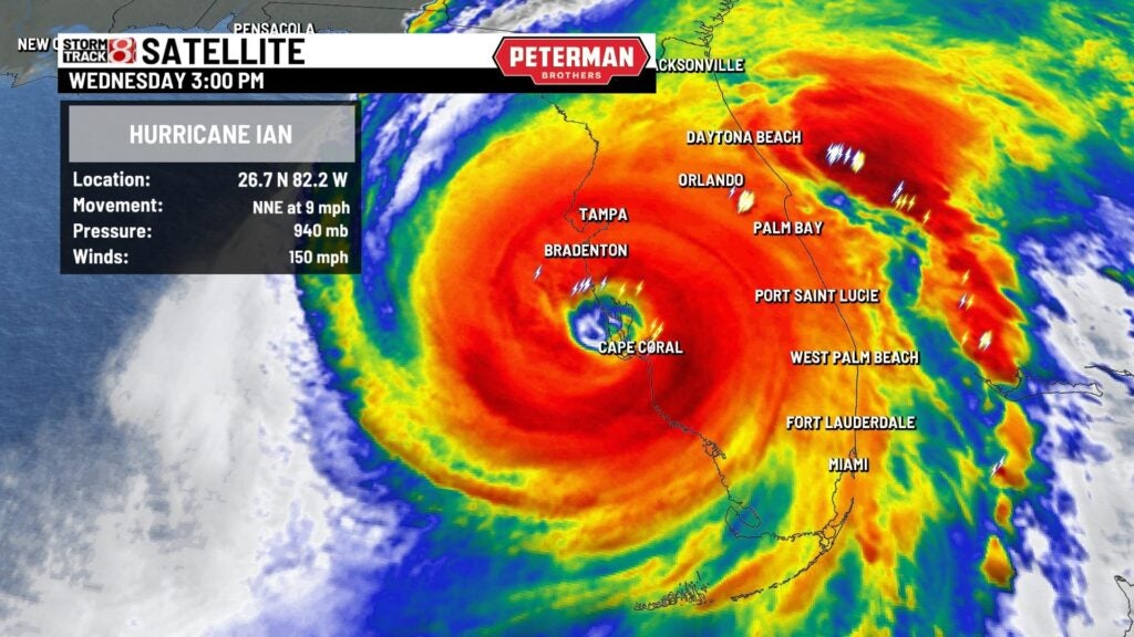
INDIANAPOLIS (WISH) — Hurricane Ian made landfall as a strong Category 4 hurricane at 3:05 p.m. Wednesday near Cayo Costa, Florida, with maximum winds of 150 mph.
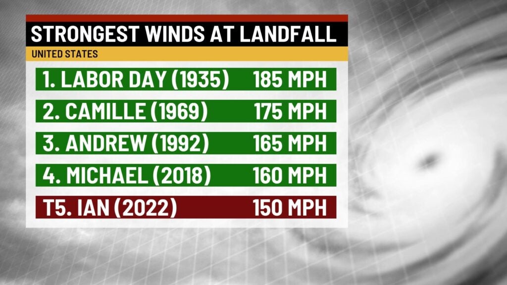
This makes it the strongest storm to hit Florida since Hurricane Michael in 2018.
In terms of strongest winds at landfall in the Unites States, Ian is tied for the fifth with multiple other storms. Remarkably, one of those storms it is tied with is Hurricane Charley, which had the same point of landfall as Ian back in 2004.
Storm surge amounts have been very high just to south and east of the center of Hurricane Ian. Estimates of the storm surge have been over 10 feet from Port Charlotte down to Fort Meyers.
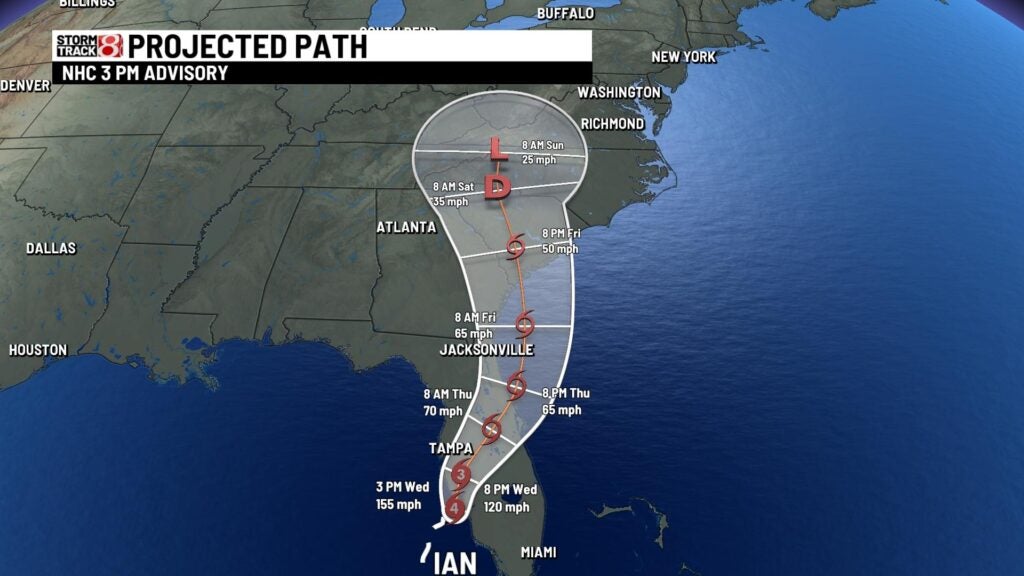
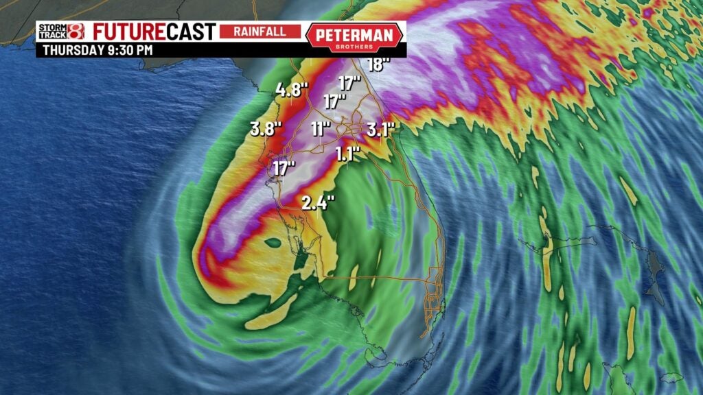
As the system continues inland into Florida, it is expected to weaken into a tropical storm by early Thursday. However, the overall storm itself will drop tremendous amounts of rain from its slower movement. The focus of this rainfall will be on the northern half of the storm and is the reason the Weather Prediction Center has issued a “high” likelihood of excessive rainfall from now into Thursday for parts of Florida.
Ian’s track could take it back out to the Atlantic Ocean before it threatens to make another landfall in the United States in Georgia or the Carolinas. The gulf stream may allow the system to try and strengthen once again east of Florida.