


Quiet weather Tuesday, mid-week mix possible
INDIANAPOLIS (WISH) — A brief quiet period early this week before another potent system takes aim on central Indiana Wednesday and Thursday, bringing a chance for rain and some snow accumulation.
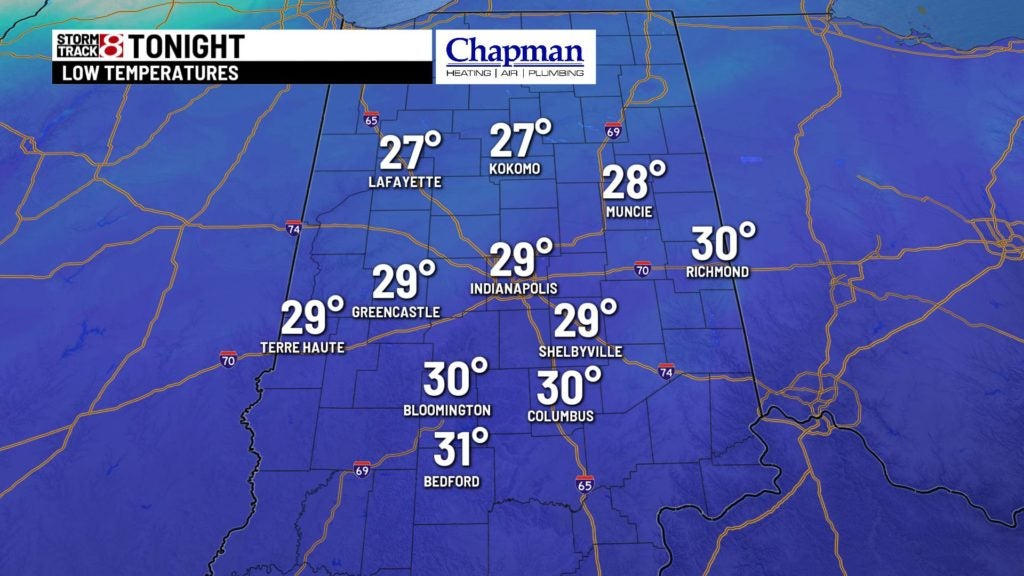
Tonight:
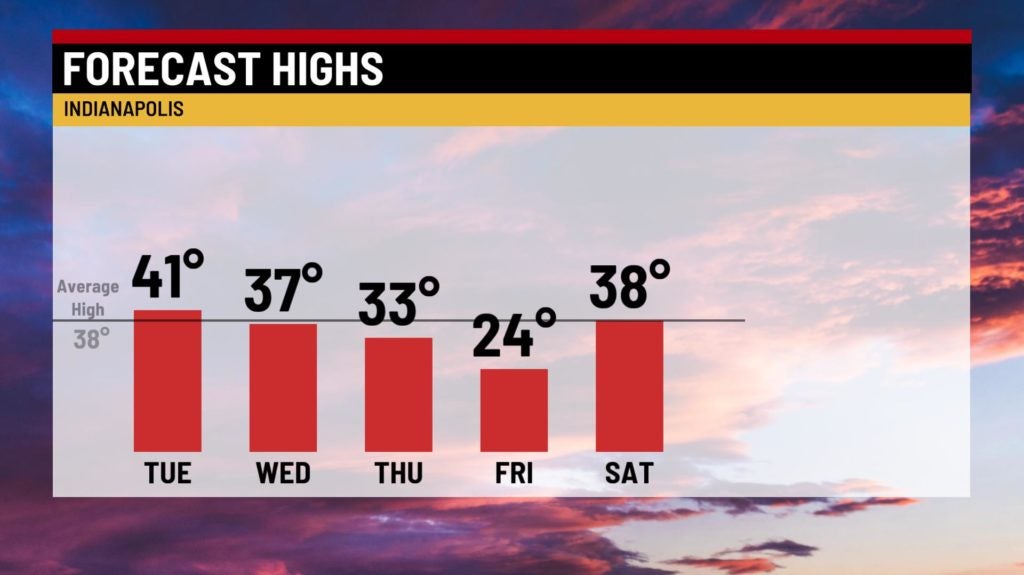
Relatively quiet conditions with an overcast sky through the overnight. Temperatures only fall to the upper 20s and lower 30s

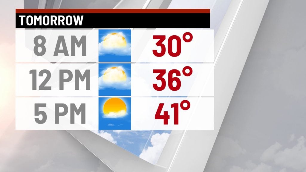
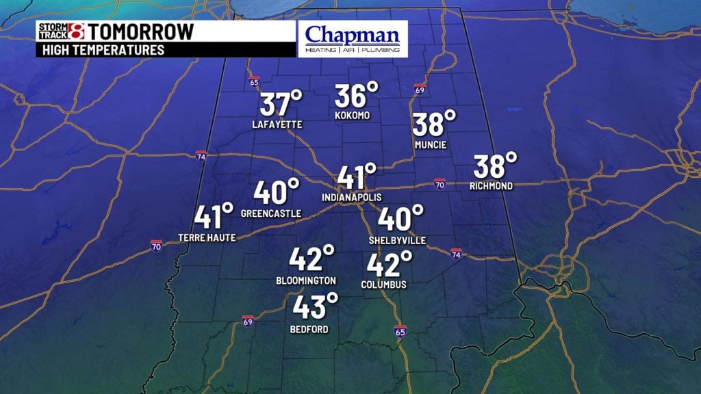
Tuesday:
Quiet weather all day. We should see a gradual decrease in the cloud cover through the afternoon, so some sunshine will be possible late in the day. Highs top out in the lower 40s.
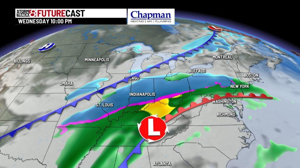
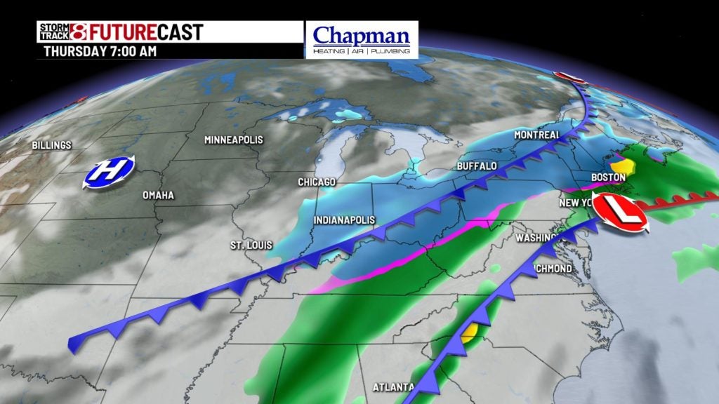
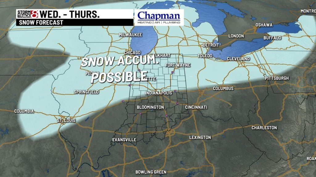
Mid-week system:
Potent system works in from the south for the second half of Wednesday into Wednesday night and Thursday. There are still many possibilities on the track of this low, so more data needs to be monitored, but some possibilities of snowfall accumulations for the northern half of the state. With a slight shift to the south of the storm track, some areas south of I-70 could also see snow accumulation. That said, we’ll call for a mix of rain and snow, then changing to snow for the overnight into Thursday.
Briefly colder:
Following the mid-week system we’ll get a quick but significant shot of colder air diving in from Canada. Lows fall to the single digits and wind chills below zero Friday morning, with highs only hitting the lower to middle 20s.
8 day forecast:
Temperatures will rebound quickly for the weekend and beyond. We’re back to near normal levels on Saturday, and into the 40s with isolated rain chances Sunday. Upper 40s and even some 50s will be possible across our area Monday and Tuesday of next week.
