Snow changing to rain Sunday
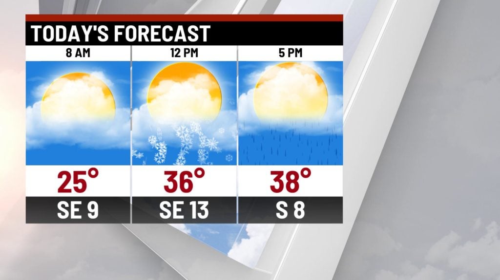
INDIANAPOLIS (WISH) — A potent system moving through the Midwest will bring a shot for snow showers, breezy conditions and steady rain later this afternoon.
Today:
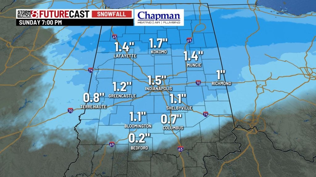
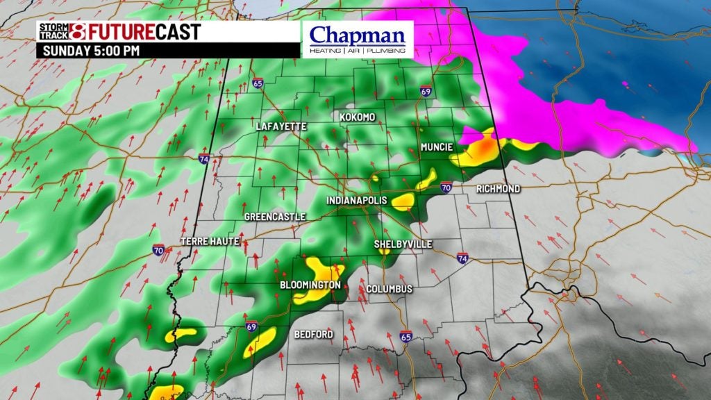
Large system ejecting from the southwest will move into the region today. Along the warm front, expect precipitation to start as snow by late morning along and north of the I-70 corridor. A pretty good thump of snow for a few hours could result in around 1″ of quick accumulation around midday. A winter weather is in effect for far northern counties due to the snow impact.
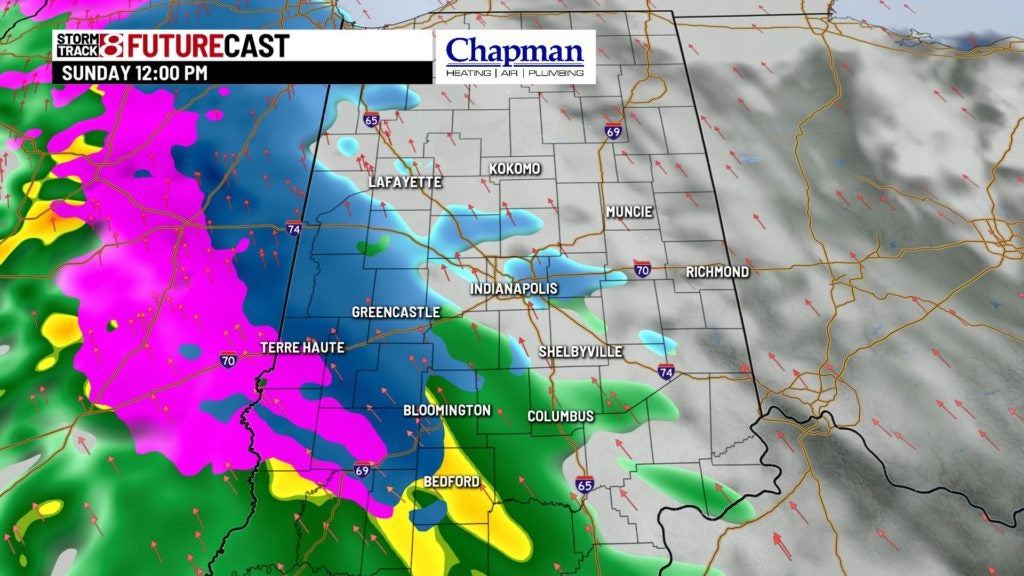
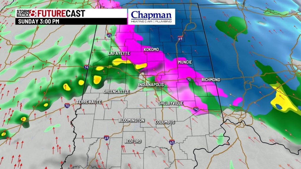
By midafternoon, the warm front will slide north, allowing temperatures to rise above freezing, and thus all precipitation will change over to rain for the remainder of the day.
Highs top out in the lower to middle 40s this afternoon.
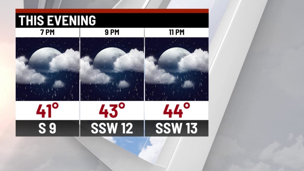
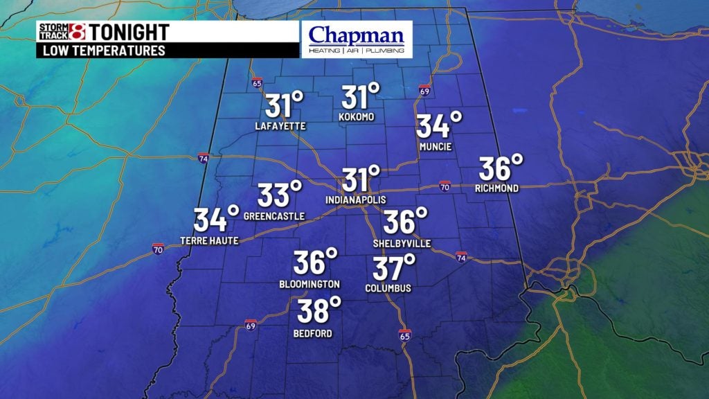
Tonight:
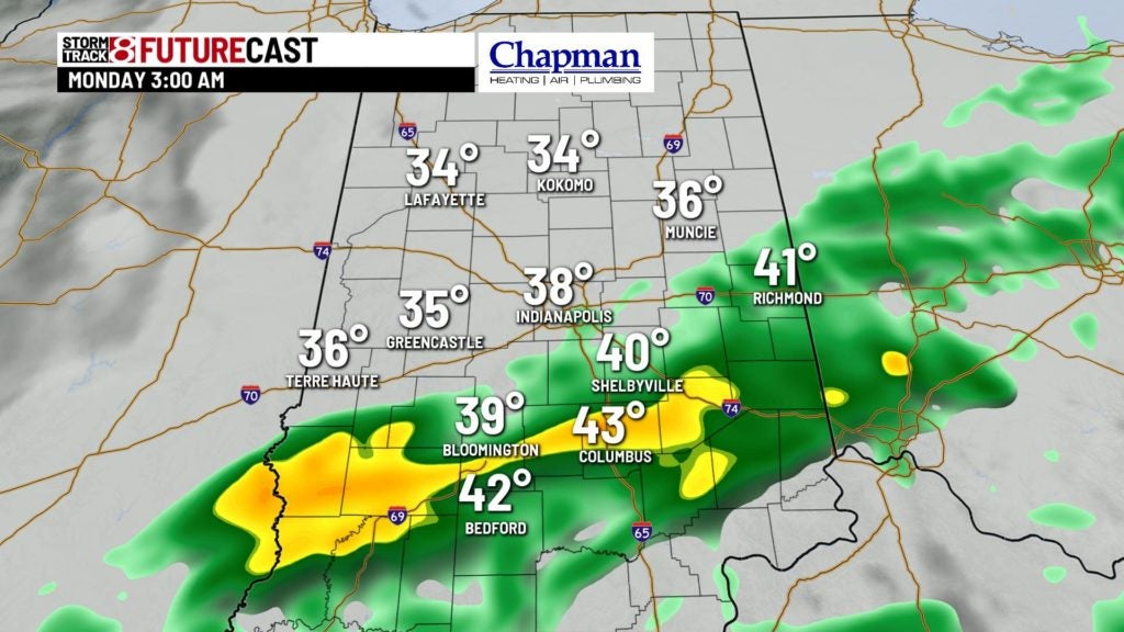
Steady showers, with potential for heavy rain at times for this evening and overnight as a cold front approaches from the west. Rain should end from northwest to southeast overnight over much of the area.
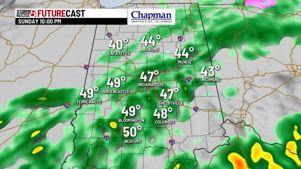
Lows fall to the lower to middle 30s.
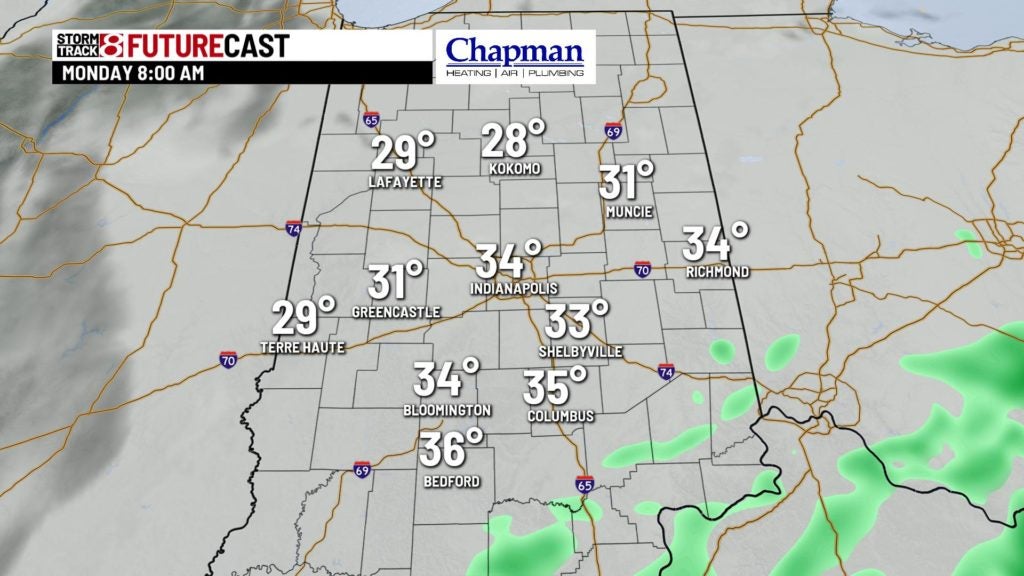
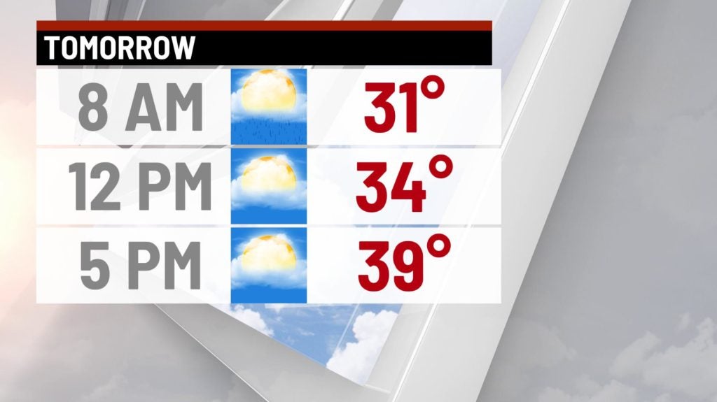
Monday:
A few leftover showers will be possible near daybreak for our southernmost counties. Otherwise, it’s a cloudy a chilly day. Highs top out in the middle to upper 30s.
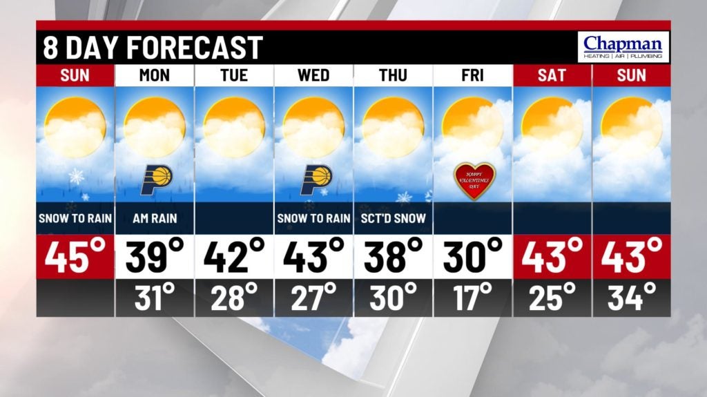
8 day forecast:
Dry weather continues into Tuesday and much of Wednesday. The next system of interest arrives Wednesday night into Thursday, where we’ll see a chance for snow and rain showers (still some questions pertaining to track and precipitation type). Before this, temperatures should hit the lower to middle 40s Tuesday/Wednesday. Much colder air briefly settles in on Friday before warming up again next weekend.