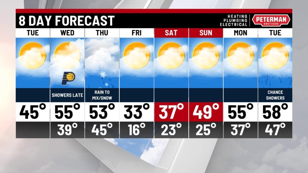
Mild day!
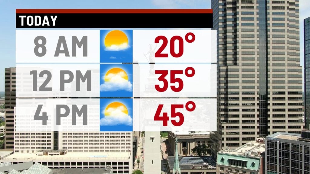
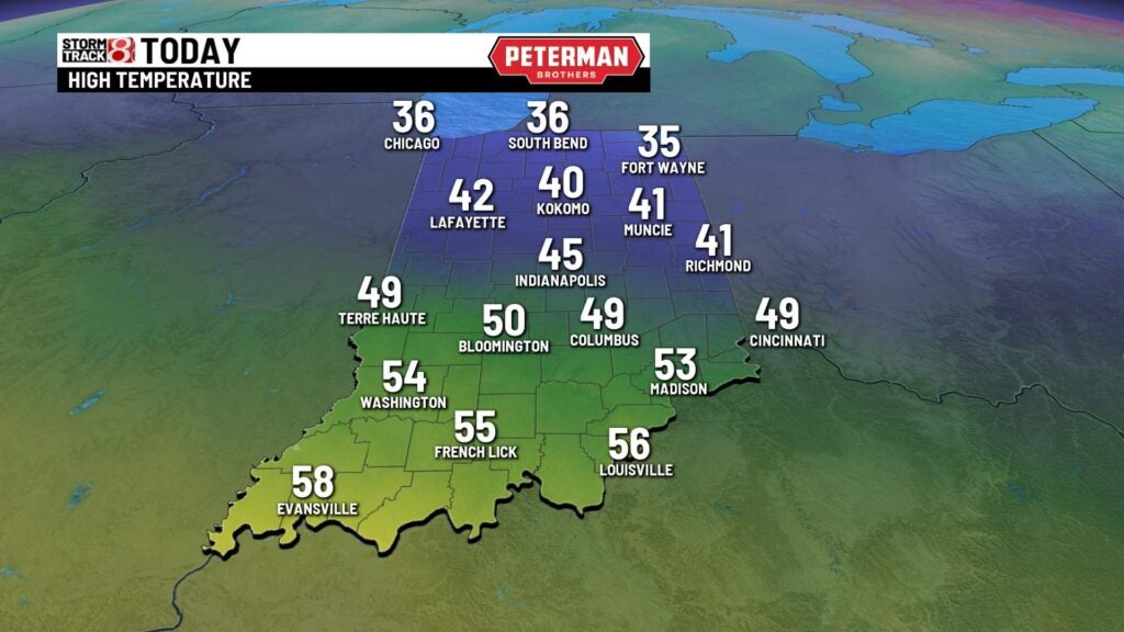
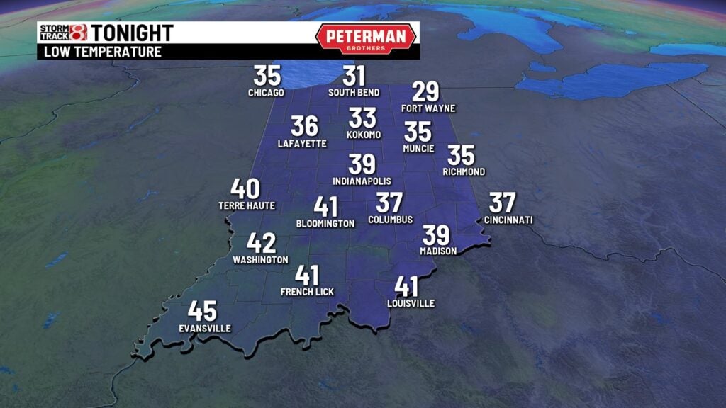
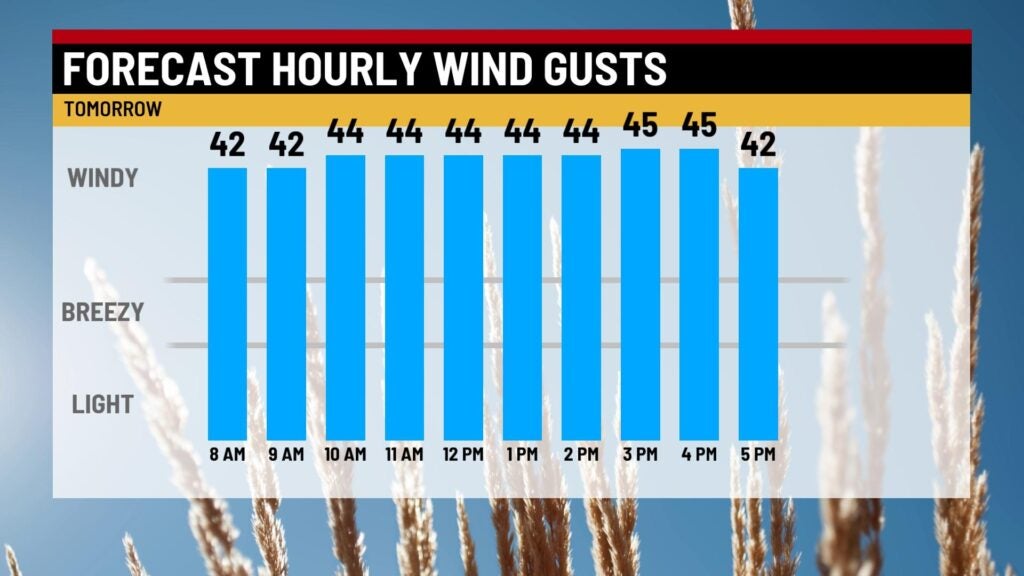
INDIANAPOLIS (WISH) — Another cold start to the morning with temperatures in the teens with feel like temperatures in the lower teens. Should be one of the better days we see this week with highs in the mid 40s with a mix of sun and clouds. Lows tonight will fall to the upper 30s. Wednesday will be the warmest day we see this week but also the windiest with wind gusts upwards of 20-30 mph. That will boost temperatures to the mid 50s through the afternoon with increasing clouds. We could see a few showers arrive late in the evening.
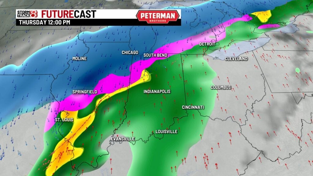
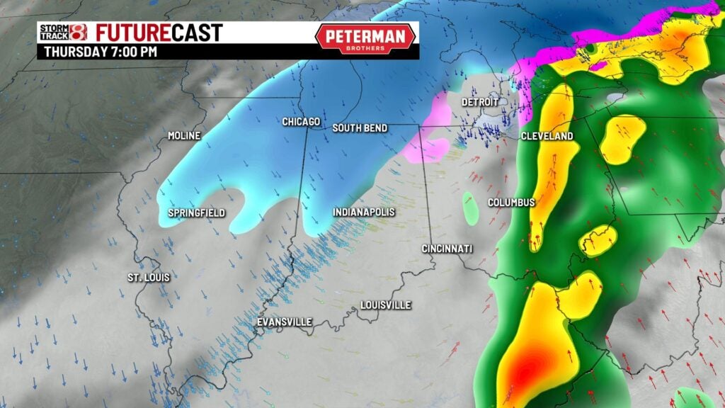
We have a flood watch out for much of the state for our next weather maker Thursday. This will bring in the chance for some heavy rain during the day. Highs will top out in the lower 50s. As temperatures drop we could see a light wintry mix to snow with most accumulation to be in NW Indiana. Right behind this cold front highs by the end of the week will to out in the lower 30s.
Nice rebound this weekend with highs in the upper 30s to near 40° with sunshine! Highs will continue to warm Sunday with most spots in the upper 40s to near 50°. Highs will continue to trend towards to mid to upper 50s next week with rain chances.