Uneven temperature pattern continues with renewed rain chances ahead
INDIANAPOLIS (WISH) — Today was almost a copycat of Tuesday’s forecast, except we had a breezy northwesterly winds with highs around 50. Temperatures are going to continue being up-and-down over the next several days into the weekend and next week.
We’re even watching a smaller rain chance by Friday and an even better one early next week.
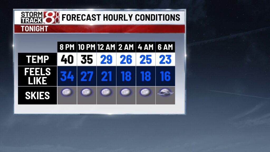
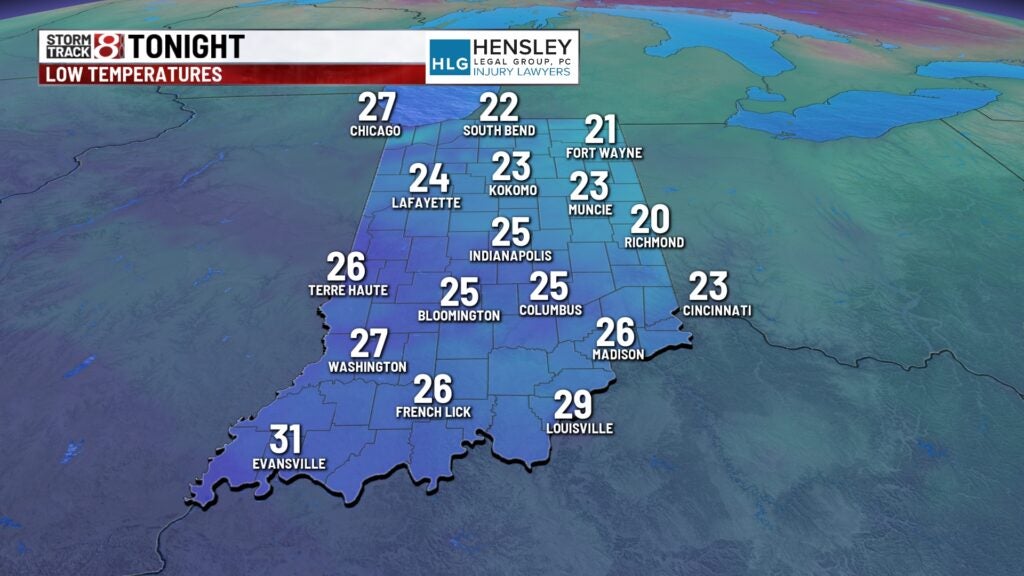
Wednesday night: Skies will turn mainly clear tonight, which will cause us to turn very cold. Lows will plummet into the low to mid 20s, and we will have a hard freeze because of these temperatures and much lighter winds. Wind chill values will be in the teens heading into daybreak Thursday.
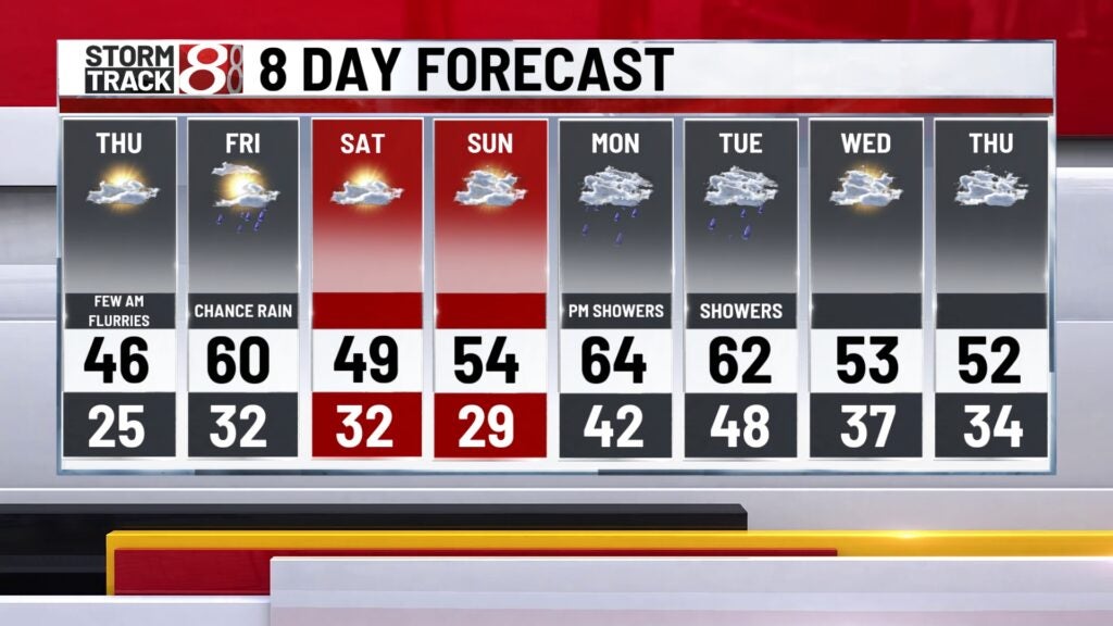
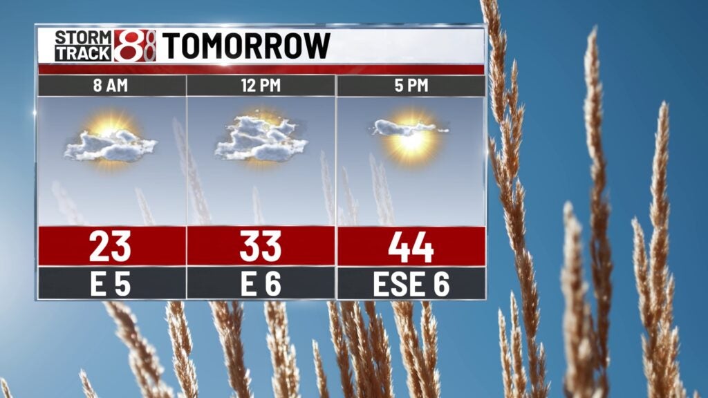
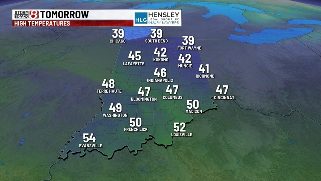
Thursday: Get ready for a brisk Thursday morning and bundle up. There is even a very small chance for some flurries Thursday morning for locations northwest of Indy. We won’t quite get back into the 50s Thursday as cloud cover increase a little bit. Highs will only top out in the mid 40s with a light wind out of the north.
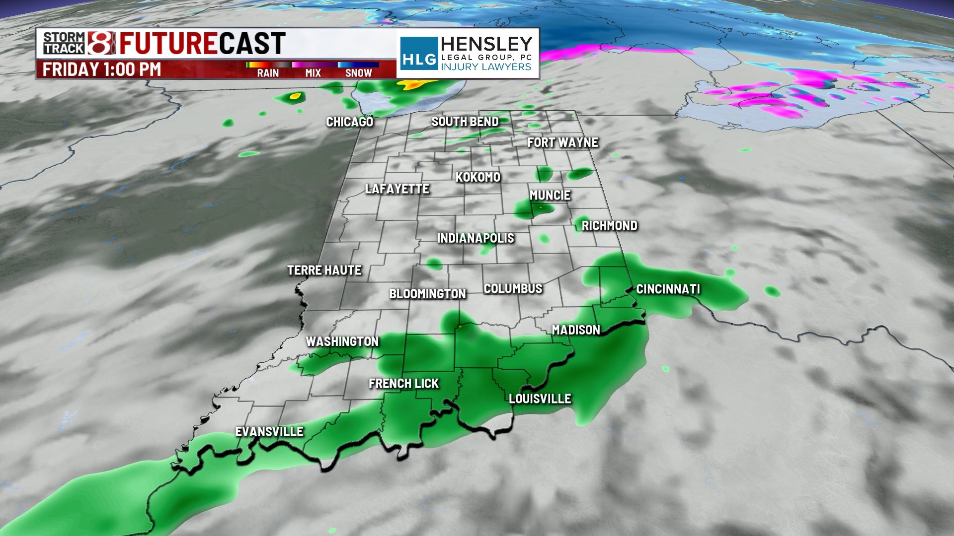
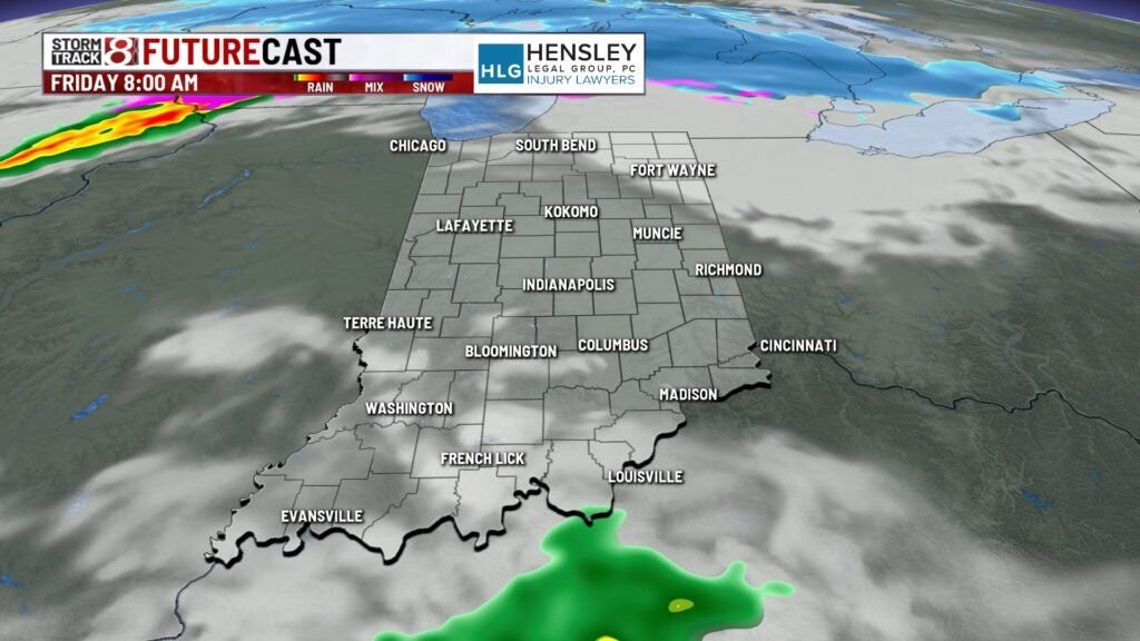
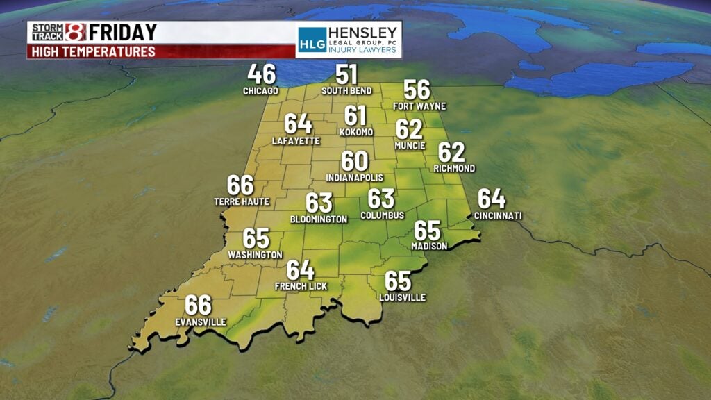
Friday: The end to the workweek will feature a bit of a temperature jump with the chance for some showers. Best shower chance will be in the afternoon and nighttime hours.

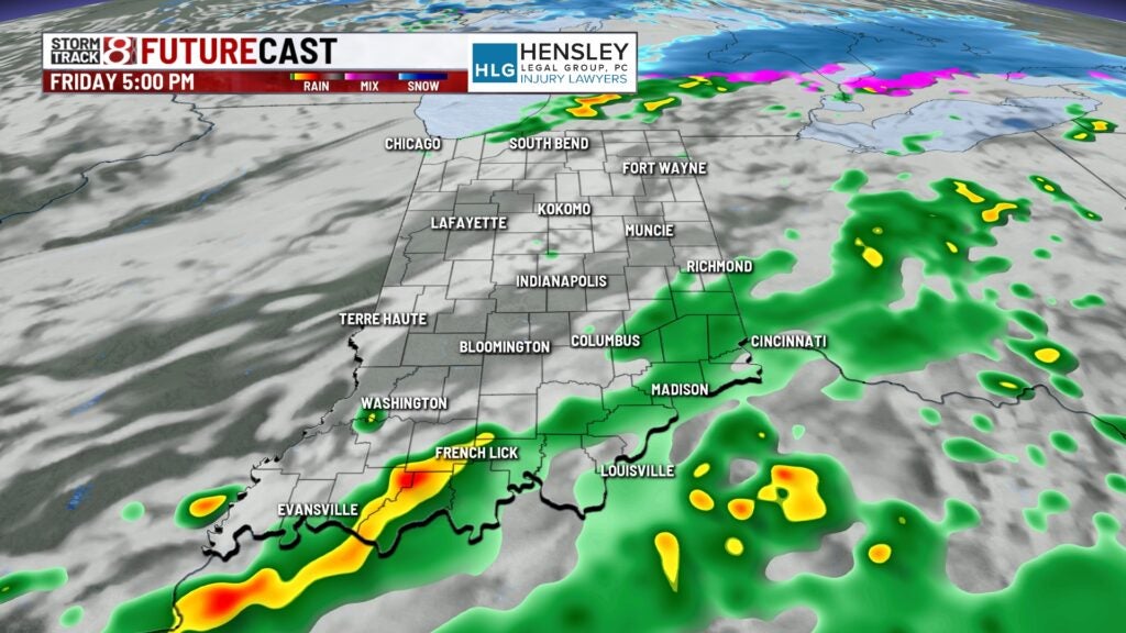
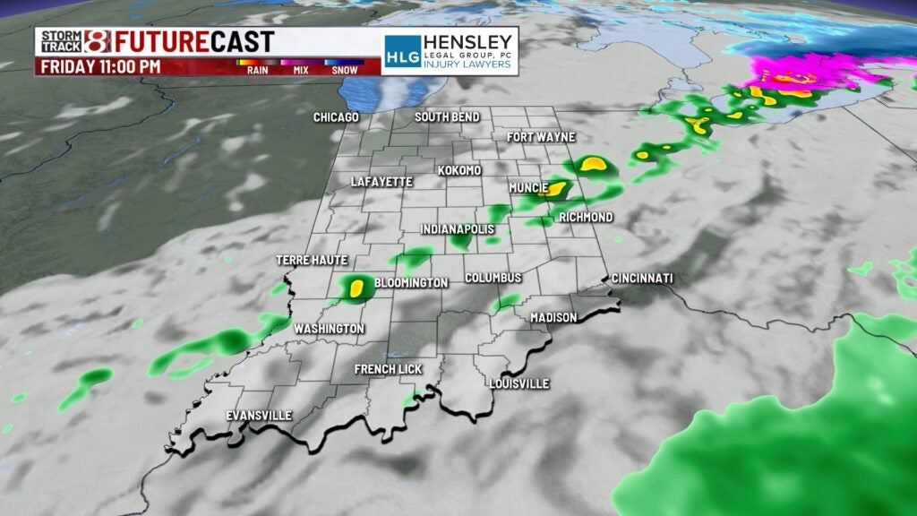
Highs look to cruise towards the upper 50s to low 60s thanks to winds turning southerly and becoming a little breezy again.
8-Day Forecast: We’ll change the wind direction back to northerly Saturday with some gusts up to 25-30 MPH at times. This will cause highs to have a hard time reaching the mid to upper 40s Saturday with decreasing clouds after starting the day mostly cloudy. Temperatures then rebound again Sunday and into next week with highs back in the 60s by Monday. However, a higher chance for rain and a few storms will emerge Monday into Tuesday. No severe weather is expected at this time.