


Windy with some snow Friday night, arctic air arrives this weekend
INDIANAPOLIS (WISH) — We’ve endured a busy end to the workweek with rain, some afternoon snow, thundersnow in eastern Indiana, and gusty winds. We’re still on track for high winds and some snow for our Friday night with temperatures to drop a bit.
By Sunday, arctic air will have fully locked its grip on us.
High Wind Warnings will conclude at 8 PM EST Friday. Wind Advisories will stay in place until 9 AM EST Saturday.

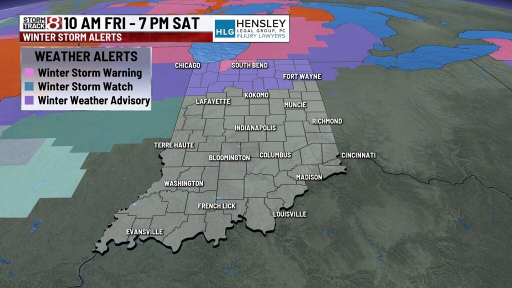
Winter Weather Advisories and Winter Storm Warnings will also remain in effect in northern Indiana until 7 PM EST Saturday.
Friday night: Conditions are going to remain rough with the high winds and slick spots on the roads tonight. Wind gusts will push over 50 MPH at times. Along with these strong winds, more snow will develop on the backside of this system.


There could be up to an inch (isolated higher totals possible) of snow from this specific round of precip.
Temperatures will fall into the low 20s by daybreak Saturday, but due to the high winds, wind chill values will tumble into the single digits. Overall, be cautious on the roads tonight and into Saturday morning.


Saturday: Brisk and breezy weather will dominant our Saturday with potential for sporadic snow showers throughout the day. Temperatures are not going to budge much as we hang around in the low to mid 20s. Keep in mind that roads may still be slick in spots through Saturday.


Sunday: Unfortunately, Saturday is not going to be the coldest day of this extended forecast. A stretch of bitter arctic air will arrive starting on Sunday. We’re going to start the day off in the single digits for the air temperature, but wind chill values are going to be down in the -10 to -15 degree range. Do not expect us to feel like above zero at all on Sunday with actual highs only getting into the low teens.


8-Day Forecast: This bitter air will keep on rolling into Martin Luther King Jr. Day on Monday and Tuesday with highs in the teens. Wind chill values will be below zero at times through Monday, Tuesday, and into Wednesday morning as well. There is a chance for some snow on Monday into Tuesday as well. Highs may start to bounce back a little but by next Wednesday with temps in the 20s.

