


19 tornadoes confirmed in Indiana from Friday night storms
UPDATE: The National Weather Service on Monday confirmed that an 18th and 19th tornado, these in Grant County, touched down in Indiana on Friday night.
INDIANAPOLIS (WISH) — The National Weather Service in Indianapolis has confirmed nine tornadoes from storms on Friday night.
Full storm tracks have yet to be released for all nine tornadoes.
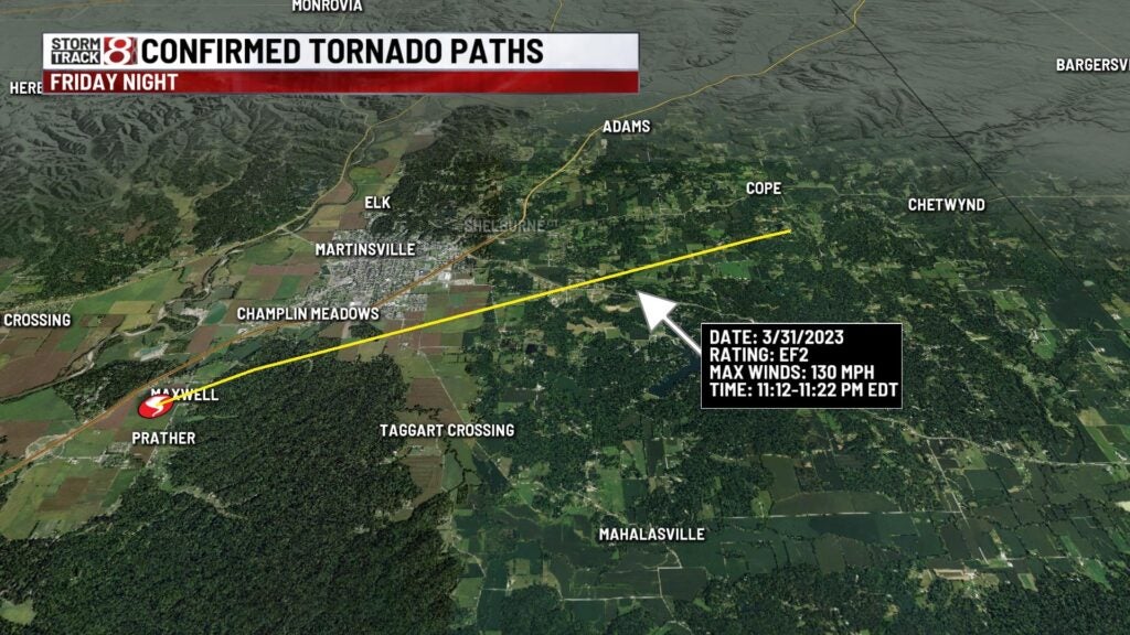
Sunday evening, they confirmed two of these tornadoes. An EF3 tornado with max winds of 138 mph that started in Owen county and ended in Monroe county. Also, an EF2 in Morgan county with max winds of 130 mph was confirmed that had a track south of Martinsville.

The strongest tornado of all the confirmations so far was an EF3 in Sullivan County that had maximum winds of 155 mph.

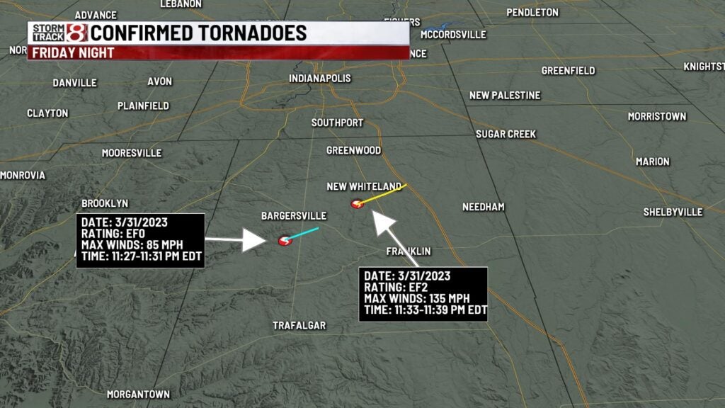
Two other tornadoes were confirmed in Johnson county. An EF3 struck Whiteland with maximum winds of 140 mph. Just south of Bargersville, an EF0 was confirmed with maximum winds of 85 mph. Below are the exact tracks of the tornadoes.

4 more tornadoes were confirmed Saturday in Howard and Clinton counties.
Clinton Co: EF1 w/ peak winds at 110mph
SW Howard Co; 2 EF0 tornadoes w/ peak winds at 80mph
SE Howard Co: EF1 w/peak winds at 110mph

Elsewhere in the state. the National Weather Service offices in northern Indiana and Chicago have confirmed 8 additional tornadoes as of 10:50 pm, Sunday. Three of those tornadoes coming from Benton county (one EF1, two EF2s).
Storm survey teams will continue to gather data on these full tracks. We will also have to wait and see if they confirm any other tornadoes in what was an active Friday night of weather.