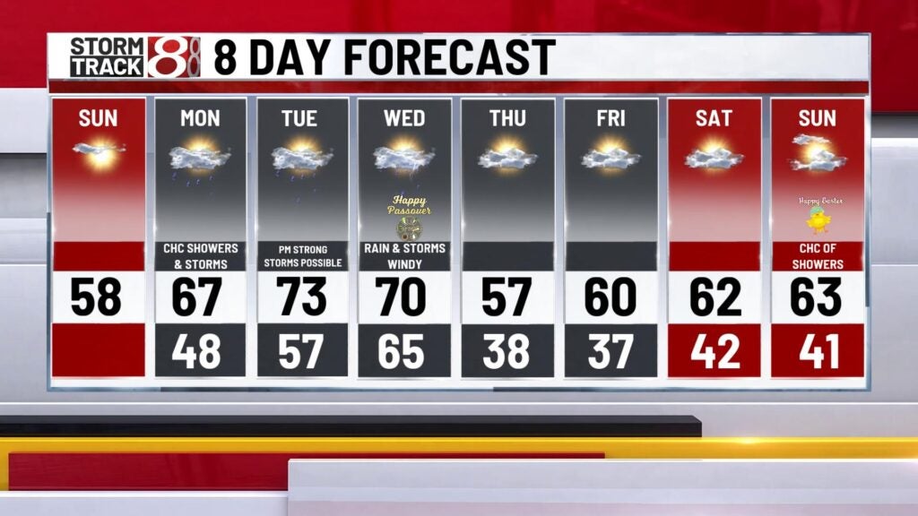
Beautiful Sunday, strong storms return Tuesday
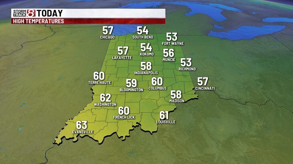
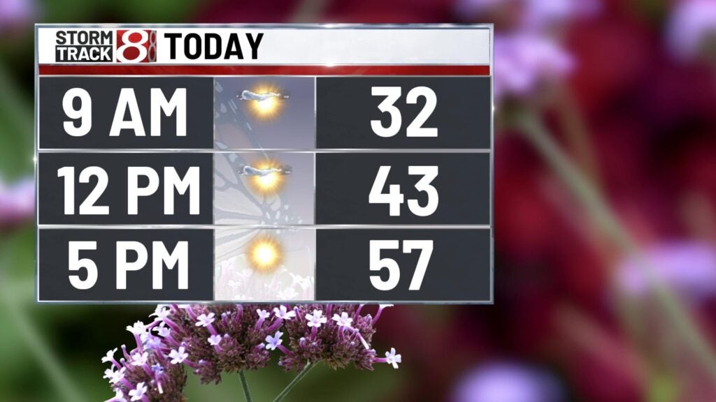
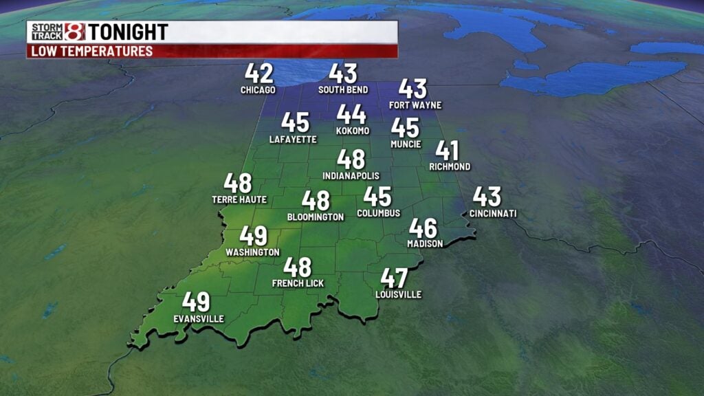
A chilly start to the morning with temperatures in the mid 30s. Skies will clear this morning with loads of sunshine today! Highs will top out in the upper 50s! Lows tonight will cool to the upper 40s.
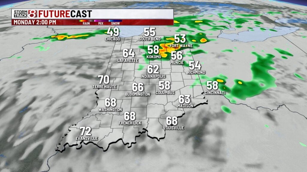
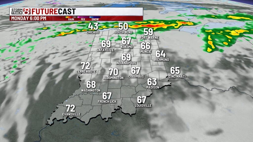
Monday we’ll have showers move in for the morning drive. Pockets of moderate rain are possible from time to time. Rain should move out mid to late afternoon wit a few peeks of sunshine possible through the later part of the day. Highs will soar to the upper 60s to near 70°!

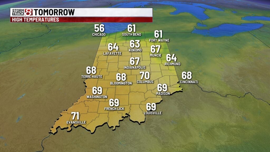
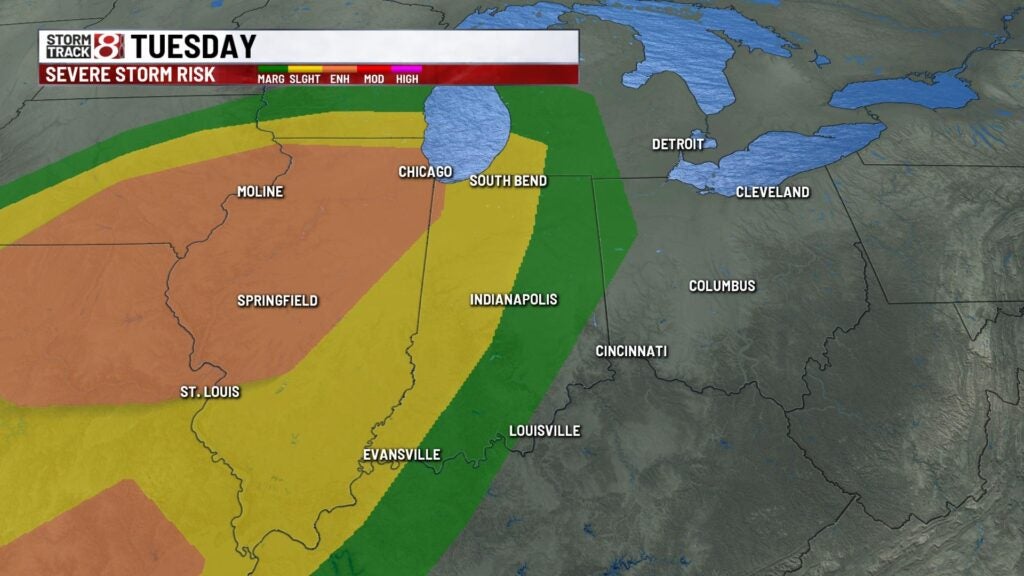
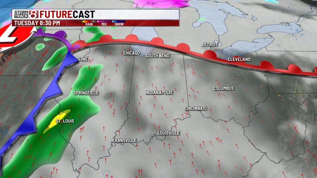
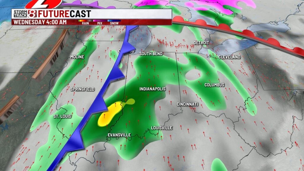
Tuesday will be another active day. We’ll have a potent area of low pressure that will move eastward through the day. A warm front will lift and will usher in very wrm air through the day with highs in the lower to mid 70s with a gusty south wind. We have a slight risk for wester portions of Indiana late Tuesday into Wednesday morning with an enhanced risk in Illinois. Set up looks to be similar to what we saw last Friday with all severe weather modes in play. Once the front passes through the state highs will cool to the upper 50s with showers around Wednesday.
Highs will remain near seasonal through the end of the week with sunshine. Highs will be closer to the lower 60s through Easter weekend.