Beautiful Monday ahead
INDIANAPOLIS (WISH) — Highs will flirty with 80° again, Monday. Several storm chances move in mid-week.
Right now:
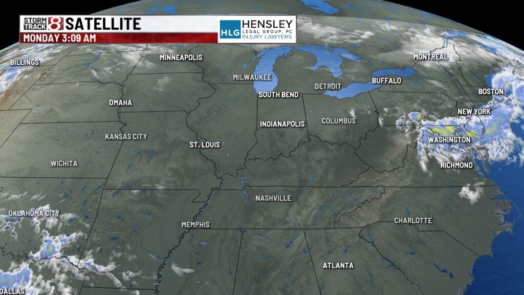
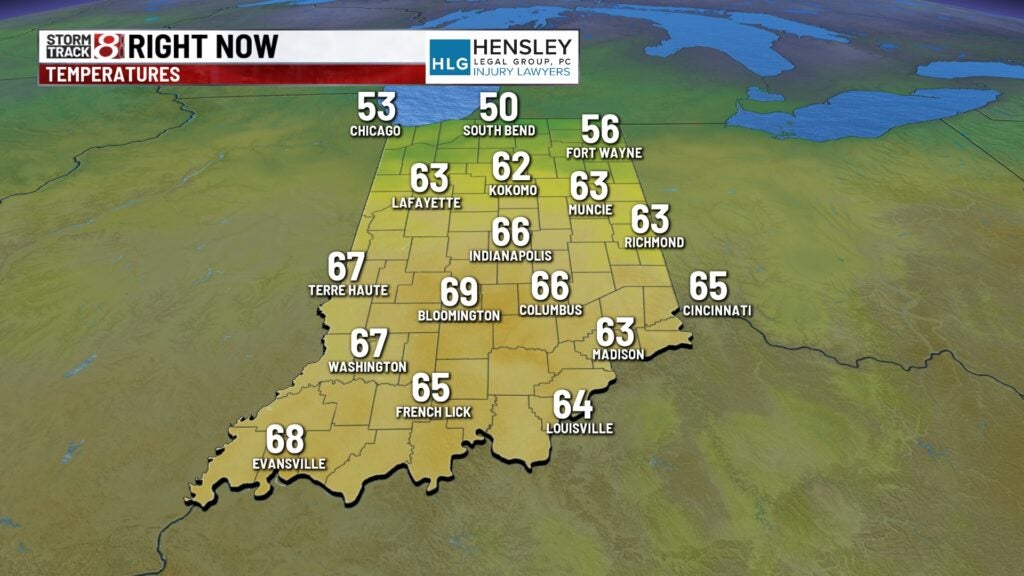
A cold front is draped across the central portions of the state this morning. Temperatures are running a bit cooler to the north, but for everybody else, it is a very mild start to your Monday morning.
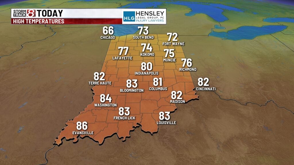
Monday:
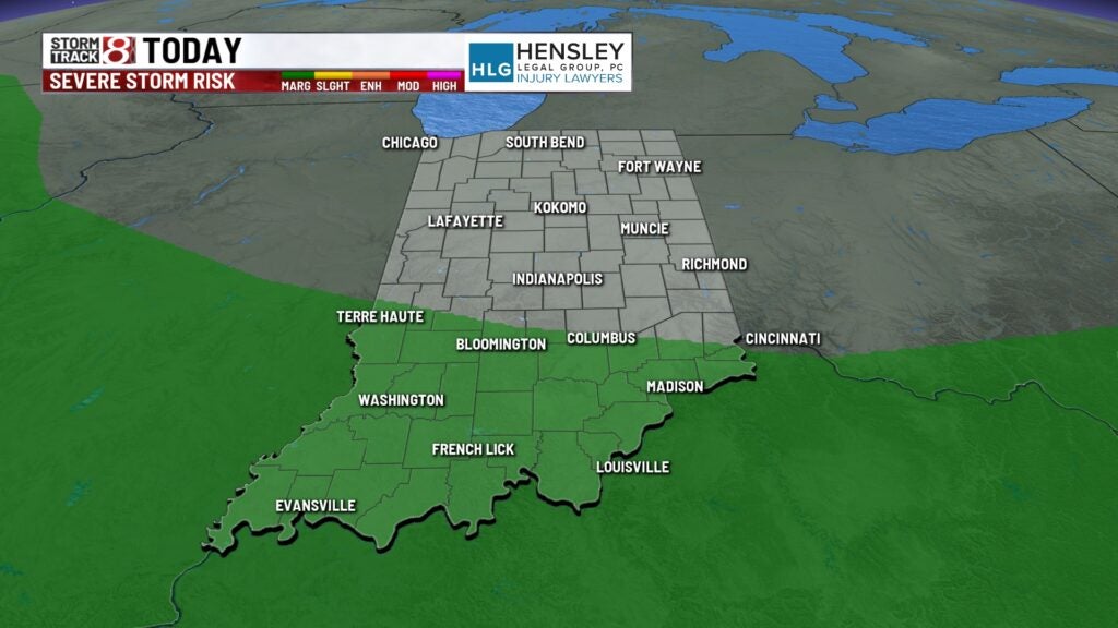
The cold front will sag south gradually as we go into the afternoon hours. There is not much moisture involved with this, so we should stay dry for most of the day. There is a chance for a few isolated thunderstorms in the southern portions of the state late this afternoon. A few of those storms could produce some gusty winds and large hail.
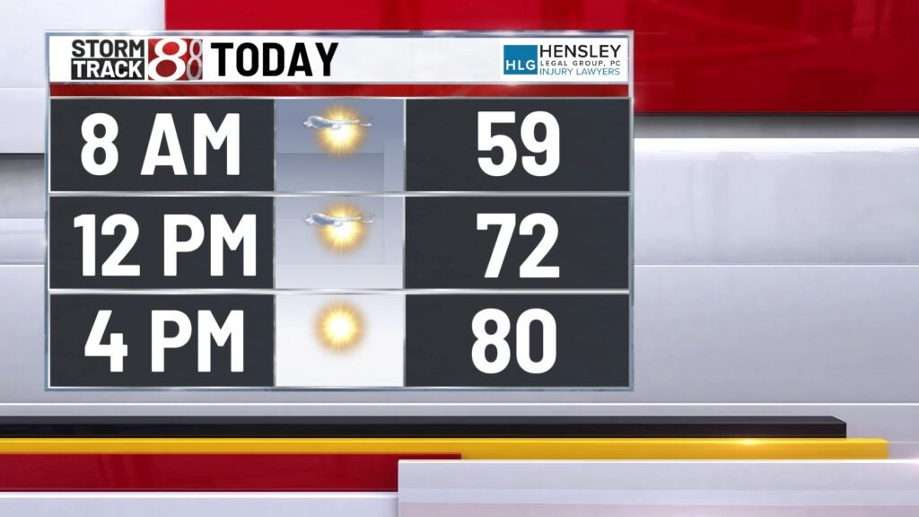
The high temperature should flirt with 80° again this afternoon.
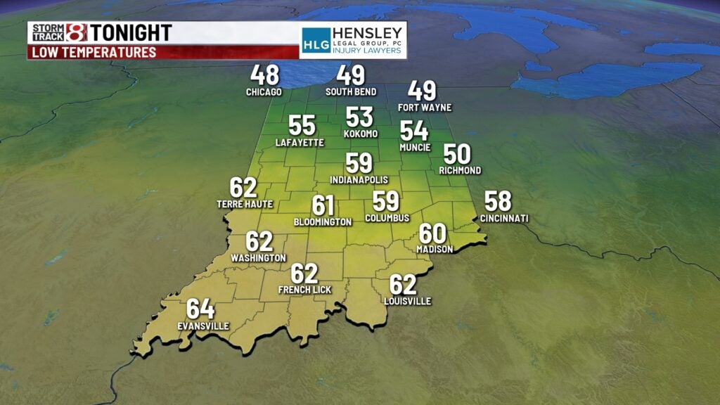
Monday night:
Clouds will be on the rise. We made it through the overnight hours, but we should stay dry for the most part. There will be some scattered showers and thunderstorms that will develop in the southwestern portions of the state overnight. A few hail stones will be possible with some of those storms.
Overnight lows will fall to around 60°.
Rain chances return:
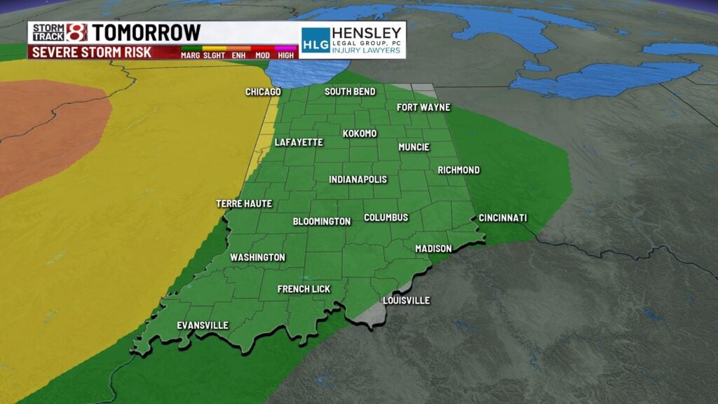
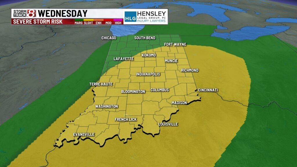
An upper-level low will roll into the Midwest on Tuesday and Wednesday, bringing numerous chances for showers and thunderstorms. Some scattered clusters of thunderstorms will be possible as we go through the late morning and early afternoon hours on Tuesday. A few stronger storms will likely be rolling through as we head into your late Tuesday night into early Wednesday morning. Hail and damaging wind will be the primary concerns here for that timeframe, but an isolated tornado cannot be ruled out.
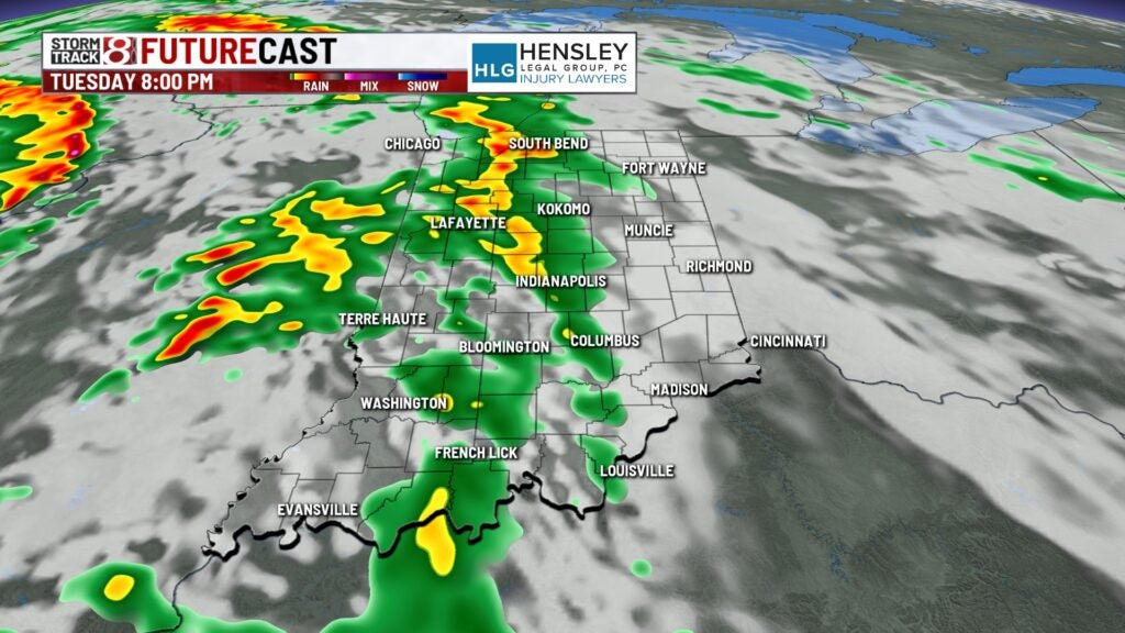
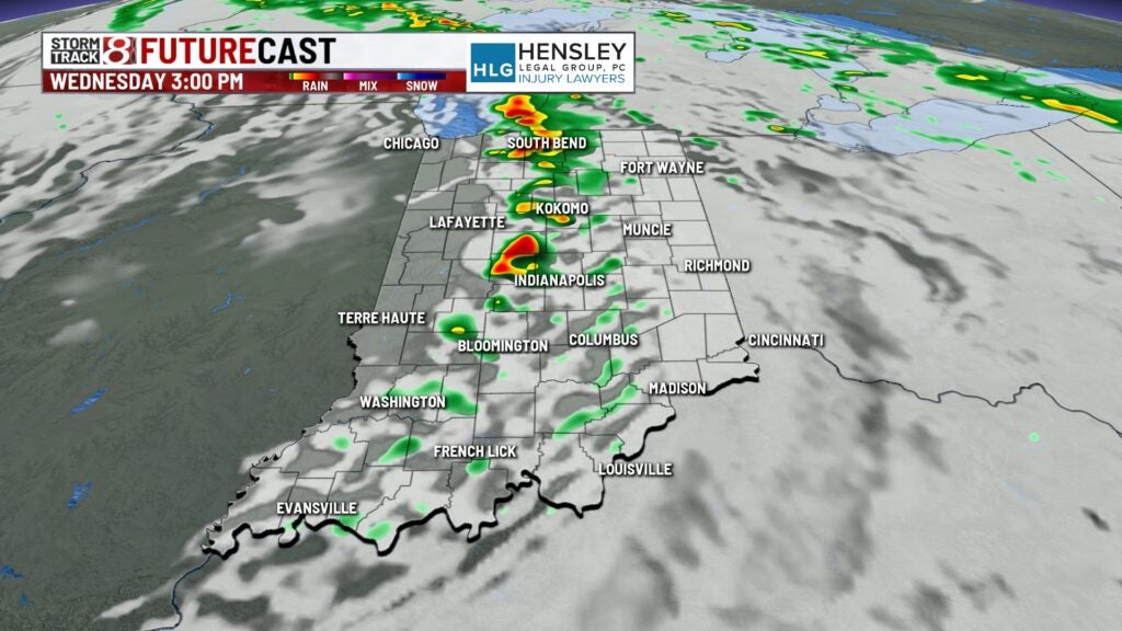
Scattered showers and thunderstorms will again be possible heading into Wednesday. Again, all modes of severe weather are in play.
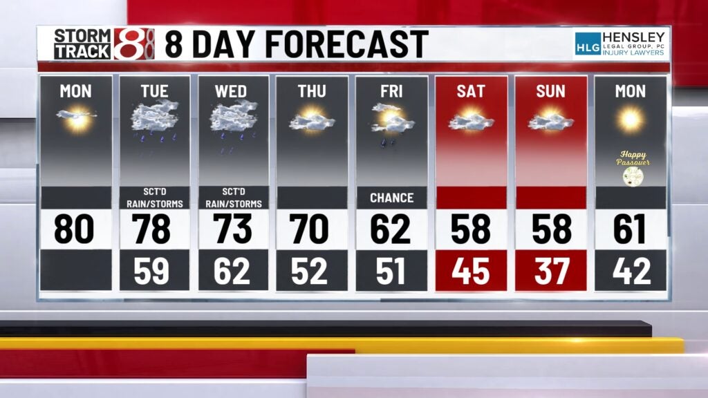
8 day forecast:
Thursday does look to be dry for the most part, although an isolated shower could be possible. Highs will remain around 70° on Thursday. A cold front moving through on Friday will bring scattered showers in the morning. The bigger story will likely be the big cooldown that’s coming our way from Friday into the weekend. High will only hit the 60s as we go into your Friday. Overnight Friday night into Saturday morning could slip into the mid-upper 30s, which could be cold enough for some areas of frost. It will only top out in the upper 50s for the weekend.