Complete breakdown of Indy 500 rain & storm chances
INDIANAPOLIS (WISH) — A line of storms has developed in the states to our west. Eventually, this line will cause rain chances that will impact the Indy 500.
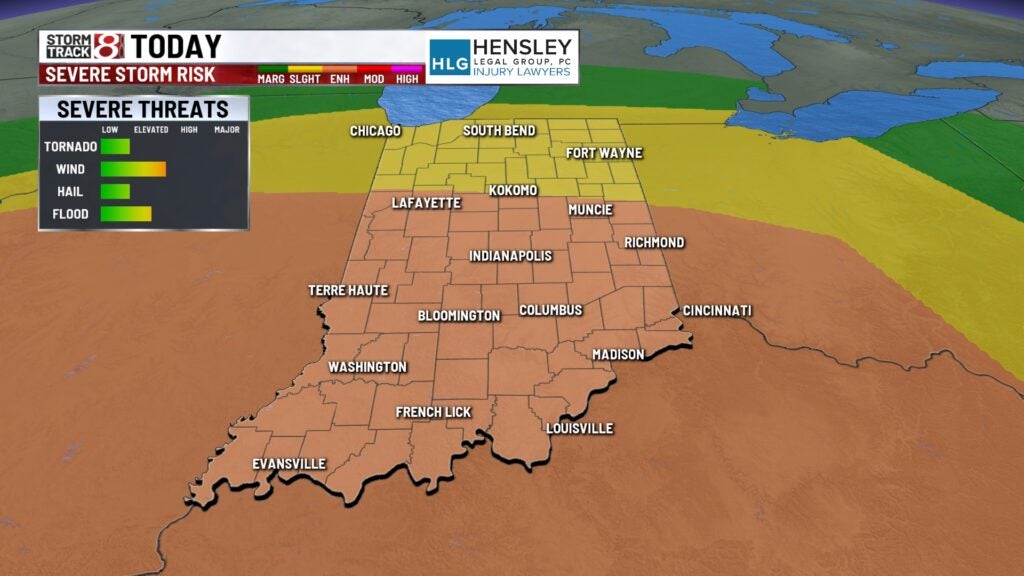
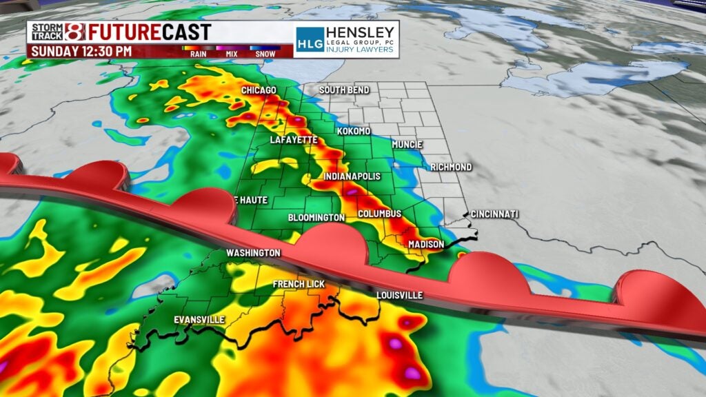
TODAY: We are waking up this morning dry in central Indiana. Rain chances will work in with two waves for today. An enhanced (3/5) risk if severe weather is in place mainly for the 2nd wave of storms. All modes of severe weather are on the table.
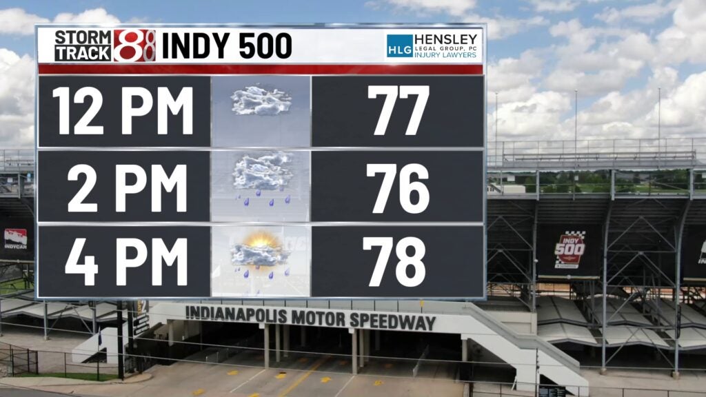
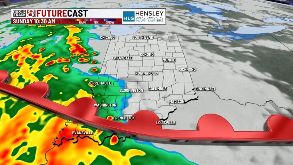
Round 1, midday into the early afternoon: A line of showers and storms arrives in the Indy metro close to the green flag for the Indy 500 which could delay the start or stop the race shortly in. This line will contain some lightning strikes as well as gusty winds.
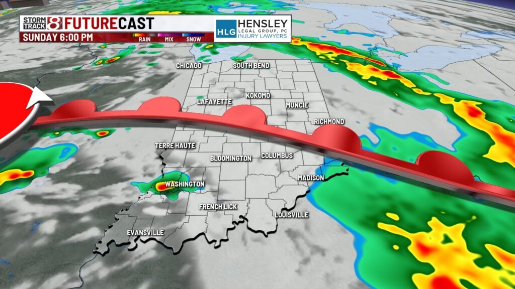
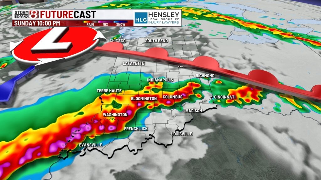
Round 2, late evening into the overnight: Once round 1, exits expect some dry time to work in for the mid-afternoon and early evening. Hopefully, this window will allow us to complete the Indy 500. Strong to severe storms will once develop later in evening. This will likely be the main severe threat with the focus south of I-70.
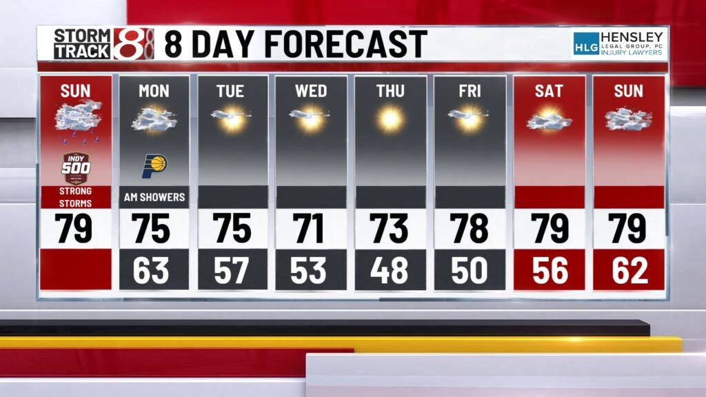
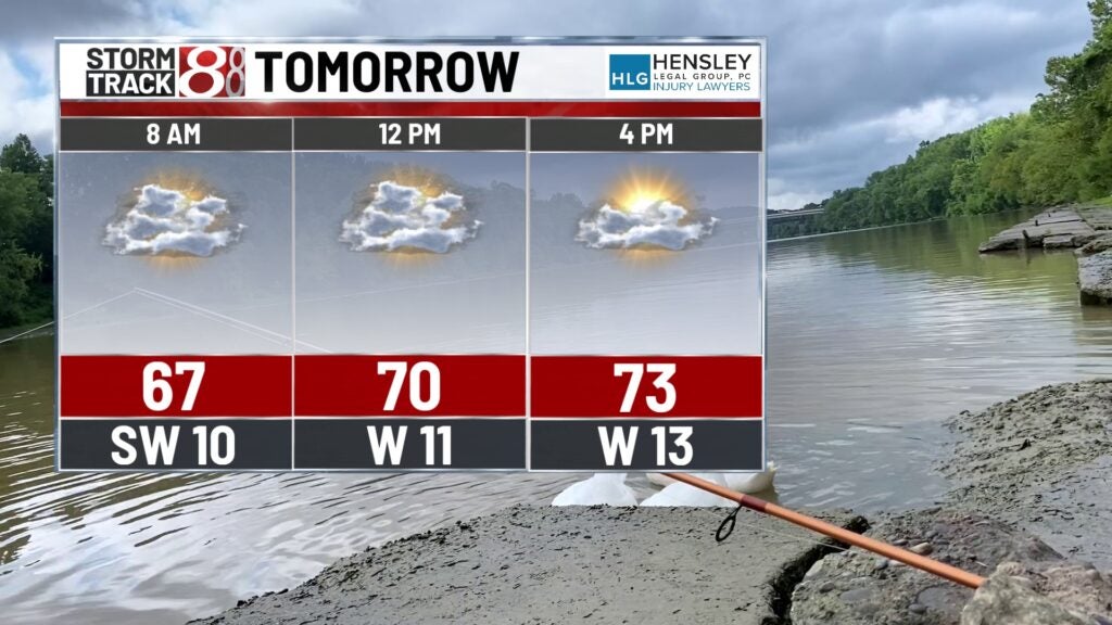
MEMORIAL DAY: In the morning, a few morning showers are possible. Most remain dry with clouds breaking up a touch in the afternoon. Winds gust up to 25 mph with high temperatures in the low to mid-70s.
8-DAY FORECAST: A string of dry and sunny days last from mid to late week. Temperatures will consistently be running in the 70s which is pretty close to average. More clouds will arrive on the back half of next weekend.