Gusty, warm day with storms late tonight
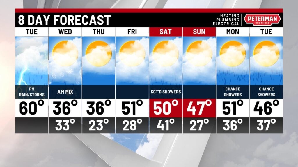
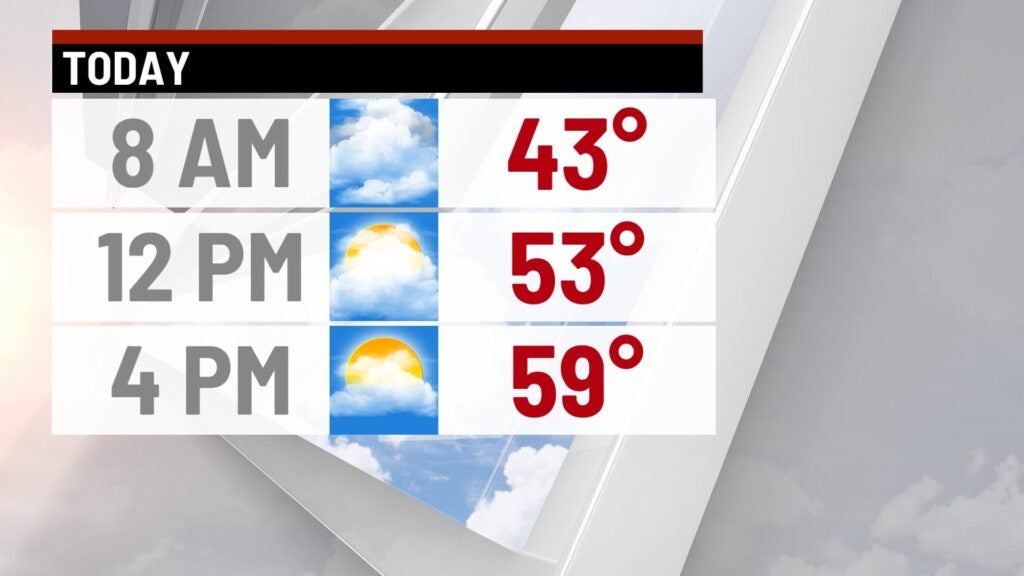
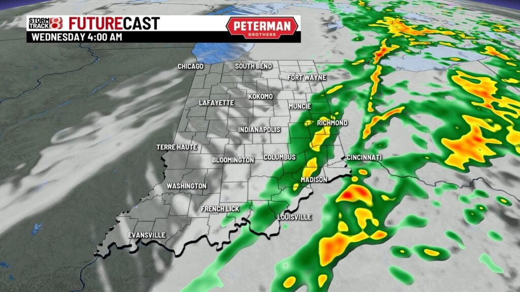
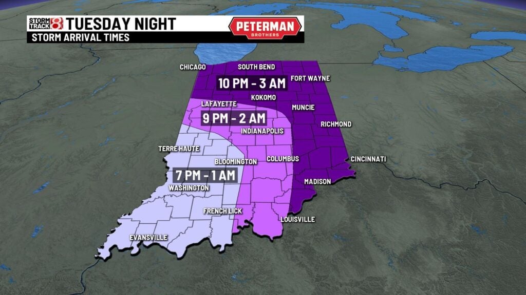
A quiet start this morning with temperatures in the lower to mid 40s. We should see plenty of dry time today with highs warming to 60°. Winds will pick up through the day with wind gusts around 30-40 mph with winds picking up even more later on tonight with gusts around 45-50mph! This is all out ahead of our next cold front which will generate a few storms late this afternoon and evening. There is a marginal risk statewide for an isolated stronger to severe storm to develop with damaging winds as the main threat but all severe weather modes are in play. Showers and storms will linger through the very early part of the morning Wednesday. Temperatures will turn sharply colder early Wednesday with lows in the upper 30s so any left over rain could transition to a light mix.


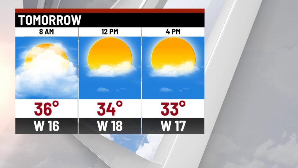
We should salvage the afternoon with sunshine and clouds through the day. Highs will struggle though with most spots in the mid 30s. We’ll remain chilly through Thursday with highs in the mid 30s with sunshine,
Highs by the end of the week will warm to the lower 50s with dry time and sunshine! Next chance of scattered showers arrives this weekend. Saturdya highs remain mild with rain chances and highs in the lower 50s. Slightly cooler Sunday with highs in the upper 40s. Rain chances with mild temperatures continue through the first part of next week with highs in the upper 40s to lower 50s.